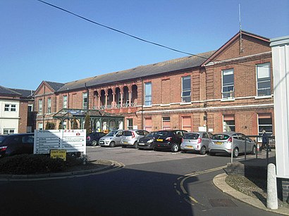
Directions to Lowestoft Hospital (Waveney) with public transport
The following transport lines have routes that pass near Lowestoft Hospital
How to get to Lowestoft Hospital by bus?
Click on the bus route to see step by step directions with maps, line arrival times and updated time schedules.
How to get to Lowestoft Hospital by train?
Click on the train route to see step by step directions with maps, line arrival times and updated time schedules.
Bus stops near Lowestoft Hospital in Waveney
- Adrian Road, Lowestoft, 3 min walk,
- Manor Court, Lowestoft, 5 min walk,
- Police Station, Lowestoft, 5 min walk,
- Old Nelson Street, Lowestoft, 5 min walk,
- Bus Station, Lowestoft, 7 min walk,
Bus lines to Lowestoft Hospital in Waveney
- BH2, Bungay,
- SJL2, Beccles,
- 1, Martham,
- 1A, Martham,
- X1, Lowestoft,
- 101, Gunton,
- 981, Gorleston,
- NORTH LOWESTOFT BUZZABOUT, St Olaves,
- 102, Lowestoft - Oulton Village Circular,
- 105, Lowestoft - Oulton Rock Circular,
- 122, Lowestoft - Oulton Village Circular,
- 109, Carlton Colville,
- 106, Lowestoft,
- 99, Kessingland,
- X2, Norwich - Lowestoft,
- X21, Norwich - Lowestoft,
- 902, Notre Dame School - Lowestoft,
- X22, Carlton Colville,
What are the nearest stations to Lowestoft Hospital?
The nearest stations to Lowestoft Hospital are:
- Adrian Road, Lowestoft is 212 meters away, 3 min walk.
- Manor Court, Lowestoft is 361 meters away, 5 min walk.
- Police Station, Lowestoft is 368 meters away, 5 min walk.
- Old Nelson Street, Lowestoft is 379 meters away, 5 min walk.
- Bus Station, Lowestoft is 504 meters away, 7 min walk.
Which bus lines stop near Lowestoft Hospital?
These bus lines stop near Lowestoft Hospital: 1, 99, X1.
Which train line stops near Lowestoft Hospital?
GREATER ANGLIA
What’s the nearest bus stop to Lowestoft Hospital in Waveney?
The nearest bus stop to Lowestoft Hospital in Waveney is Adrian Road, Lowestoft. It’s a 3 min walk away.
What time is the first bus to Lowestoft Hospital in Waveney?
The X1 is the first bus that goes to Lowestoft Hospital in Waveney. It stops nearby at 05:35.
What time is the last bus to Lowestoft Hospital in Waveney?
The X21 is the last bus that goes to Lowestoft Hospital in Waveney. It stops nearby at 00:12.
See Lowestoft Hospital, Waveney, on the map
Public Transit to Lowestoft Hospital in Waveney
Wondering how to get to Lowestoft Hospital in Waveney, United Kingdom? Moovit helps you find the best way to get to Lowestoft Hospital with step-by-step directions from the nearest public transit station.
Moovit provides free maps and live directions to help you navigate through your city. View schedules, routes, timetables, and find out how long does it take to get to Lowestoft Hospital in real time.
Looking for the nearest stop or station to Lowestoft Hospital? Check out this list of stops closest to your destination: Adrian Road; Manor Court; Police Station; Old Nelson Street; Bus Station.
Bus: 1, 99, X1, BH2, SJL2, 1A, 101, 981, NORTH LOWESTOFT BUZZABOUT, 102, 105, 122, 109, 106.Train: GREATER ANGLIA.
Want to see if there’s another route that gets you there at an earlier time? Moovit helps you find alternative routes or times. Get directions from and directions to Lowestoft Hospital easily from the Moovit App or Website.
We make riding to Lowestoft Hospital easy, which is why over 1.5 million users, including users in Waveney, trust Moovit as the best app for public transit. You don’t need to download an individual bus app or train app, Moovit is your all-in-one transit app that helps you find the best bus time or train time available.
For information on prices of bus and train, costs and ride fares to Lowestoft Hospital, please check the Moovit app.
Use the app to navigate to popular places including to the airport, hospital, stadium, grocery store, mall, coffee shop, school, college, and university.
Location: Waveney, East Anglia
Attractions near Lowestoft Hospital
Bombshell Games,Diana, Princess of Wales Memorial Childrens Centre,Ethical Online Limited,Alexandra Road,The Factory Arms,Cabana Hair & Beauty by Megan,Edinburgh Woollen Mill,High Street Kessingland Post Office,Bespoke Hair Systems,East Coast Cakes & Preserves at North Lowestoft Post Office,Hoseasons,Motability Scheme At John Grose Ford Lowestoft,Crown Street Motors,LCS Mini Market,Waveney Community Care Farm Shop,Omega Games,Beccles Mini Market,P & P Executive Travel,The Britten Centre,LDC Learner Driving CentreHow to get to popular attractions in Waveney with public transportation
Nuffield Health Norwich Fitness & Wellbeing Gym, Norwich,Ely Railway Station (ELY), East Cambridgeshire,Cb1 3df, Cambridge,Newmarket Leisure Centre, Forest Heath,Stilton, Huntingdonshire,Haverhill Rovers FC. The New Croft, St Edmundsbury,Burwell, East Cambridgeshire,Pint Shop, Cambridge,St Andrews Car Park, Norwich,Reffley, King'S Lynn And West Norfolk,David Lloyd, Ipswich,Zara, Cambridge,PS3 & PS4 Gym, Broadland,Asda, Great Yarmouth,Cambourne, South Cambridgeshire,The Cricketers (Wetherspoon), Ipswich,The Varsity Hotel & Spa, Cambridge,Globe Hotel (Wetherspoon), King'S Lynn And West Norfolk,Tesco, Norwich,Thetford, BrecklandGet around East Anglia by public transport!
Travelling around East Anglia has never been so easy. See step by step directions as you travel to any attraction, street or major public transport station. View bus and train timetables, arrival times, service alerts and detailed routes on a map, so you know exactly how to get to anywhere in East Anglia.
When travelling to any destination around East Anglia use Moovit's Live Directions with Get Off Notifications to know exactly where and how far to walk, how long to wait for your line , and how many stops are left. Moovit will alert you when it’s time to get off — no need to constantly re-check whether yours is the next stop.
Wondering how to use public transport in East Anglia or how to pay for public transport in East Anglia? Moovit public transport app can help you navigate your way with public transport easily, and at minimum cost. It includes public transport fees, ticket prices, and costs. Looking for a map of East Anglia public transport lines? Moovit public transport app shows all public transport maps in East Anglia with all Bus, Train and Ferry routes and stops on an interactive map.
East Anglia has 3 transport type(s), including: Bus, Train and Ferry, operated by several transport agencies, including National Rail, Ambassador Travel, Harwich Harbour Ferry, Stephensons of Essex, Villager Minibus Sharnbrook, The Voluntary Network, Dews Coaches, Lord's Travel, Felixstowe Ferry Boat Yard, Hadleigh Community Transport, Beestons, Fenland Association for Community Transport, First Norfolk & Suffolk, Mulleys Motorways, Halesworth Area Community Transport