The Most Popular Urban Mobility App in Los Angeles.
All local mobility options in one app
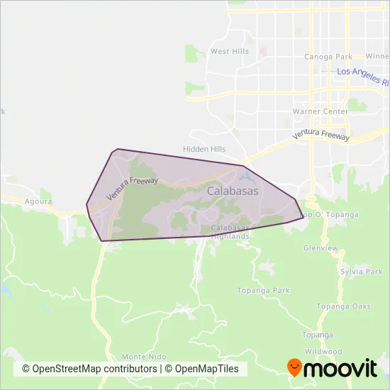
Calabasas Transit System (Calabasas Trolley) is a public transportation provider in Los Angeles which operates Bus routes.
The Calabasas Transit System has 6 Bus routes in Los Angeles with 83 Bus stops.
Their Bus routes cover an area from the Helmond Dr. & Ludgate Dr. stop to the Dardenne St. & via Del Prado stop and from the Las Virgenes Road (Malibu Creek Apts Leasing Court) stop to the Lost Hills Road & El Encanto Dr. (Juan Bautista De Anza Park) stop.
Calabasas Transit System line schedules (timetables, itineraries, service hours), and departure and arrival times to stations are updated in the app in real time.
For Calabasas Transit System service alerts, please check the Moovit website for real-time info on bus status, bus delays, changes of bus routes, changes of stops and any service changes.
Calabasas Transit System (Calabasas Trolley) is a public transportation provider in Los Angeles which operates Bus routes.
The Calabasas Transit System has 6 Bus routes in Los Angeles with 83 Bus stops.
Their Bus routes cover an area from the Helmond Dr. & Ludgate Dr. stop to the Dardenne St. & via Del Prado stop and from the Las Virgenes Road (Malibu Creek Apts Leasing Court) stop to the Lost Hills Road & El Encanto Dr. (Juan Bautista De Anza Park) stop.
Calabasas Transit System line schedules (timetables, itineraries, service hours), and departure and arrival times to stations are updated in the app in real time.
The Calabasas Transit System has Bus routes operating across Los Angeles including: Topanga, Calabasas.
The longest line from the Calabasas Transit System is: LINE 1. This Bus route starts from Las Virgenes Rd & Parkmor Rd and ends at Park Sorrento & Civic Center Way (City Hall). It covers over 41 km and has 48 stops.
The shortest line is: LINE 2. This Bus line begins from Ruthwood Dr. & Veva Way and finishes at Las Virgenes Rd. (A.E. Wright Middle School South Driveway). It runs through 6 km with 8 stops.
According to Moovit Insights, the most popular lines for Calabasas Transit System are .
Costs and prices of different ticket types may change, based on several factors. Please check the Moovit app to view bus fares of individual lines. For more information on ride fares and for buying bus tickets online please visit Calabasas Transit System's official site.
Looking for a specific Calabasas Transit System Bus schedule? All Calabasas Transit System lines and schedules in Los Angeles can be found in the Moovit App. Moovit gives you directions for Calabasas Transit System routes and provides helpful step-by-step navigation.