The Most Popular Urban Mobility App in Toronto.
All local mobility options in one app
| Line | Direction | Time |
|---|---|---|
| 63 | Sunnyside Loop | 5:13 AM |
| 63A | Ossington Station | 5:15 AM |
| 63 | Sunnyside Loop | 5:28 AM |
| 63A | Ossington Station | 5:30 AM |
| 63 | Sunnyside Loop | 5:43 AM |
| 63A | Ossington Station | 5:45 AM |
| 63A | Ossington Station | 6:00 AM |
| 63 | Sunnyside Loop | 6:00 AM |
| 63A | Ossington Station | 6:15 AM |
| 63 | Sunnyside Loop | 6:15 AM |
| 63A | Ossington Station | 6:30 AM |
| 63 | Sunnyside Loop | 6:30 AM |
| 63A | Ossington Station | 6:45 AM |
| 63 | Sunnyside Loop | 6:45 AM |
| 63 | Sunnyside Loop | 7:00 AM |
| 63A | Ossington Station | 7:00 AM |
| 63 | Sunnyside Loop | 7:10 AM |
| 63A | Ossington Station | 7:10 AM |
| 63B | Ossington Station | 7:15 AM |
| 63 | Sunnyside Loop | 7:15 AM |
| 63 | Sunnyside Loop | 7:20 AM |
| 63A | Ossington Station | 7:20 AM |
| 63B | Ossington Station | 7:25 AM |
| 63 | Sunnyside Loop | 7:25 AM |
| 63 | Sunnyside Loop | 7:30 AM |
The following transit lines have routes that pass near Sunnyside Loop
Click on the Bus route to see step by step directions with maps, line arrival times and updated time schedules.
Click on the Train route to see step by step directions with maps, line arrival times and updated time schedules.
Click on the Subway route to see step by step directions with maps, line arrival times and updated time schedules.
The closest stations to Sunnyside Loop are:
These Bus lines stop near Sunnyside Loop: 300B, 47A, 63
These Train lines stop near Sunnyside Loop: UP
These Subway lines stop near Sunnyside Loop: 2
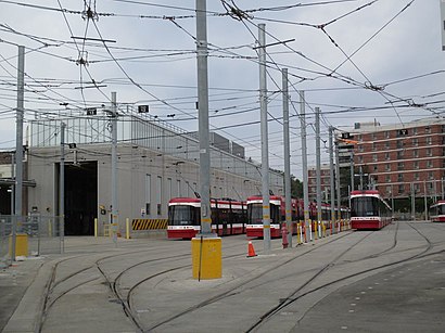
These Streetcar lines stop near Sunnyside Loop: 301, 304, 504B
The nearest streetcar stations to Sunnyside Loop in Toronto are Roncesvalles Ave at Queen St West and Queen St West at Roncesvalles Ave. The closest one is a 3 min walk away.
The nearest bus stops to Sunnyside Loop in Toronto are King St West at the Queensway and King St West at Queen St West. The closest one is a 4 min walk away.
The 504 is the first Streetcar that goes to Sunnyside Loop in Toronto. It stops nearby at 3:00 AM.
The 304 is the last Streetcar that goes to Sunnyside Loop in Toronto. It stops nearby at 3:51 AM.
The 47A is the first Bus that goes to Sunnyside Loop in Toronto. It stops nearby at 5:02 AM.
The 63S is the last Bus that goes to Sunnyside Loop in Toronto. It stops nearby at 2:35 AM.
The Bus fare to Sunnyside Loop costs about $3.10.
The Streetcar fare to Sunnyside Loop costs about $3.30.
Looking for directions to Sunnyside Loop in Toronto, Canada?
Download the Moovit App to find the current schedule and step-by-step directions for Bus, Streetcar, Subway or Train routes that pass through Sunnyside Loop.
Looking for the nearest stops closest to Sunnyside Loop ? Check out this list of closest stops to your destination: Roncesvalles Ave at Queen St West; Queen St West at Roncesvalles Ave; King St West at the Queensway; King St West at Queen St West; Parkside Dr at the Queensway; Macdonell Ave at Queen St West North Side.
Bus:Train:Subway:Streetcar:
We make riding on public transit to Sunnyside Loop easy, which is why over 1.5 million users, including users in Toronto trust Moovit as the best app for public transit.
Use the app to navigate to popular places including to the airport, hospital, stadium, grocery store, mall, coffee shop, school, college, and university.
Sunnyside Loop stop’s code is 11155
The first line to this stop is 63, at 5:13 AM, and the last line is 63 at 2:29 AM.
28 Sunnyside Ave, Toronto, ON, Canada
This stop serves TTC’s lines