Directions to Sunnyvale with public transportation
The following transit lines have routes that pass near Sunnyvale
How to get to Sunnyvale by bus?
Click on the bus route to see step by step directions with maps, line arrival times and updated time schedules.
How to get to Sunnyvale by train?
Click on the train route to see step by step directions with maps, line arrival times and updated time schedules.
Bus stops near Sunnyvale
- El Camino & Mathilda (E), 1 min walk,
- Sunnyvale-Saratoga & El Camino (N), 7 min walk,
- El Camino & Sunnyvale (W), 7 min walk,
- Washington & Charles (E), 14 min walk,
Train stations near Sunnyvale
- Sunnyvale, 17 min walk,
Light Rail stations near Sunnyvale
- Middlefield Station, 54 min walk,
Bus lines to Sunnyvale
- 22, Eastridge,
- 55, Lawrence & Tasman,
- 523, Rapid San Jose State,
- 522, Rapid Palo Alto,
- 53, Sunnyvale Transit Ctr,
What are the closest stations to Sunnyvale?
The closest stations to Sunnyvale are:
- El Camino & Mathilda (E) is 22 yards away, 1 min walk.
- Sunnyvale-Saratoga & El Camino (N) is 500 yards away, 7 min walk.
- El Camino & Sunnyvale (W) is 553 yards away, 7 min walk.
- Washington & Charles (E) is 1166 yards away, 14 min walk.
- Sunnyvale is 1410 yards away, 17 min walk.
- Middlefield Station is 4557 yards away, 54 min walk.
Which bus lines stop near Sunnyvale?
These bus lines stop near Sunnyvale: 22, 523.
Which train lines stop near Sunnyvale?
These train lines stop near Sunnyvale: LOCAL, LTD 4.
What’s the nearest train station to Sunnyvale?
The nearest train station to Sunnyvale is Sunnyvale. It’s a 17 min walk away.
What’s the nearest bus stop to Sunnyvale?
The nearest bus stop to Sunnyvale is El Camino & Mathilda (E). It’s a 1 min walk away.
What time is the first light rail to Sunnyvale?
The ORANGE LINE is the first light rail that goes to Sunnyvale. It stops nearby at 5:29 AM.
What time is the last light rail to Sunnyvale?
The ORANGE LINE is the last light rail that goes to Sunnyvale. It stops nearby at 11:04 PM.
What time is the first train to Sunnyvale?
The LOCAL is the first train that goes to Sunnyvale. It stops nearby at 4:38 AM.
What time is the last train to Sunnyvale?
The LOCAL is the last train that goes to Sunnyvale. It stops nearby at 1:25 AM.
What time is the first bus to Sunnyvale?
The 22 is the first bus that goes to Sunnyvale. It stops nearby at 4:49 AM.
What time is the last bus to Sunnyvale?
The 22 is the last bus that goes to Sunnyvale. It stops nearby at 2:12 AM.
See Sunnyvale on the map
Public Transportation to Sunnyvale
Wondering how to get to Sunnyvale, United States? Moovit helps you find the best way to get to Sunnyvale with step-by-step directions from the nearest public transit station.
Moovit provides free maps and live directions to help you navigate through your city. View schedules, routes, timetables, and find out how long does it take to get to Sunnyvale in real time.
Looking for the nearest stop or station to Sunnyvale? Check out this list of stops closest to your destination: El Camino & Mathilda (E); Sunnyvale-Saratoga & El Camino (N); El Camino & Sunnyvale (W); Washington & Charles (E); Sunnyvale; Middlefield Station.
Bus: 22, 523, 55, 522, 53.Train: LOCAL, LTD 4, LTD 3, LTD 5.
Want to see if there’s another route that gets you there at an earlier time? Moovit helps you find alternative routes or times. Get directions from and directions to Sunnyvale easily from the Moovit App or Website.
We make riding to Sunnyvale easy, which is why over 1.5 million users, including users in Sunnyvale, trust Moovit as the best app for public transit. You don’t need to download an individual bus app or train app, Moovit is your all-in-one transit app that helps you find the best bus time or train time available.
For information on prices of bus, train and light rail, costs and ride fares to Sunnyvale, please check the Moovit app.
Use the app to navigate to popular places including to the airport, hospital, stadium, grocery store, mall, coffee shop, school, college, and university.
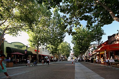
Sunnyvale Address: West El Camino Real street in Sunnyvale
Popular routes to Sunnyvale
Popular routes from Sunnyvale
Attractions near Sunnyvale
ITEX,Brian O'Neill Construction,A-Sams Garage Doors,Vivint Home Security,FedEx,Garage Door Repair Sunnyvale,Jeff Scott - Home Mortgage Consultant,Larry D Hughes Attorney,A D T About A D T Alarm A D T Security,STARBUCKS,Alma Infotech,Silicon Valley Spine Disc,Josephine Cheung,Elements Massage - Sunnyvale,Madison Reed Hair Color Bar- Sunnyvale - Coming Soon!,Yantra Skin Philosophy,T-Mobile,Sunnyvale Lockout & Change,Dish Network,Bay Casino GamingHow to get to popular attractions in Sunnyvale with public transit
Walmart Supercenter, American Canyon,City of Rohnert Park, Rohnert Park,Concord BART Station, Concord,California's Great America, Santa Clara,Regal Cinemas Hacienda Crossings 21 & IMAX, Dublin,Renaissance ClubSport Walnut Creek Hotel, Contra Costa Centre,eBay Headquarters, San Jose,NASA Ames Research Center,Fentons Creamery & Restaurant, Oakland,San Ramon, San Ramon,City of Cupertino, Cupertino,Santa Clara, CA, Santa Clara,Whole Foods Market, San Ramon,ClubSport, Fremont,Highway 4, Pacheco,440 Castro, Castro/Upper Market,Santa Rosa Plaza, Santa Rosa,Buena Vista Cafe, Russian Hill, Sf,De Anza College, Cupertino,South Hayward BART Station, HaywardGet around San Francisco - San Jose, CA by public transit!
Traveling around San Francisco - San Jose, CA has never been so easy. See step by step directions as you travel to any attraction, street or major public transit station. View bus and train schedules, arrival times, service alerts and detailed routes on a map, so you know exactly how to get to anywhere in San Francisco - San Jose, CA.
When traveling to any destination around San Francisco - San Jose, CA use Moovit's Live Directions with Get Off Notifications to know exactly where and how far to walk, how long to wait for your line, and how many stops are left. Moovit will alert you when it's time to get off — no need to constantly re-check whether yours is the next stop.
Wondering how to use public transit in San Francisco - San Jose, CA or how to pay for public transit in San Francisco - San Jose, CA? Moovit public transit app can help you navigate your way with public transit easily, and at minimum cost. It includes public transit fees, ticket prices, and costs. Looking for a map of San Francisco - San Jose, CA public transit lines? Moovit public transit app shows all public transit maps in San Francisco - San Jose, CA with all Bus, Train, BART, Light Rail, Ferry and Cable Car routes and stops on an interactive map.
San Francisco - San Jose, CA has 6 transit type(s), including: Bus, Train, BART, Light Rail, Ferry and Cable Car, operated by several transit agencies, including BART, Bay Area Rapid Transit, Muni Metro, Caltrain, VTA, Capitol Corridor, Sonoma Marin Area Rail Transit, MUNI, SF Cable Car, AC Transit, Dumbarton Express, Golden Gate Transit, County Connection, SamTrans, SamTrans / City of Menlo Park