Directions to Times Sq (Manhattan) with public transportation
The following transit lines have routes that pass near Times Sq
How to get to Times Sq by bus?
Click on the bus route to see step by step directions with maps, line arrival times and updated time schedules.
How to get to Times Sq by train?
Click on the train route to see step by step directions with maps, line arrival times and updated time schedules.
How to get to Times Sq by subway?
Click on the subway route to see step by step directions with maps, line arrival times and updated time schedules.
Bus stops near Times Sq in Manhattan
- 7 Av/W 44 St, 2 min walk,
- W 42 St/Broadway, 4 min walk,
- W 42 St/7 Av, 4 min walk,
- 7 Av/W 41 St, 4 min walk,
- 6 Av/W 44 St, 5 min walk,
- W 44 St/6 Av, 5 min walk,
- Av Of the Americas/W 45 St, 5 min walk,
- 6 Av/W 43 St, 5 min walk,
- 6 Av/W 42 St, 6 min walk,
Subway stations near Times Sq in Manhattan
- Times Sq - 42 St [N,Q,R,S,1,2,3,7,7x], 4 min walk,
- 42 St - Bryant Pk [B,D,F,M], 7 min walk,
Bus lines to Times Sq in Manhattan
- M7, 14 St Via Columbus Via 7 Av,
- M104, 41 St Via Broadway/7 Av,
- M42, East Side U N-1 Av Crosstown,
- SIM8, Arden Hts Via Richmond Av Via Woodrow Rd,
- SIM8X, Park and Ride Si Mall,
- SIM22, Eltingville Via Ar Kill Rd Via Richmond,
- SIM25, Tottenville Via Rossville Av Via Foster,
- SIM26, Midtown Via 42 St Via Madison Av,
- SIM30, Rosebank Via Forest Av,
- BXM2, West Midtown Penn Sta-34 St Via Kappock St,
- M20, Lincoln Center 66 St Via 8 Av,
- QM15, Lindenwood - Midtown Express,
- QM16, Neponsit - Midtown Express,
- QM17, Far Rockaway - Midtown Express,
- QM18, South Ozone Park - Midtown Express,
- QM2, Bay Terrace Bell Bl Via Whitestone Exy Via Bayside,
- QM3, Midtown 57 St Via 6 Av,
- QM4, Electchester 164 St Via Jewel Av,
- QM20, Bay Terrace 211 St Via Willets Pt Bl Via Clearview,
- M55, 44 St 6 Av,
What are the closest stations to Times Sq?
The closest stations to Times Sq are:
- 7 Av/W 44 St is 71 yards away, 2 min walk.
- Times Sq - 42 St [N,Q,R,S,1,2,3,7,7x] is 235 yards away, 4 min walk.
- W 42 St/Broadway is 268 yards away, 4 min walk.
- W 42 St/7 Av is 274 yards away, 4 min walk.
- 7 Av/W 41 St is 300 yards away, 4 min walk.
- 6 Av/W 44 St is 327 yards away, 5 min walk.
- W 44 St/6 Av is 337 yards away, 5 min walk.
- Av Of the Americas/W 45 St is 370 yards away, 5 min walk.
- 6 Av/W 43 St is 378 yards away, 5 min walk.
- 6 Av/W 42 St is 435 yards away, 6 min walk.
- 42 St - Bryant Pk [B,D,F,M] is 556 yards away, 7 min walk.
Which bus lines stop near Times Sq?
These bus lines stop near Times Sq: 199, BXM2, M104, M55, Q32, QM10, QM18, QM20, X37.
Which train lines stop near Times Sq?
These train lines stop near Times Sq: FAR ROCKAWAY, HARLEM, HUDSON, LONG BEACH, MONTAUK, NC, PATH, PORT WASHINGTON.
Which subway lines stop near Times Sq?
These subway lines stop near Times Sq: 1, 7X, A, C, F, R, W.
What’s the nearest subway station to Times Sq in Manhattan?
The nearest subway station to Times Sq in Manhattan is Times Sq - 42 St [N,Q,R,S,1,2,3,7,7x]. It’s a 4 min walk away.
What’s the nearest bus stop to Times Sq in Manhattan?
The nearest bus stop to Times Sq in Manhattan is 7 Av/W 44 St. It’s a 2 min walk away.
See Times Sq, Manhattan, on the map
Public Transit to Times Sq in Manhattan
Wondering how to get to Times Sq in Manhattan, United States? Moovit helps you find the best way to get to Times Sq with step-by-step directions from the nearest public transit station.
Moovit provides free maps and live directions to help you navigate through your city. View schedules, routes, timetables, and find out how long does it take to get to Times Sq in real time.
Looking for the nearest stop or station to Times Sq? Check out this list of stops closest to your destination: 7 Av/W 44 St; Times Sq - 42 St [N,Q,R,S,1,2,3,7,7x]; W 42 St/Broadway; W 42 St/7 Av; 7 Av/W 41 St; 6 Av/W 44 St; W 44 St/6 Av; Av Of the Americas/W 45 St; 6 Av/W 43 St; 6 Av/W 42 St; 42 St - Bryant Pk [B,D,F,M].
Bus: 199, BXM2, M104, M55, Q32, QM10, QM18, QM20, X37, M7, M42, SIM8, SIM8X, SIM22, SIM25, SIM26, M20.Train: FAR ROCKAWAY, HARLEM, HUDSON, LONG BEACH, MONTAUK, NC, PATH, PORT WASHINGTON.Subway: 1, 7X, A, C, F, R, W, N, Q, S, B, D, FX, M.
Want to see if there’s another route that gets you there at an earlier time? Moovit helps you find alternative routes or times. Get directions from and directions to Times Sq easily from the Moovit App or Website.
We make riding to Times Sq easy, which is why over 1.5 million users, including users in Manhattan, trust Moovit as the best app for public transit. You don’t need to download an individual bus app or train app, Moovit is your all-in-one transit app that helps you find the best bus time or train time available.
For information on prices of subway, train and bus, costs and ride fares to Times Sq, please check the Moovit app.
Use the app to navigate to popular places including to the airport, hospital, stadium, grocery store, mall, coffee shop, school, college, and university.
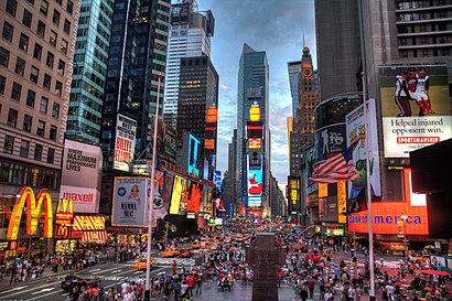
Times Sq Address: New York, NY 10036 street in Manhattan
Attractions near Times Sq
LINE Friends Store,Lion King Broadway Musical,Minskoff Theatre,Junior's Cheesecake ,Roy Rogers Restaurant,Marketing Computers Magazine,ChaCha,MTV Studios,GE Wonderground - Time Square,MTV TRL Studios,The Sky Square @ Viacom,Footlocker. Times square 42nd St.,GAP,Häagen-Dazs,B1 Models,MTV Networks,NYC Hot Carts Tour,Nokia Theater Times Square,Kiko Milano,Line Friends Store New YorkHow to get to popular attractions in Manhattan with public transit
Nassau Community College, East Garden City, Ny,JFK Terminal 5 / Air Train Station, Queens,103 Canal St, Manhattan,Consulado del Ecuador en Nueva York, Manhattan,Times Square, Manhattan,165-08 88th Avenue, Queens,Coram, NY, Coram, Ny,Atlantic City, NJ, Atlantic City, Nj,Community Coach Bus 77, West Orange, Nj,1000 5th Avenue, Manhattan,3400 Bainbridge Avenue Bronx, Bronx,MTA Subway - Lexington Ave / 53rd St (E / M/6), Manhattan,Norwalk, CT, Norwalk, Ct,Uniondale, NY, Uniondale, Ny,MTA Bus - M1 / M2 / M3 (Madison Ave & E 30th St), Manhattan,Edge NYC, Manhattan,Vessel, Manhattan,Walmart, Linden, Nj,Whitney Museum Of American Art, Manhattan,Astor Place Subway Station, ManhattanGet around New York - New Jersey by public transit!
Traveling around New York - New Jersey has never been so easy. See step by step directions as you travel to any attraction, street or major public transit station. View bus and train schedules, arrival times, service alerts and detailed routes on a map, so you know exactly how to get to anywhere in New York - New Jersey.
When traveling to any destination around New York - New Jersey use Moovit's Live Directions with Get Off Notifications to know exactly where and how far to walk, how long to wait for your line, and how many stops are left. Moovit will alert you when it's time to get off — no need to constantly re-check whether yours is the next stop.
Wondering how to use public transit in New York - New Jersey or how to pay for public transit in New York - New Jersey? Moovit public transit app can help you navigate your way with public transit easily, and at minimum cost. It includes public transit fees, ticket prices, and costs. Looking for a map of New York - New Jersey public transit lines? Moovit public transit app shows all public transit maps in New York - New Jersey with all Bus, Train, Subway, Light Rail, Ferry and Cable Car routes and stops on an interactive map.
New York - New Jersey has 6 transit type(s), including: Bus, Train, Subway, Light Rail, Ferry and Cable Car, operated by several transit agencies, including MTA Subway, Metro-North Railroad, LIRR, PATH, Shore Line East, MTA Bus Company, MTA New York City Transit - Express routes, MTA Bus, NJ Transit, NYC Ferry, NICE bus, Bee-Line Bus, NJ Transit Rail, Norwalk Transit District, CTTransit - Waterbury-Meriden