Directions to BF International (Las Piñas) with public transportation
The following transit lines have routes that pass near BF International
How to get to BF International by bus?
Click on the bus route to see step by step directions with maps, line arrival times and updated time schedules.
Bus stops near BF International in Las Piñas
- Alabang-Zapote Road, Las Piñas City, Manila, 27 min walk,
Bus lines to BF International in Las Piñas
- BUS, Moonwalk - Plaza Lawton,
- BUS, Alabang Lawton via Zapote Coastal Rd,
- BUS, Alabang - Plaza Lawton,
- JEEP, Baclaran - Moonwalk via Quirino,
- JEEP, Alabang - Baclaran via San Dionisio, Zapote,
- JEEP, BACLARAN - ALABANG via SAN DIONISIO,
- JEEP, Alabang Baclaran via Coastal,
- JEEP, Almanza ( Las Pi�as ) - Baclaran,
- JEEP, ALABANG - LAS PINAS,
- JEEP, Alabang - Zapote (Las Pi�as),
- UV, Mrt-3 Ayala Station, Makati City, Manila,
What are the closest stations to BF International?
The closest stations to BF International are:
- Alabang-Zapote Road, Las Piñas City, Manila is 2082 meters away, 27 min walk.
Which bus lines stop near BF International?
These bus lines stop near BF International: LTFRB-PUJ1014, LTFRB-PUJ1098, LTFRB-PUJ2087, LTFRB-PUJ2089, LTFRB-PUJ2594.
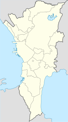
See BF International, Las Piñas, on the map
- Map derived from File:BlankMap-MetroManila.png
- Colors and stroke widths based from File:Italy location map.svg
Public Transit to BF International in Las Piñas
Wondering how to get to BF International in Las Piñas, Philippines? Moovit helps you find the best way to get to BF International with step-by-step directions from the nearest public transit station.
Moovit provides free maps and live directions to help you navigate through your city. View schedules, routes, timetables, and find out how long does it take to get to BF International in real time.
Looking for the nearest stop or station to BF International? Check out this list of stops closest to your destination: Alabang-Zapote Road.
Bus: LTFRB-PUJ1014, LTFRB-PUJ1098, LTFRB-PUJ2087, LTFRB-PUJ2089, LTFRB-PUJ2594, BUS, BUS, BUS, JEEP, JEEP, UV.
Want to see if there’s another route that gets you there at an earlier time? Moovit helps you find alternative routes or times. Get directions from and directions to BF International easily from the Moovit App or Website.
We make riding to BF International easy, which is why over 1.5 million users, including users in Las Piñas, trust Moovit as the best app for public transit. You don’t need to download an individual bus app or train app, Moovit is your all-in-one transit app that helps you find the best bus time or train time available.
For information on prices of bus, costs and ride fares to BF International, please check the Moovit app.
Use the app to navigate to popular places including to the airport, hospital, stadium, grocery store, mall, coffee shop, school, college, and university.
BF International Address: Taipei street in Las Piñas
- Map derived from File:BlankMap-MetroManila.png
- Colors and stroke widths based from File:Italy location map.svg
Attractions near BF International
Las Pinas 2,Taipei,Tropical Palace Resort, BF Homes,Tropical Palace,Teheran,33 Tehran,Open Church,El Grande,31 Teheran,El Grande Ave,Nur Bldg,237 El Grande Avenue,BF Thai,Alba's Catering BF Homes,Alba Catering and Foods Services,Bf Tourist Homeowners Association, Inc.,Perth,43 Perth,Orlando LL Ortiz Designs Associates,Lord's Christian CircleHow to get to popular attractions in Las Piñas with public transit
Landbank Plaza, Manila,Forever 21,Starbucks Coffee,North Olympus Subdivision, Kalookan City,Malate, Manila,Bahayang Pag-asa Subdivision, Imus,SM Cinema Southmall, Las Piñas,Starbucks Coffee, Dasmariñas,Divisoria, Manila,Manila-Cavite Expressway (CavitEx), Las Piñas,Starbucks Coffee, Las Piñas,NAIA Terminal 4 Arrival Area,DFA Office of Consular Affairs, Parañaque,Starbucks Coffee, San Pedro,Fairview, Quezon City,Starbucks Coffee, Quezon City,Starbucks Coffee, Las Piñas,Ninoy Aquino International Airport (MNL) Terminal 4,Seaside Boulevard,Katarungan Village, MuntinlupaGet around Manila by public transit!
Traveling around Manila has never been so easy. See step by step directions as you travel to any attraction, street or major public transit station. View bus and train schedules, arrival times, service alerts and detailed routes on a map, so you know exactly how to get to anywhere in Manila.
When traveling to any destination around Manila use Moovit's Live Directions with Get Off Notifications to know exactly where and how far to walk, how long to wait for your line, and how many stops are left. Moovit will alert you when it's time to get off — no need to constantly re-check whether yours is the next stop.
Wondering how to use public transit in Manila or how to pay for public transit in Manila? Moovit public transit app can help you navigate your way with public transit easily, and at minimum cost. It includes public transit fees, ticket prices, and costs. Looking for a map of Manila public transit lines? Moovit public transit app shows all public transit maps in Manila with all Bus and Train routes and stops on an interactive map.
Manila has 2 transit type(s), including: Bus and Train, operated by several transit agencies, including MRTC, LRTA, PNR, LTFRB, BGC Bus, P2P, UV Express