Directions to Cathedral Parish of St. Andrew (Parañaque) with public transportation
The following transit lines have routes that pass near Cathedral Parish of St. Andrew
How to get to Cathedral Parish of St. Andrew by bus?
Click on the bus route to see step by step directions with maps, line arrival times and updated time schedules.
How to get to Cathedral Parish of St. Andrew by train?
Click on the train route to see step by step directions with maps, line arrival times and updated time schedules.
Bus stops near Cathedral Parish of St. Andrew in Parañaque
- P. Dandan / Quirino Ave Intersection, Parañaque City, Manila, 2 min walk,
- Manila-Cavite Expressway, Parañaque City, Manila, 5 min walk,
- Imelda Bridge, Parañaque City, Manila, 7 min walk,
- Multinational Avenue, Paranaque City, 14 min walk,
- Quirino Ave, Parañaque City, Manila, 16 min walk,
Train stations near Cathedral Parish of St. Andrew in Parañaque
- Edsa Lrt, 35 min walk,
- Taft Ave Mrt, 36 min walk,
Bus lines to Cathedral Parish of St. Andrew in Parañaque
- JEEP, Baclaran - Moonwalk via Quirino,
- JEEP, Alabang - Baclaran via San Dionisio, Zapote,
- JEEP, BACLARAN - ALABANG via SAN DIONISIO,
- JEEP, Baclaran - Zapote (Las Pinas),
- JEEP, Almanza ( Las Pi�as ) - Baclaran,
- JEEP, Baclaran - Bacoor,
- JEEP, Imus Zapote,
- JEEP, Baclaran Zapote via Redemptorist,
- JEEP, BACLARAN - ZAPOTE BACOOR,
- BUS, Governor's Dv, Dasmariñas City, Manila,
- BUS, Mrt-3 Ayala Station, Makati City, Manila,
- BUS, Plaza Santa Cruz, Manila City,
- BUS, San Agustin Bus Terminal, Emilio Aguinaldo Hwy, Lungsod Ng Dasmariñas, Manila,
- BUS, Andres Soriano Jr Ave / Muralla Intersection, Manila,
- BUS, Alabang-Zapote Road, Muntinlupa City, Manila,
- JEEP, Manila-Cavite Expressway, Parañaque City, Manila,
- JEEP, Roxas Blvd / C. Rivera Intersection, Parañaque City, Manila,
- JEEP, Fb Harrison, 3050,
- JEEP, Block-B Internal Rd, Lungsod Ng Dasmariñas, Manila,
- JEEP, Baclaran - Sucat/SSH via Quirino Ave.,
What are the closest stations to Cathedral Parish of St. Andrew?
The closest stations to Cathedral Parish of St. Andrew are:
- P. Dandan / Quirino Ave Intersection, Parañaque City, Manila is 84 meters away, 2 min walk.
- Manila-Cavite Expressway, Parañaque City, Manila is 353 meters away, 5 min walk.
- Imelda Bridge, Parañaque City, Manila is 515 meters away, 7 min walk.
- Multinational Avenue, Paranaque City is 1026 meters away, 14 min walk.
- Quirino Ave, Parañaque City, Manila is 1163 meters away, 16 min walk.
- Edsa Lrt is 2737 meters away, 35 min walk.
- Taft Ave Mrt is 2773 meters away, 36 min walk.
Which bus lines stop near Cathedral Parish of St. Andrew?
These bus lines stop near Cathedral Parish of St. Andrew: BUS, JEEP.
Which train line stops near Cathedral Parish of St. Andrew?
LRT 1
What’s the nearest bus stop to Cathedral Parish of St. Andrew in Parañaque?
The nearest bus stop to Cathedral Parish of St. Andrew in Parañaque is P. Dandan / Quirino Ave Intersection, Parañaque City, Manila. It’s a 2 min walk away.
What time is the first train to Cathedral Parish of St. Andrew in Parañaque?
The LRT 1 is the first train that goes to Cathedral Parish of St. Andrew in Parañaque. It stops nearby at 5:00 AM.
What time is the last train to Cathedral Parish of St. Andrew in Parañaque?
The MRT3 is the last train that goes to Cathedral Parish of St. Andrew in Parañaque. It stops nearby at 11:27 PM.
What time is the first bus to Cathedral Parish of St. Andrew in Parañaque?
The JEEP is the first bus that goes to Cathedral Parish of St. Andrew in Parañaque. It stops nearby at 7:00 AM.
What time is the last bus to Cathedral Parish of St. Andrew in Parañaque?
The BUS is the last bus that goes to Cathedral Parish of St. Andrew in Parañaque. It stops nearby at 2:48 AM.
See Cathedral Parish of St. Andrew, Parañaque, on the map
Public Transit to Cathedral Parish of St. Andrew in Parañaque
Wondering how to get to Cathedral Parish of St. Andrew in Parañaque, Philippines? Moovit helps you find the best way to get to Cathedral Parish of St. Andrew with step-by-step directions from the nearest public transit station.
Moovit provides free maps and live directions to help you navigate through your city. View schedules, routes, timetables, and find out how long does it take to get to Cathedral Parish of St. Andrew in real time.
Looking for the nearest stop or station to Cathedral Parish of St. Andrew? Check out this list of stops closest to your destination: P. Dandan / Quirino Ave Intersection; Manila-Cavite Expressway; Imelda Bridge; Multinational Avenue; Quirino Ave; Edsa Lrt; Taft Ave Mrt.
Bus: BUS, JEEP.Train: LRT 1, MRT3.
Want to see if there’s another route that gets you there at an earlier time? Moovit helps you find alternative routes or times. Get directions from and directions to Cathedral Parish of St. Andrew easily from the Moovit App or Website.
We make riding to Cathedral Parish of St. Andrew easy, which is why over 1.5 million users, including users in Parañaque, trust Moovit as the best app for public transit. You don’t need to download an individual bus app or train app, Moovit is your all-in-one transit app that helps you find the best bus time or train time available.
For information on prices of bus and train, costs and ride fares to Cathedral Parish of St. Andrew, please check the Moovit app.
Use the app to navigate to popular places including to the airport, hospital, stadium, grocery store, mall, coffee shop, school, college, and university.
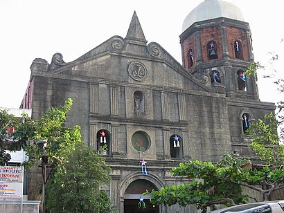
Cathedral Parish of St. Andrew Address: Quirino Ave. street in Parañaque
Attractions near Cathedral Parish of St. Andrew
Parañaque Police Station 2,SM Savemore, Zapote Bacoor,Psbank La Huerta Branch,La Huerta,Ospital ng Parañaque,Paranaque Super Palengke,MDC 077 Paranaque La Huerta,Bureau of Fire Protection,1700 Paranaque - Sucat Road,Pamilihang Bayan Ng Paranaque,J.A. Macaraig Lying-in Clinic,Saint Andrew's School,Units 6&7 Palanca St.,Fruition Bldg., BF Homes, 1700 Parañaque,DSV,Parañaque Public Market,La Huerta Wet and Dry Market,Sacred Heart Catholic School,St. Andrews School,Union Bank ATM, Paranaque,New Corona Builders Center Corp.How to get to popular attractions in Parañaque with public transit
Fitness First, Manila,Ninoy Aquino International Airport (MNL) Terminal 2,CaviteX Las Piñas Toll Barrier, Las Piñas,De La Salle University - Dasmariñas, Dasmariñas,Mall of Asia Arena Annex Building, Parañaque,Newport City,C5 Waterfun, Taguig,Malate, Manila,Starbucks Coffee, San Pedro,Starbucks Coffee, Quezon City,Filinvest Interchange, Muntinlupa,DLTB Co.,SM City Molino, Bacoor,J.CO Donuts & Coffee,Starbucks Coffee, Bulacan,Forever 21,LRT 1 (Gil Puyat Station),Mabuhay Lounge,Valenzuela City, Valenzuela,College of Tourism and Hospitality Management (CTHM) Building, DasmariñasGet around Manila by public transit!
Traveling around Manila has never been so easy. See step by step directions as you travel to any attraction, street or major public transit station. View bus and train schedules, arrival times, service alerts and detailed routes on a map, so you know exactly how to get to anywhere in Manila.
When traveling to any destination around Manila use Moovit's Live Directions with Get Off Notifications to know exactly where and how far to walk, how long to wait for your line, and how many stops are left. Moovit will alert you when it's time to get off — no need to constantly re-check whether yours is the next stop.
Wondering how to use public transit in Manila or how to pay for public transit in Manila? Moovit public transit app can help you navigate your way with public transit easily, and at minimum cost. It includes public transit fees, ticket prices, and costs. Looking for a map of Manila public transit lines? Moovit public transit app shows all public transit maps in Manila with all Bus and Train routes and stops on an interactive map.
Manila has 2 transit type(s), including: Bus and Train, operated by several transit agencies, including MRTC, LRTA, PNR, LTFRB, BGC Bus, P2P, UV Express