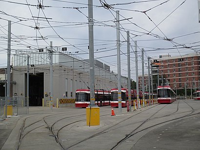
Sunnyside Loop stop - Thursday schedule
| Line | Direction | Time |
|---|---|---|
| 63 | Sunnyside Loop | 5:13 AM |
| 63A | Ossington Station | 5:15 AM |
| 63A | Eglinton West Station | 5:20 AM |
| 63 | Sunnyside Loop | 5:23 AM |
| 63A | Ossington Station | 5:30 AM |
| 63A | Ossington Station | 5:45 AM |
| 63 | Sunnyside Loop | 5:46 AM |
| 63 | Sunnyside Loop | 5:57 AM |
| 63A | Ossington Station | 6:00 AM |
| 63 | Sunnyside Loop | 6:07 AM |
| 63A | Ossington Station | 6:15 AM |
| 63 | Sunnyside Loop | 6:24 AM |
| 63A | Ossington Station | 6:30 AM |
| 63 | Sunnyside Loop | 6:39 AM |
| 63A | Ossington Station | 6:45 AM |
| 63 | Sunnyside Loop | 6:54 AM |
| 63 | Sunnyside Loop | 6:59 AM |
| 63A | Ossington Station | 7:00 AM |
| 63 | Sunnyside Loop | 7:04 AM |
| 63 | Sunnyside Loop | 7:09 AM |
| 63A | Ossington Station | 7:10 AM |
| 63 | Sunnyside Loop | 7:13 AM |
| 63B | Ossington Station | 7:15 AM |
| 63 | Sunnyside Loop | 7:19 AM |
| 63A | Ossington Station | 7:20 AM |
Directions to Sunnyside Loop (Toronto) with public transportation
The following transit lines have routes that pass near Sunnyside Loop
How to get to Sunnyside Loop by bus?
Click on the bus route to see step by step directions with maps, line arrival times and updated time schedules.
How to get to Sunnyside Loop by train?
Click on the train route to see step by step directions with maps, line arrival times and updated time schedules.
How to get to Sunnyside Loop by subway?
Click on the subway route to see step by step directions with maps, line arrival times and updated time schedules.
Bus stops near Sunnyside Loop in Toronto
- St Joseph's Health Centre at 30 the Queensway, 2 min walk,
- Parkside Dr at the Queensway, 5 min walk,
- Parkside Dr at the Queensway North Side, 5 min walk,
- King St West at the Queensway, 7 min walk,
- King St West at Queen St West, 8 min walk,
- Macdonell Ave at Queen St West North Side, 12 min walk,
Streetcar stations near Sunnyside Loop in Toronto
- The Queensway at Glendale Ave East Side - St Joseph's Health Centre, 2 min walk,
- Roncesvalles Ave at Queen St West, 3 min walk,
Bus lines to Sunnyside Loop in Toronto
- 402, Toronto Rehab - Bickle Centre at 130 Dunn Ave,
- 80, Sherway Gardens Rd at Sherway Gate Mall West Side,
- 80A, Keele Station,
- 63A, Ossington Station,
- 63B, Ossington Station,
- 63S, Shaw St at King St West North Side,
- 63, Sunnyside Loop,
- 47A, Lansdowne Ave at Wade Ave - Lansdowne Station,
- 47B, Lansdowne Ave at Wade Ave - Lansdowne Station,
- 47C, Lansdowne Ave at Wade Ave - Lansdowne Station,
What are the closest stations to Sunnyside Loop?
The closest stations to Sunnyside Loop are:
- St Joseph's Health Centre at 30 the Queensway is 106 meters away, 2 min walk.
- The Queensway at Glendale Ave East Side - St Joseph's Health Centre is 129 meters away, 2 min walk.
- Roncesvalles Ave at Queen St West is 198 meters away, 3 min walk.
- Parkside Dr at the Queensway is 312 meters away, 5 min walk.
- Parkside Dr at the Queensway North Side is 314 meters away, 5 min walk.
- King St West at the Queensway is 546 meters away, 7 min walk.
- King St West at Queen St West is 561 meters away, 8 min walk.
- Macdonell Ave at Queen St West North Side is 904 meters away, 12 min walk.
Which bus lines stop near Sunnyside Loop?
These bus lines stop near Sunnyside Loop: 47B, 63, 80.
Which train line stops near Sunnyside Loop?
UP
Which subway line stops near Sunnyside Loop?
2
Which Streetcar lines stop near Sunnyside Loop?
These Streetcar lines stop near Sunnyside Loop: 504A, 504B.
What’s the nearest Streetcar station to Sunnyside Loop in Toronto?
The nearest Streetcar station to Sunnyside Loop in Toronto is The Queensway at Glendale Ave East Side - St Joseph's Health Centre. It’s a 2 min walk away.
What’s the nearest bus stop to Sunnyside Loop in Toronto?
The nearest bus stop to Sunnyside Loop in Toronto is St Joseph's Health Centre at 30 the Queensway. It’s a 2 min walk away.
What time is the first Streetcar to Sunnyside Loop in Toronto?
The 301 is the first Streetcar that goes to Sunnyside Loop in Toronto. It stops nearby at 3:05 AM.
What time is the last Streetcar to Sunnyside Loop in Toronto?
The 304 is the last Streetcar that goes to Sunnyside Loop in Toronto. It stops nearby at 3:51 AM.
What time is the first bus to Sunnyside Loop in Toronto?
The 47A is the first bus that goes to Sunnyside Loop in Toronto. It stops nearby at 5:02 AM.
What time is the last bus to Sunnyside Loop in Toronto?
The 63S is the last bus that goes to Sunnyside Loop in Toronto. It stops nearby at 2:35 AM.
How much is the subway fare to Sunnyside Loop?
The subway fare to Sunnyside Loop costs about $3.30.
How much is the Streetcar fare to Sunnyside Loop?
The Streetcar fare to Sunnyside Loop costs about $3.30.
How much is the bus fare to Sunnyside Loop?
The bus fare to Sunnyside Loop costs about $3.10 - $3.75.
See Sunnyside Loop, Toronto, on the map
Public transit to Sunnyside Loop stop (ID: 11155) in Toronto
Looking for directions to Sunnyside Loop in Toronto, Canada?
Download the Moovit App to find the current schedule and step-by-step directions for Bus, Subway, Streetcar or Train routes that pass through Sunnyside Loop.
Looking for the nearest stops closest to Sunnyside Loop ? Check out this list of closest stops to your destination: St Joseph's Health Centre at 30 the Queensway; The Queensway at Glendale Ave East Side - St Joseph's Health Centre; Roncesvalles Ave at Queen St West; Parkside Dr at the Queensway; Parkside Dr at the Queensway North Side; King St West at the Queensway; King St West at Queen St West; Macdonell Ave at Queen St West North Side.
Bus: 47B, 63, 80, 402, 80A, 63A, 63B, 63S, 47A, 47C.Train: UP.Subway: 2.Streetcar: 504A, 504B.
We make riding on public transit to Sunnyside Loop easy, which is why over 1.5 million users, including users in Toronto trust Moovit as the best app for public transit.
Use the app to navigate to popular places including to the airport, hospital, stadium, grocery store, mall, coffee shop, school, college, and university.
Sunnyside Loop stop’s code is 11155
The first line to this stop is 63, at 5:13 AM, and the last line is 63S at 2:29 AM.
28 Sunnyside Ave, Toronto, ON, Canada
This stop serves TTC’s lines
Popular routes from Sunnyside Loop, Toronto
Bus stops near Sunnyside Loop
St Joseph's Health Centre at 30 the Queensway,Parkside Dr at the Queensway,Parkside Dr at the Queensway North Side,King St West at the Queensway,King St West at Queen St West,Macdonell Ave at Queen St West North SideStreetcar stations near Sunnyside Loop
The Queensway at Glendale Ave East Side - St Joseph's Health Centre,Roncesvalles Ave at Queen St WestPopular public transit stations in Toronto
Bathurst Street Ferry Terminal,682 Warden Ave,Eglinton Ave East at Kennedy Rd,Rogers Rd at Prospect Cemetery,Runnymede Station,Yorkdale,Steeles Ave. E. @ Kennedy Rd. S.,Clarington Blvd. @ Durham Hwy. 2 (Bowmanville) Park & Ride,Symington Ave at Dupont St,King at Caroline,Milner Ave at Mccowan Rd,Sheppard Ave East at Kingston Rd North Side,Winston Churchill Blvd at Maple Lodge Farms,Erindale Go,Carlaw Ave at Queen St East,Mcnicoll Ave at Markham Rd,St George Station,Don Mills Rd at Wynford Dr,Queens Quay West at Rees St,Lisgar Dr at Derry RdGet around Toronto by public transit!
Traveling around Toronto has never been so easy. See step by step directions as you travel to any attraction, street or major public transit station. View bus and train schedules, arrival times, service alerts and detailed routes on a map, so you know exactly how to get to anywhere in Toronto.
When traveling to any destination around Toronto use Moovit's Live Directions with Get Off Notifications to know exactly where and how far to walk, how long to wait for your line, and how many stops are left. Moovit will alert you when it's time to get off — no need to constantly re-check whether yours is the next stop.
Wondering how to use public transit in Toronto or how to pay for public transit in Toronto? Moovit public transit app can help you navigate your way with public transit easily, and at minimum cost. It includes public transit fees, ticket prices, and costs. Looking for a map of Toronto public transit lines? Moovit public transit app shows all public transit maps in Toronto with all Bus, Train, Subway, Streetcar and Ferry routes and stops on an interactive map.
Toronto has 5 transit type(s), including: Bus, Train, Subway, Streetcar and Ferry, operated by several transit agencies, including TTC, TTC Streetcar, Toronto Subway, Brampton Transit, MiWay, York Region Transit, GO Transit Bus, GO Transit, Durham Region Transit, UP Express, Grand River Transit, Guelph Transit, grt, Hamilton Street Railway, Burlington Transit