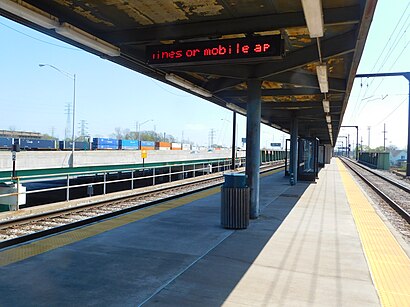
Directions to Gary Metro Center with public transportation
The following transit lines have routes that pass near Gary Metro Center
How to get to Gary Metro Center by bus?
Click on the bus route to see step by step directions with maps, line arrival times and updated time schedules.
How to get to Gary Metro Center by train?
Click on the train route to see step by step directions with maps, line arrival times and updated time schedules.
Bus stops near Gary Metro Center
- Gary Bus Station, 2 min walk,
- 5th & Broadway, 5 min walk,
- Gary State Bank (5th Ave), 6 min walk,
- 5th & Adams, 6 min walk,
- Metro Center, 10 min walk,
Bus lines to Gary Metro Center
- GREYHOUND US0100, Atlanta - Chicago,
- GREYHOUND US0120, Chicago - Cincinnati,
- GREYHOUND US0120S, Chicago - Indianapolis,
- GREYHOUND US0130, Chicago - St. Louis - Memphis,
- GREYHOUND US0155S, Chicago - Davenport - Des Moines,
- GREYHOUND US0160, Chicago - Kalamazoo - Detroit,
- GREYHOUND US0164, Chicago - Cleveland - Washington,
- L2, Metro Center,
- R3, Burr-Lake-Ridge To Metro Center - Flag the Bus at Any Stop Or Intersection,
- R-BMX, Roundtrip,
- L1, Metro Center,
- R1, Roundtrip,
What are the closest stations to Gary Metro Center?
The closest stations to Gary Metro Center are:
- Gary Bus Station is 102 yards away, 2 min walk.
- 5th & Broadway is 357 yards away, 5 min walk.
- Gary State Bank (5th Ave) is 436 yards away, 6 min walk.
- 5th & Adams is 439 yards away, 6 min walk.
- Metro Center is 795 yards away, 10 min walk.
Which bus lines stop near Gary Metro Center?
These bus lines stop near Gary Metro Center: GREYHOUND US0100, R1.
Which train line stops near Gary Metro Center?
SSL
What’s the nearest bus stop to Gary Metro Center?
The nearest bus stop to Gary Metro Center is Gary Bus Station. It’s a 2 min walk away.
What time is the first bus to Gary Metro Center?
The R-BMX is the first bus that goes to Gary Metro Center. It stops nearby at 5:12 AM.
What time is the last bus to Gary Metro Center?
The GREYHOUND US0100 is the last bus that goes to Gary Metro Center. It stops nearby at 1:10 PM.
See Gary Metro Center on the map
Public Transportation to Gary Metro Center
Wondering how to get to Gary Metro Center, United States? Moovit helps you find the best way to get to Gary Metro Center with step-by-step directions from the nearest public transit station.
Moovit provides free maps and live directions to help you navigate through your city. View schedules, routes, timetables, and find out how long does it take to get to Gary Metro Center in real time.
Looking for the nearest stop or station to Gary Metro Center? Check out this list of stops closest to your destination: Gary Bus Station; 5th & Broadway; Gary State Bank (5th Ave); 5th & Adams; Metro Center.
Bus: GREYHOUND US0100, R1, GREYHOUND US0120, GREYHOUND US0120S, GREYHOUND US0130, GREYHOUND US0155S, L2, R3, R-BMX, L1.Train: SSL.
Want to see if there’s another route that gets you there at an earlier time? Moovit helps you find alternative routes or times. Get directions from and directions to Gary Metro Center easily from the Moovit App or Website.
We make riding to Gary Metro Center easy, which is why over 1.5 million users, including users in Gary, trust Moovit as the best app for public transit. You don’t need to download an individual bus app or train app, Moovit is your all-in-one transit app that helps you find the best bus time or train time available.
For information on prices of train and bus, costs and ride fares to Gary Metro Center, please check the Moovit app.
Get to Gary Metro Center with public transit and pay for the ride in the Moovit app. In addition to all info you may need for your trip to Gary Metro Center, including live directions, real-time arrivals and fare prices, you can also buy public transit passes for your rides. No need for cash or paper tickets to get to Gary Metro Center - everything you need is accessible in the app with a click of the button.
Use the app to navigate to popular places including to the airport, hospital, stadium, grocery store, mall, coffee shop, school, college, and university.
Gary Metro Center Address: Gary, IN 46402 street in Gary
Popular routes from Gary Metro Center
Attractions near Gary Metro Center
Adam Benjamin Metro Center,Greyhound Bus,Lake County Sherif Dept Civil,Gary, Indiana,Broadway,County Clerk,Public Information,200 W 4th Ave,Peter Drywall Tape and Paint,Downtown Gary,pass control USS Gary works,Us Steel Pass Control,The Diamond Center at US Steel Yard,Gary Human Relations,Senior Health Information Network,Gary Action Now,The Remix Consignment and Resale Boutique,Lake County of Indiana,Calumet Township N Annex Building,City of GaryHow to get to popular attractions in Gary with public transit
LondonHouse Chicago, Curio Collection by Hilton, Chicago,Goodman Theater, Chicago,Selina Hotel Chicago, Chicago,Candy Cane Lane, Lincolnwood,Jew Town, Chicago,Sri Venkateswara Swami (Balaji) Temple of Greater Chicago, Aurora,Fairmont Hotel, Chicago,Elmhurst University, Elmhurst,Mercury Theater Chicago, Chicago,Hyatt Place Chicago / Downtown - the Loop, Chicago,36 S. Wabash, Chicago,Macy's (Macy's Downtown Chicago), Chicago,California Ave & 26th St, Chicago,Kenosha Metra Station,West Loop, Chicago,Northern Illinois University, Dekalb,400 North Michigan Avenue, Chicago,Homewood,IL, Homewood,Aon Center, Chicago,The Wit Hotel, ChicagoGet around Chicago by public transit!
Traveling around Chicago has never been so easy. See step by step directions as you travel to any attraction, street or major public transit station. View bus and train schedules, arrival times, service alerts and detailed routes on a map, so you know exactly how to get to anywhere in Chicago.
When traveling to any destination around Chicago use Moovit's Live Directions with Get Off Notifications to know exactly where and how far to walk, how long to wait for your line, and how many stops are left. Moovit will alert you when it's time to get off — no need to constantly re-check whether yours is the next stop.
Wondering how to use public transit in Chicago or how to pay for public transit in Chicago? Moovit public transit app can help you navigate your way with public transit easily, and at minimum cost. It includes public transit fees, ticket prices, and costs. Looking for a map of Chicago public transit lines? Moovit public transit app shows all public transit maps in Chicago with all Bus, Train and Chicago 'L' routes and stops on an interactive map.
Chicago has 3 transit type(s), including: Bus, Train and Chicago 'L', operated by several transit agencies, including CTA 'L', Metra, Northern Indiana Commuter Transportation District, CTA, PACE, Gary Public Transit, Amtrak, River Valley Metro, Valpo Transit, DeKalb Public Transit, FlixBus-us, Greyhound-us, Van Galder (Coach USA), Wisconsin Coach Lines