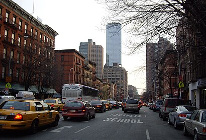
Directions to Hells Kitchen (Manhattan) with public transportation
The following transit lines have routes that pass near Hells Kitchen
How to get to Hells Kitchen by bus?
Click on the bus route to see step by step directions with maps, line arrival times and updated time schedules.
How to get to Hells Kitchen by train?
Click on the train route to see step by step directions with maps, line arrival times and updated time schedules.
How to get to Hells Kitchen by subway?
Click on the subway route to see step by step directions with maps, line arrival times and updated time schedules.
Bus stops near Hells Kitchen in Manhattan
- W 34 St/11 Av, 4 min walk,
- W 42 St/11 Av, 4 min walk,
- 11 Av/W 34 St, 5 min walk,
- Lincoln Tnl Ap/Lincoln Tnl Ap, 5 min walk,
- 10 Av/W 37 St, 5 min walk,
Subway stations near Hells Kitchen in Manhattan
- 34 St - 11 Av (7), 7 min walk,
- 34 St - Penn Station [A,C,E], 15 min walk,
Bus lines to Hells Kitchen in Manhattan
- M34-SBS, Select Bus Waterside Via 34 St Via 2 Av,
- M42, East Side U N-1 Av Crosstown,
- M12, Midtown West Columbus Circle,
- SIM8X, Park and Ride Si Mall,
- SIM22, Eltingville Via Ar Kill Rd Via Richmond,
- SIM23, Annadale Via Arden Av,
- SIM24, Princes Bay Via Huguenot Av,
- SIM25, Tottenville Via Rossville Av Via Foster,
- SIM26, Tottenville Via Blmingdale Rd Via Amboy,
- SIM30, Sunnyside Via Forest Av,
- M11, Riverbank 145 St Via 10 Av,
What are the closest stations to Hells Kitchen?
The closest stations to Hells Kitchen are:
- W 34 St/11 Av is 327 yards away, 4 min walk.
- W 42 St/11 Av is 334 yards away, 4 min walk.
- 11 Av/W 34 St is 340 yards away, 5 min walk.
- Lincoln Tnl Ap/Lincoln Tnl Ap is 342 yards away, 5 min walk.
- 10 Av/W 37 St is 367 yards away, 5 min walk.
- 34 St - 11 Av (7) is 504 yards away, 7 min walk.
- 34 St - Penn Station [A,C,E] is 1191 yards away, 15 min walk.
Which bus lines stop near Hells Kitchen?
These bus lines stop near Hells Kitchen: 161, 199, M11, M12, M20, M34-SBS, M42.
Which train lines stop near Hells Kitchen?
These train lines stop near Hells Kitchen: FAR ROCKAWAY, HARLEM, HUDSON, NC, PATH, PORT WASHINGTON.
Which subway lines stop near Hells Kitchen?
These subway lines stop near Hells Kitchen: 7, 7X, A.
Which ferry line stops near Hells Kitchen?
BELFORD/HARBOR WAY-PIER 11/WALL ST
What’s the nearest subway station to Hells Kitchen in Manhattan?
The nearest subway station to Hells Kitchen in Manhattan is 34 St - 11 Av (7). It’s a 7 min walk away.
What’s the nearest bus stop to Hells Kitchen in Manhattan?
The nearest bus stops to Hells Kitchen in Manhattan are W 34 St/11 Av and W 42 St/11 Av. The closest one is a 4 min walk away.
See Hells Kitchen, Manhattan, on the map
Public Transit to Hells Kitchen in Manhattan
Wondering how to get to Hells Kitchen in Manhattan, United States? Moovit helps you find the best way to get to Hells Kitchen with step-by-step directions from the nearest public transit station.
Moovit provides free maps and live directions to help you navigate through your city. View schedules, routes, timetables, and find out how long does it take to get to Hells Kitchen in real time.
Looking for the nearest stop or station to Hells Kitchen? Check out this list of stops closest to your destination: W 34 St/11 Av; W 42 St/11 Av; 11 Av/W 34 St; Lincoln Tnl Ap/Lincoln Tnl Ap; 10 Av/W 37 St; 34 St - 11 Av (7); 34 St - Penn Station [A,C,E].
Bus: 161, 199, M11, M12, M20, M34-SBS, M42, SIM8X, SIM22, SIM23, SIM24, SIM25.Train: FAR ROCKAWAY, HARLEM, HUDSON, NC, PATH, PORT WASHINGTON.Subway: 7, 7X, A, C, E.Ferry: BELFORD/HARBOR WAY-PIER 11/WALL ST.
Want to see if there’s another route that gets you there at an earlier time? Moovit helps you find alternative routes or times. Get directions from and directions to Hells Kitchen easily from the Moovit App or Website.
We make riding to Hells Kitchen easy, which is why over 1.5 million users, including users in Manhattan, trust Moovit as the best app for public transit. You don’t need to download an individual bus app or train app, Moovit is your all-in-one transit app that helps you find the best bus time or train time available.
For information on prices of bus, subway, train and ferry, costs and ride fares to Hells Kitchen, please check the Moovit app.
Use the app to navigate to popular places including to the airport, hospital, stadium, grocery store, mall, coffee shop, school, college, and university.
Hells Kitchen Address: New York NY street in Manhattan
Attractions near Hells Kitchen
11 Av/W 38 St,W 38th St 11th Ave,Javits Center Shuttle Bus,11th Ave & W 37th,W 37th / 11th,11th Ave 37th,643 W 37th St,552 W 38th St,Die Happy Tonight,Tranny Strip,James Bahn Private Investigator,11th Ave (39th street and 11th),NY NOW,Amtrak Train 49 Lake Shore Limited,Crazy Blind Date,11th Ave (11th avenue and west 36th),11th Ave (11th avenue and 36th street),11th Ave (11th and w 36th),11th Ave (11th west 36th street),11th Ave (west 36th and 11th ave)How to get to popular attractions in Manhattan with public transit
8th Ave and 31st St, Manhattan,Six Flags Great Adventure, Jackson, Nj,95-25 Queens Boulevard, Queens,Macy's Thanksgiving Day Parade, Manhattan,Crotona Park, Bronx,Bronx Zoo, Bronx,New York Aquarium,Garden State Plaza, Paramus, Nj,Norwalk, CT, Norwalk, Ct,Newport Mall, Jersey City, Nj,7th Avenue, Manhattan,Union City, NJ, Union City, Nj,Ellen's Stardust Diner, Manhattan,1 Bowling Grn, Manhattan,Color Factory, Manhattan,Flatiron Building, Manhattan,300 Community Drive, Manhasset, Ny,Long Island City, Queens,Empire City Casino Yonkers, Bronx,227 Madison Street, ManhattanGet around New York - New Jersey by public transit!
Traveling around New York - New Jersey has never been so easy. See step by step directions as you travel to any attraction, street or major public transit station. View bus and train schedules, arrival times, service alerts and detailed routes on a map, so you know exactly how to get to anywhere in New York - New Jersey.
When traveling to any destination around New York - New Jersey use Moovit's Live Directions with Get Off Notifications to know exactly where and how far to walk, how long to wait for your line, and how many stops are left. Moovit will alert you when it's time to get off — no need to constantly re-check whether yours is the next stop.
Wondering how to use public transit in New York - New Jersey or how to pay for public transit in New York - New Jersey? Moovit public transit app can help you navigate your way with public transit easily, and at minimum cost. It includes public transit fees, ticket prices, and costs. Looking for a map of New York - New Jersey public transit lines? Moovit public transit app shows all public transit maps in New York - New Jersey with all Bus, Train, Subway, Light Rail, Ferry and Cable Car routes and stops on an interactive map.
New York - New Jersey has 6 transit type(s), including: Bus, Train, Subway, Light Rail, Ferry and Cable Car, operated by several transit agencies, including MTA Subway, Metro-North Railroad, LIRR, PATH, Shore Line East, MTA Bus Company, MTA New York City Transit - Express routes, MTA Bus, NJ Transit, NYC Ferry, NICE bus, Bee-Line Bus, NJ Transit Rail, Norwalk Transit District, CTTransit - Waterbury-Meriden