Directions to Langwith-Whaley Thorns (Bolsover) with public transport
The following transport lines have routes that pass near Langwith-Whaley Thorns
How to get to Langwith-Whaley Thorns by bus?
Click on the bus route to see step by step directions with maps, line arrival times and updated time schedules.
How to get to Langwith-Whaley Thorns by train?
Click on the train route to see step by step directions with maps, line arrival times and updated time schedules.
Bus stops near Langwith-Whaley Thorns in Bolsover
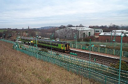
- Rail Station, Whaley Thorns, 4 min walk,
- Portland Road, Langwith, 7 min walk,
Bus lines to Langwith-Whaley Thorns in Bolsover
- 23, Whaley Thorns,
- 23A, Mansfield,
- 23B, Whaley Thorns,
- 1, Chesterfield,
- 209, Edwinstowe,
What are the nearest stations to Langwith-Whaley Thorns?
The nearest stations to Langwith-Whaley Thorns are:
- Rail Station, Whaley Thorns is 242 meters away, 4 min walk.
- Portland Road, Langwith is 519 meters away, 7 min walk.
Which bus lines stop near Langwith-Whaley Thorns?
These bus lines stop near Langwith-Whaley Thorns: 1, 23B.
Which train line stops near Langwith-Whaley Thorns?
EAST MIDLANDS RAILWAY
What’s the nearest bus stop to Langwith-Whaley Thorns in Bolsover?
The nearest bus stop to Langwith-Whaley Thorns in Bolsover is Rail Station, Whaley Thorns. It’s a 4 min walk away.
What time is the first bus to Langwith-Whaley Thorns in Bolsover?
The 23B is the first bus that goes to Langwith-Whaley Thorns in Bolsover. It stops nearby at 09:03.
What time is the last bus to Langwith-Whaley Thorns in Bolsover?
The 23B is the last bus that goes to Langwith-Whaley Thorns in Bolsover. It stops nearby at 21:07.
See Langwith-Whaley Thorns, Bolsover, on the map
Public Transit to Langwith-Whaley Thorns in Bolsover
Wondering how to get to Langwith-Whaley Thorns in Bolsover, United Kingdom? Moovit helps you find the best way to get to Langwith-Whaley Thorns with step-by-step directions from the nearest public transit station.
Moovit provides free maps and live directions to help you navigate through your city. View schedules, routes, timetables, and find out how long does it take to get to Langwith-Whaley Thorns in real time.
Looking for the nearest stop or station to Langwith-Whaley Thorns? Check out this list of stops closest to your destination: Rail Station; Portland Road.
Bus: 1, 23B, 23, 23A, 209.Train: EAST MIDLANDS RAILWAY.
Want to see if there’s another route that gets you there at an earlier time? Moovit helps you find alternative routes or times. Get directions from and directions to Langwith-Whaley Thorns easily from the Moovit App or Website.
We make riding to Langwith-Whaley Thorns easy, which is why over 1.5 million users, including users in Bolsover, trust Moovit as the best app for public transit. You don’t need to download an individual bus app or train app, Moovit is your all-in-one transit app that helps you find the best bus time or train time available.
For information on prices of bus and train, costs and ride fares to Langwith-Whaley Thorns, please check the Moovit app.
Use the app to navigate to popular places including to the airport, hospital, stadium, grocery store, mall, coffee shop, school, college, and university.
Langwith-Whaley Thorns Address: Park View street in Bolsover
Attractions near Langwith-Whaley Thorns
Langwith-Whaley Thorns,Langwith Whaley Thorns Station,Shop-Equip,Mansfield Refrigeration & Air Conditioning Co,Rich Designs,Langwith Amateur Boxing Club,Fine Interior Plastering,Oaklands Care Centre,Oaklands Care Home,Cas Behavioural Health,Jellys Courier,Post Office,Langwith Fried Chicken and Pizza,Whaley Thorns Post Office,Mimi's Hair & Beauty Salon,Snappa Bargain Com,Babies Galore,West Street Turning Circle,Langwith Cricket Club,Jellico StreetHow to get to popular attractions in Bolsover with public transportation
Chaddesden, Derby,Calverton Car Boot, Gedling,Stagecoach Depot, Northampton, Northampton,Hartington,Freeman's Park Campus, Leicester,Far Cotton, Northampton,Buy Pregabalin 300 MG Uk, Derby,Victoria Retail Park, Gedling,Franklin's Gardens (Northampton Saints RFC), Northampton,Nottingham High School, Nottingham,Trent Valley Crematorium, South Derbyshire,Rolls-Royce - Moor Lane, Derby,Rykneld Road, Derby,Silverstone UTC, South Northamptonshire,Hmp Five Wells, Wellingborough,Derby Railway Station (Railway Station (Stop S1), Derby), Derby,Holme Pierrepont Country Park, Rushcliffe,Rushden Lakes (Stop 1), Rushden, East Northamptonshire,Ripley Hospital, Amber Valley,Fengate, PeterboroughGet around East Midlands by public transport!
Travelling around East Midlands has never been so easy. See step by step directions as you travel to any attraction, street or major public transport station. View bus and train timetables, arrival times, service alerts and detailed routes on a map, so you know exactly how to get to anywhere in East Midlands.
When travelling to any destination around East Midlands use Moovit's Live Directions with Get Off Notifications to know exactly where and how far to walk, how long to wait for your line , and how many stops are left. Moovit will alert you when it’s time to get off — no need to constantly re-check whether yours is the next stop.
Wondering how to use public transport in East Midlands or how to pay for public transport in East Midlands? Moovit public transport app can help you navigate your way with public transport easily, and at minimum cost. It includes public transport fees, ticket prices, and costs. Looking for a map of East Midlands public transport lines? Moovit public transport app shows all public transport maps in East Midlands with all Bus, Train and Light rail routes and stops on an interactive map.
East Midlands has 3 transport type(s), including: Bus, Train and Light rail, operated by several transport agencies, including National Rail, Ashbourne Community Transport, Delaine Buses, Arriva Midlands, Centrebus, Our Centre, Hulleys of Baslow, D & G Bus, Stagecoach East Midlands, North Lincolnshire Council, Roberts Coaches, Hawkes Coaches, Lawson's of Corby, East Yorkshire, Soar Valley Community Bus