Directions to Maris Stella High School Primary (Southeast) with public transport
The following transport lines have routes that pass near Maris Stella High School Primary
How to get to Maris Stella High School Primary by bus?
Click on the bus route to see step by step directions with maps, line arrival times and updated time schedules.
How to get to Maris Stella High School Primary by metro?
Click on the metro route to see step by step directions with maps, line arrival times and updated time schedules.
Bus stops near Maris Stella High School Primary in Southeast
- Bartley Rd - Opp Bartley Chr CH (62081), 6 min walk,
- Bartley Rd - Bartley Chr CH (62089), 7 min walk,
- Upp Paya Lebar Rd - Wisma Aupe (62021), 9 min walk,
- Bartley Rd - Bartley Stn Exit A (62071), 9 min walk,
- Upp Paya Lebar Rd - Raya Gdn (62039), 11 min walk,
Metro stations near Maris Stella High School Primary in Southeast
- Bartley (CC12), 9 min walk,
- Woodleigh (NE11), 11 min walk,
Bus lines to Maris Stella High School Primary in Southeast
- 28, Toa Payoh Int,
- 93, Harbourfront Int,
- 129, St. Michael's Ter,
- 146, Bartley Rd,
- 158, Serangoon Int,
- 129B, Tampines Ave 1 (Opp Temasek Poly East G),
- MPC5, Braddell Heights ,
- 22, Ang Mo Kio Int ↔ Eunos Int,
- 24, Ang Mo Kio Int ↺ Changi Airport,
- 43, Punggol Temp Int ↔ Upp East Coast Ter,
- 58, Bishan Int ↔ Pasir Ris Int,
- 62, Punggol Temp Int ↺ Sims Ave,
- 70, Yio Chu Kang Int ↔ Shenton Way Ter,
- 80, Sengkang Int ↔ HarbourFront Int,
- 70M, Yio Chu Kang Int ↺ Temasek Ave,
- 129A, Bartley Rd (Bartley Stn Exit A),
- 76, Yio Chu Kang Int,
- 58A, Tampines Ave 10 (Bef Tpe),
- 62A, Aljunied Rd (Aljunied Stn),
- 70A, Temasek Ave (Opp the Ritz Carlton),
What are the nearest stations to Maris Stella High School Primary?
The nearest stations to Maris Stella High School Primary are:
- Bartley Rd - Opp Bartley Chr CH (62081) is 388 meters away, 6 min walk.
- Bartley Rd - Bartley Chr CH (62089) is 522 meters away, 7 min walk.
- Bartley (CC12) is 636 meters away, 9 min walk.
- Upp Paya Lebar Rd - Wisma Aupe (62021) is 660 meters away, 9 min walk.
- Bartley Rd - Bartley Stn Exit A (62071) is 679 meters away, 9 min walk.
- Upp Paya Lebar Rd - Raya Gdn (62039) is 774 meters away, 11 min walk.
- Woodleigh (NE11) is 778 meters away, 11 min walk.
Which bus lines stop near Maris Stella High School Primary?
These bus lines stop near Maris Stella High School Primary: 129, 146, 158, 28, 93.
Which metro line stops near Maris Stella High School Primary?
CIRCLE LINE
What’s the nearest metro station to Maris Stella High School Primary in Southeast?
The nearest metro station to Maris Stella High School Primary in Southeast is Bartley (CC12). It’s a 9 min walk away.
What’s the nearest bus stop to Maris Stella High School Primary in Southeast?
The nearest bus stop to Maris Stella High School Primary in Southeast is Bartley Rd - Opp Bartley Chr CH (62081). It’s a 6 min walk away.
What time is the first metro to Maris Stella High School Primary in Southeast?
The NORTH EAST LINE is the first metro that goes to Maris Stella High School Primary in Southeast. It stops nearby at 06:15.
What time is the last metro to Maris Stella High School Primary in Southeast?
The CIRCLE LINE is the last metro that goes to Maris Stella High School Primary in Southeast. It stops nearby at 00:30.
What time is the first bus to Maris Stella High School Primary in Southeast?
The 24 is the first bus that goes to Maris Stella High School Primary in Southeast. It stops nearby at 05:32.
What time is the last bus to Maris Stella High School Primary in Southeast?
The 80 is the last bus that goes to Maris Stella High School Primary in Southeast. It stops nearby at 01:09.
See Maris Stella High School Primary, Southeast, on the map
Public Transit to Maris Stella High School Primary in Southeast
Wondering how to get to Maris Stella High School Primary in Southeast, Singapore? Moovit helps you find the best way to get to Maris Stella High School Primary with step-by-step directions from the nearest public transit station.
Moovit provides free maps and live directions to help you navigate through your city. View schedules, routes, timetables, and find out how long does it take to get to Maris Stella High School Primary in real time.
Looking for the nearest stop or station to Maris Stella High School Primary? Check out this list of stops closest to your destination: Bartley Rd - Opp Bartley Chr CH (62081); Bartley Rd - Bartley Chr CH (62089); Bartley (CC12); Upp Paya Lebar Rd - Wisma Aupe (62021); Bartley Rd - Bartley Stn Exit A (62071); Upp Paya Lebar Rd - Raya Gdn (62039); Woodleigh (NE11).
Bus: 129, 146, 158, 28, 93, 129B, MPC5, 22, 24, 43, 58, 62, 129A.Metro: CIRCLE LINE, NORTH EAST LINE.
Want to see if there’s another route that gets you there at an earlier time? Moovit helps you find alternative routes or times. Get directions from and directions to Maris Stella High School Primary easily from the Moovit App or Website.
We make riding to Maris Stella High School Primary easy, which is why over 1.5 million users, including users in Southeast, trust Moovit as the best app for public transit. You don’t need to download an individual bus app or train app, Moovit is your all-in-one transit app that helps you find the best bus time or train time available.
For information on prices of metro and bus, costs and ride fares to Maris Stella High School Primary, please check the Moovit app.
Use the app to navigate to popular places including to the airport, hospital, stadium, grocery store, mall, coffee shop, school, college, and university.
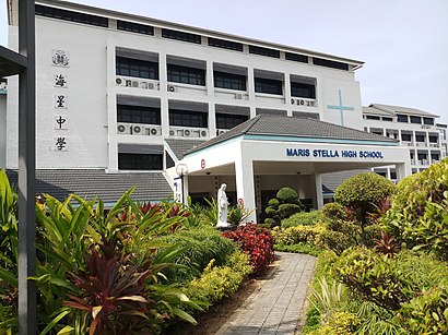
Maris Stella High School Primary Address: 25 Mount Vernon Rd street in Southeast
Attractions near Maris Stella High School Primary
Maris Stella High Pri,wings counselling centre,Bus Stop 62079,Ramakrishna Mission,Bartley Christian Church,Ramakrishna Mission Sarada Kindergarten,4 How Sun Drive,179 Bartley Road,20 How Sun Dr,Gym @ Bartley Residences,7a Lor How Sun,Maris Stella High School,Bartley MRT Station (CC12),Bartley Residences Lor How Sun,Sports-Centred Media Services,Bartley Greenrise,Lor How Sun,Bartley Beacon,Mount Vernon Road,Bartley ResidencesHow to get to popular attractions in Southeast with public transportation
Tang Plaza, Singapore,Hong Yi Hao Trading Ptd Ltd, Northwest,Bus Stop 20121 (Opp Blk 51), Southwest,West Bay Condominium, Southwest,15 Pioneer Walk Coffee Shop, Southwest,Downtown East, Northeast,Ng Teng Fong General Hospital, Southwest,Blk 335 Bukit Botak Street 32, Southwest,RS Component, Southwest,Lanpan Base, Southwest,Citilink Warehouse Complex, Southwest,Blk 413 Coffee Shop, Southwest,Greenlink Medical Clinic, Singapore,Al Ehsan, Southwest,Mount Elizabeth Novena Hospital, Singapore,Woodlands Checkpoint Carbay Custom Office, Northwest,Tuas checkpoint Auditorium, Southwest,Bus Stop 16141 (Tentera Diraja Mosque), Southwest,Sembawang Wharves (main), Northwest,Hausmann Marketing Aquarium, SouthwestGet around Singapore by public transport!
Travelling around Singapore has never been so easy. See step by step directions as you travel to any attraction, street or major public transport station. View bus and train timetables, arrival times, service alerts and detailed routes on a map, so you know exactly how to get to anywhere in Singapore.
When travelling to any destination around Singapore use Moovit's Live Directions with Get Off Notifications to know exactly where and how far to walk, how long to wait for your line , and how many stops are left. Moovit will alert you when it’s time to get off — no need to constantly re-check whether yours is the next stop.
Wondering how to use public transport in Singapore or how to pay for public transport in Singapore? Moovit public transport app can help you navigate your way with public transport easily, and at minimum cost. It includes public transport fees, ticket prices, and costs. Looking for a map of Singapore public transport lines? Moovit public transport app shows all public transport maps in Singapore with all Bus, Train, Metro, MRT & LRT, Ferry and Cable Car routes and stops on an interactive map.
Singapore has 6 transport type(s), including: Bus, Train, Metro, MRT & LRT, Ferry and Cable Car, operated by several transport agencies, including SMRT, SBS Transit, MRT/LRT Replacement Services, Tower Transit, Go-Ahead Singapore, Premium Bus, City Direct Bus, Changi Airport, Sentosa Development Corporation, Cross Border Bus, Singapore Cable Car Network, NUS Shuttle (ComfortDelGro), NTU Shuttle (ComfortDelGro), JTC Corp, Shuttle Bus (Appx. Schedule)