Directions to Anne Arundel Community College (Anne Arundel County) with public transportation
The following transit lines have routes that pass near Anne Arundel Community College
How to get to Anne Arundel Community College by bus?
Click on the bus route to see step by step directions with maps, line arrival times and updated time schedules.
Bus stops near Anne Arundel Community College in Anne Arundel County
- Aacc Loop Rd., 3 min walk,
- Ring Rd & West Campus (Aacc) Eb, 3 min walk,
Bus lines to Anne Arundel Community College in Anne Arundel County
- GOLD, Anne Arundel Community College,
- 70, Patapsco Light Rail,
What are the closest stations to Anne Arundel Community College?
The closest stations to Anne Arundel Community College are:
- Aacc Loop Rd. is 171 yards away, 3 min walk.
- Ring Rd & West Campus (Aacc) Eb is 178 yards away, 3 min walk.
Which bus lines stop near Anne Arundel Community College?
These bus lines stop near Anne Arundel Community College: 70, GOLD.
What’s the nearest bus stop to Anne Arundel Community College in Anne Arundel County?
The nearest bus stops to Anne Arundel Community College in Anne Arundel County are Aacc Loop Rd. and Ring Rd & West Campus (Aacc) Eb. The closest one is a 3 min walk away.
What time is the first bus to Anne Arundel Community College in Anne Arundel County?
The 70 is the first bus that goes to Anne Arundel Community College in Anne Arundel County. It stops nearby at 5:14 AM.
What time is the last bus to Anne Arundel Community College in Anne Arundel County?
The 70 is the last bus that goes to Anne Arundel Community College in Anne Arundel County. It stops nearby at 2:12 AM.
See Anne Arundel Community College, Anne Arundel County, on the map
Public Transit to Anne Arundel Community College in Anne Arundel County
Wondering how to get to Anne Arundel Community College in Anne Arundel County, United States? Moovit helps you find the best way to get to Anne Arundel Community College with step-by-step directions from the nearest public transit station.
Moovit provides free maps and live directions to help you navigate through your city. View schedules, routes, timetables, and find out how long does it take to get to Anne Arundel Community College in real time.
Looking for the nearest stop or station to Anne Arundel Community College? Check out this list of stops closest to your destination: Aacc Loop Rd.; Ring Rd & West Campus (Aacc) Eb.
Bus: 70, GOLD.
Want to see if there’s another route that gets you there at an earlier time? Moovit helps you find alternative routes or times. Get directions from and directions to Anne Arundel Community College easily from the Moovit App or Website.
We make riding to Anne Arundel Community College easy, which is why over 1.5 million users, including users in Anne Arundel County, trust Moovit as the best app for public transit. You don’t need to download an individual bus app or train app, Moovit is your all-in-one transit app that helps you find the best bus time or train time available.
For information on prices of bus, costs and ride fares to Anne Arundel Community College, please check the Moovit app.
Use the app to navigate to popular places including to the airport, hospital, stadium, grocery store, mall, coffee shop, school, college, and university.
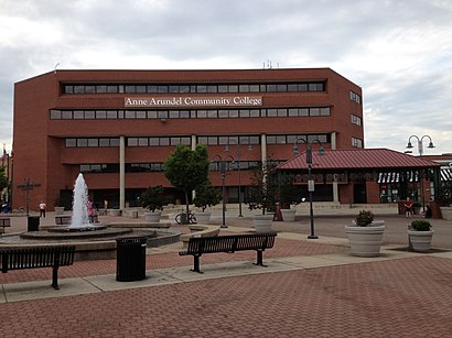
Anne Arundel Community College Address: 101 College Parkway street in Anne Arundel County
Attractions near Anne Arundel Community College
Augusta Associates,CATS R US,Pineapple Creative,Gifts That Give by Providence Center,Framers' Vise Gallery,Zmetalz,Gab Company,Magothy Therapy & Wellness,Bay Radiology,Privia Health,Spotless,161 Asquithoaks Ln,Charles S Denny,Zvezdomir Zamfirov MD,Vivek Sood MD,Farmers Insurance,Annapolis Acupuncture,Hpi Building and Renovations,Kimmel Homes,Speech MattersHow to get to popular attractions in Anne Arundel County with public transit
Corduroy, Washington,Gaithersburg High School, Montgomery County,Rome Building - Johns Hopkins SAIS, Washington,I-95 Exit 80 - Belcamp (MD 543), Harford County,Camden Potomac Yard Apartments, Arlington County,Exit 62 - SR 243 (Nutley St) / Fairfax, Vienna, Fairfax County,BJ's Wholesale Club, Baltimore,Cooks Lane, Baltimore,El Camino, Washington,St. Andrews Episcopal School, Montgomery County,Hybla Valley, Fairfax County,Red Lounge Bar & Grill, Washington,Brent Elementary School, Washington,I-95 Exit 55 (Key Hwy), Baltimore,Redland, Maryland, Montgomery County,Dirty Habit, Washington,National City Christian Church, Washington,Parkside Shopping Center, Baltimore,Defense Threat Reduction Agency, Fairfax County,Sheridan Circle, WashingtonGet around Washington, D.C. - Baltimore, MD by public transit!
Traveling around Washington, D.C. - Baltimore, MD has never been so easy. See step by step directions as you travel to any attraction, street or major public transit station. View bus and train schedules, arrival times, service alerts and detailed routes on a map, so you know exactly how to get to anywhere in Washington, D.C. - Baltimore, MD.
When traveling to any destination around Washington, D.C. - Baltimore, MD use Moovit's Live Directions with Get Off Notifications to know exactly where and how far to walk, how long to wait for your line, and how many stops are left. Moovit will alert you when it's time to get off — no need to constantly re-check whether yours is the next stop.
Wondering how to use public transit in Washington, D.C. - Baltimore, MD or how to pay for public transit in Washington, D.C. - Baltimore, MD? Moovit public transit app can help you navigate your way with public transit easily, and at minimum cost. It includes public transit fees, ticket prices, and costs. Looking for a map of Washington, D.C. - Baltimore, MD public transit lines? Moovit public transit app shows all public transit maps in Washington, D.C. - Baltimore, MD with all Bus, Train, Metro, Light Rail and Ferry routes and stops on an interactive map.
Washington, D.C. - Baltimore, MD has 5 transit type(s), including: Bus, Train, Metro, Light Rail and Ferry, operated by several transit agencies, including WMATA, Montgomery County Ride On, Montgomery County MD Ride On, Fairfax Connector, TheBus, PRTC, DC Circulator, DASH - Alexandria, Arlington Transit (ART), DC Streetcar, RTA of Central Maryland, FRED, MDOT MTA, Marc, Virginia Railway Express (VRE)