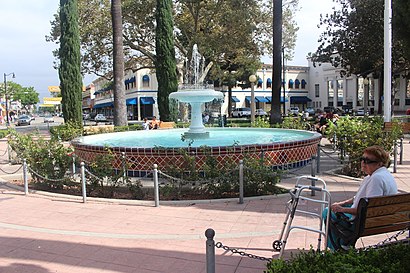
Directions to Orange Circle with public transportation
The following transit lines have routes that pass near Orange Circle
How to get to Orange Circle by bus?
Click on the bus route to see step by step directions with maps, line arrival times and updated time schedules.
How to get to Orange Circle by train?
Click on the train route to see step by step directions with maps, line arrival times and updated time schedules.
Bus stops near Orange Circle
- Glassell-Maple, 4 min walk,
- Glassell-Almond, 4 min walk,
- Lemon-Maple, 6 min walk,
Train stations near Orange Circle
- Santa Ana Station, 37 min walk,
Bus lines to Orange Circle
- 59, Tustin - the District,
- 56, Garden Grove - Belgrave and Valley View,
- 54, Orange - Chapman and Rancho Santiago,
- 453, Orange Transp Center,
What are the closest stations to Orange Circle?
The closest stations to Orange Circle are:
- Glassell-Maple is 250 yards away, 4 min walk.
- Glassell-Almond is 276 yards away, 4 min walk.
- Lemon-Maple is 427 yards away, 6 min walk.
- Santa Ana Station is 3124 yards away, 37 min walk.
Which bus lines stop near Orange Circle?
These bus lines stop near Orange Circle: 54, 56, 59.
Which train lines stop near Orange Circle?
These train lines stop near Orange Circle: INLAND EMPIRE - ORANGE COUNTY LINE, ORANGE COUNTY LINE.
What’s the nearest bus stop to Orange Circle?
The nearest bus stops to Orange Circle are Glassell-Maple and Glassell-Almond. The closest one is a 4 min walk away.
What time is the first train to Orange Circle?
The ORANGE COUNTY LINE is the first train that goes to Orange Circle. It stops nearby at 4:28 AM.
What time is the last train to Orange Circle?
The PACIFIC SURFLINER is the last train that goes to Orange Circle. It stops nearby at 11:10 PM.
What time is the first bus to Orange Circle?
The 54 is the first bus that goes to Orange Circle. It stops nearby at 5:06 AM.
What time is the last bus to Orange Circle?
The 59 is the last bus that goes to Orange Circle. It stops nearby at 10:48 PM.
See Orange Circle on the map
Public Transportation to Orange Circle
Wondering how to get to Orange Circle, United States? Moovit helps you find the best way to get to Orange Circle with step-by-step directions from the nearest public transit station.
Moovit provides free maps and live directions to help you navigate through your city. View schedules, routes, timetables, and find out how long does it take to get to Orange Circle in real time.
Looking for the nearest stop or station to Orange Circle? Check out this list of stops closest to your destination: Glassell-Maple; Glassell-Almond; Lemon-Maple; Santa Ana Station.
Bus: 54, 56, 59, 453.Train: INLAND EMPIRE - ORANGE COUNTY LINE, ORANGE COUNTY LINE, PACIFIC SURFLINER.
Want to see if there’s another route that gets you there at an earlier time? Moovit helps you find alternative routes or times. Get directions from and directions to Orange Circle easily from the Moovit App or Website.
We make riding to Orange Circle easy, which is why over 1.5 million users, including users in Orange, trust Moovit as the best app for public transit. You don’t need to download an individual bus app or train app, Moovit is your all-in-one transit app that helps you find the best bus time or train time available.
For information on prices of bus and train, costs and ride fares to Orange Circle, please check the Moovit app.
Use the app to navigate to popular places including to the airport, hospital, stadium, grocery store, mall, coffee shop, school, college, and university.
Orange Circle Address: Orange Circle, 75-, 99 Plaza Square, Orange, CA 92866, United States street in Orange
Attractions near Orange Circle
Old Towne Orange,The Orange Circle,City of Orange,Old Town Orange, California,N Glassell St,Toasted Honey Tans,Grand Gimeno,Downtown San Diego,Orange, California,Tourvia Real Estate,CW Moss Ford Parts,DODGE College of Film & Media Arts Marion Knott Studios,Futara Electronics,Chapman University - West Campus Structure,Liberty Plaza,Cp Maple,Leatherby Center For Entrepreneurship and Business Ethics,Hagler Financial Services,Chapman University IS&T,Adult Hip Hop Dance ClassesHow to get to popular attractions in Orange with public transit
Belvedere Park, East Los Angeles,Metroflex, Long Beach,Kaiser Permanente Orange County Anaheim, Anaheim,Metrolink Lancaster Station, Lancaster,Clifton A. Moore Administration Building LAX, Westchester, La,Florence And Crenshaw, Hyde Park, La,Loma Linda Academy, Loma Linda,Saddleback College Quad, Mission Viejo,La Cienega Blvd & Centinela Ave, Los Angeles,Kaiser Permanente Anaheim - Kraemer Pharmacy, Anaheim,Theo Lacy Jail Facility, Orange,Valley View High School, Moreno Valley,Denny's, Downtown, La,Miller High Life Training Center, Irwindale,Sunset & Larrabee, West Hollywood,Fontana Superior Court, Fontana,Los Alisos Intermediate School, Mission Viejo,Friendship Auditorium, Griffith Park, La,Indoor Swap Meet, Pomona,Alamo Inn & Suites, AnaheimGet around Los Angeles by public transit!
Traveling around Los Angeles has never been so easy. See step by step directions as you travel to any attraction, street or major public transit station. View bus and train schedules, arrival times, service alerts and detailed routes on a map, so you know exactly how to get to anywhere in Los Angeles.
When traveling to any destination around Los Angeles use Moovit's Live Directions with Get Off Notifications to know exactly where and how far to walk, how long to wait for your line, and how many stops are left. Moovit will alert you when it's time to get off — no need to constantly re-check whether yours is the next stop.
Wondering how to use public transit in Los Angeles or how to pay for public transit in Los Angeles? Moovit public transit app can help you navigate your way with public transit easily, and at minimum cost. It includes public transit fees, ticket prices, and costs. Looking for a map of Los Angeles public transit lines? Moovit public transit app shows all public transit maps in Los Angeles with all Bus, Train, Subway, Light Rail, Ferry and Funicular routes and stops on an interactive map.
Los Angeles has 6 transit type(s), including: Bus, Train, Subway, Light Rail, Ferry and Funicular, operated by several transit agencies, including Metro - Los Angeles, Metrolink Trains, METRO, Long Beach Transit, LADOT, OCTA, Foothill Transit, Big Blue Bus, Riverside Transit Agency, LAX FlyAway, Airporter Shuttle, Playa Vista Shuttle, Amtrak, OMNITRANS, Pasadena Transit