Directions to Tait Mckenzie Centre (Toronto) with public transportation
The following transit lines have routes that pass near Tait Mckenzie Centre
How to get to Tait Mckenzie Centre by bus?
Click on the bus route to see step by step directions with maps, line arrival times and updated time schedules.
How to get to Tait Mckenzie Centre by subway?
Click on the subway route to see step by step directions with maps, line arrival times and updated time schedules.
Bus stops near Tait Mckenzie Centre in Toronto
- The Pond Rd at Arboretum Lane - Sobeys Stadium, 5 min walk,
- 230 Ian Macdonald Blvd, 5 min walk,
- Pioneer Village Station, 6 min walk,
- Steeles Av / Settlers Rd, 7 min walk,
Subway stations near Tait Mckenzie Centre in Toronto
- Vaughan Metropolitan Centre, 8 min walk,
Bus lines to Tait Mckenzie Centre in Toronto
- 106, Sheppard West Station,
- 335, Jane St at Bloor St West - Jane Station,
- 341, Ian Macdonald Blvd at the Chimneystack Rd,
- 353, Newgale Gate at Finchdene Sq,
- 41, Trethewey Dr at Eglinton Ave West,
- 84, Sheppard Ave West at Yonge St,
- 84D, Pioneer Village Station,
- 60, Finch Station,
- 60A, Pioneer Village Station,
- 960, Finch Station,
- 108A, Pioneer Village Station,
- 108B, Sheppard West Station,
- 108C, Pioneer Village Station,
- 108S, Driftwood Ave at Finch Ave West,
- 60B, Steeles Ave West Loop at Martin Grove Rd,
- 60D, Signal Hill Ave at Steeles Ave West,
- 960B, Steeles Ave West Loop at Martin Grove Rd,
- 960D, Signal Hill Ave at Steeles Ave West,
- 935, Pioneer Village Station,
- 35A, Pioneer Village Station,
What are the closest stations to Tait Mckenzie Centre?
The closest stations to Tait Mckenzie Centre are:
- The Pond Rd at Arboretum Lane - Sobeys Stadium is 276 meters away, 5 min walk.
- 230 Ian Macdonald Blvd is 300 meters away, 5 min walk.
- Pioneer Village Station is 350 meters away, 6 min walk.
- Steeles Av / Settlers Rd is 475 meters away, 7 min walk.
- Vaughan Metropolitan Centre is 566 meters away, 8 min walk.
Which bus lines stop near Tait Mckenzie Centre?
These bus lines stop near Tait Mckenzie Centre: 165, 335, 341, 353, 35B, 60B.
Which subway line stops near Tait Mckenzie Centre?
1
What’s the nearest subway station to Tait Mckenzie Centre in Toronto?
The nearest subway station to Tait Mckenzie Centre in Toronto is Vaughan Metropolitan Centre. It’s a 8 min walk away.
What’s the nearest bus stop to Tait Mckenzie Centre in Toronto?
The nearest bus stops to Tait Mckenzie Centre in Toronto are The Pond Rd at Arboretum Lane - Sobeys Stadium and 230 Ian Macdonald Blvd. The closest one is a 5 min walk away.
What time is the first subway to Tait Mckenzie Centre in Toronto?
The 1 is the first subway that goes to Tait Mckenzie Centre in Toronto. It stops nearby at 5:51 AM.
What time is the last subway to Tait Mckenzie Centre in Toronto?
The 1 is the last subway that goes to Tait Mckenzie Centre in Toronto. It stops nearby at 2:35 AM.
What time is the first bus to Tait Mckenzie Centre in Toronto?
The 335 is the first bus that goes to Tait Mckenzie Centre in Toronto. It stops nearby at 3:02 AM.
What time is the last bus to Tait Mckenzie Centre in Toronto?
The 353 is the last bus that goes to Tait Mckenzie Centre in Toronto. It stops nearby at 3:48 AM.
How much is the bus fare to Tait Mckenzie Centre?
The bus fare to Tait Mckenzie Centre costs about $3.30 - $3.75.
See Tait Mckenzie Centre, Toronto, on the map
Public Transit to Tait Mckenzie Centre in Toronto
Wondering how to get to Tait Mckenzie Centre in Toronto, Canada? Moovit helps you find the best way to get to Tait Mckenzie Centre with step-by-step directions from the nearest public transit station.
Moovit provides free maps and live directions to help you navigate through your city. View schedules, routes, timetables, and find out how long does it take to get to Tait Mckenzie Centre in real time.
Looking for the nearest stop or station to Tait Mckenzie Centre? Check out this list of stops closest to your destination: The Pond Rd at Arboretum Lane - Sobeys Stadium; 230 Ian Macdonald Blvd; Pioneer Village Station; Steeles Av / Settlers Rd; Vaughan Metropolitan Centre.
Bus: 165, 335, 341, 353, 35B, 60B, 106, 41, 84, 84D, 60, 60A, 960.Subway: 1.
Want to see if there’s another route that gets you there at an earlier time? Moovit helps you find alternative routes or times. Get directions from and directions to Tait Mckenzie Centre easily from the Moovit App or Website.
We make riding to Tait Mckenzie Centre easy, which is why over 1.5 million users, including users in Toronto, trust Moovit as the best app for public transit. You don’t need to download an individual bus app or train app, Moovit is your all-in-one transit app that helps you find the best bus time or train time available.
For information on prices of bus and subway, costs and ride fares to Tait Mckenzie Centre, please check the Moovit app.
Use the app to navigate to popular places including to the airport, hospital, stadium, grocery store, mall, coffee shop, school, college, and university.
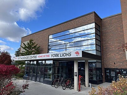
Tait Mckenzie Centre Address: Ian Macdonald Boulevard street in Toronto
Attractions near Tait Mckenzie Centre
Tait McKenzie Centre - York University,York University, Keele Campus Tait McKenzie Centre-Thompson Road Lot,York University Life Sciences Building,York University,West Office Building, York University,Norman Bethune Residence,Stong Residence,Pioneer Village Station - Howard Moscoe Way Entrance,Canlan Ice Sports- York- Rink 6,Ian MacDonald Blvd at Shoreham Dr South Side,York Stadium,Life Sciences Quad,Pioneer Village Subway Station,Pioneer Village Station - South Entrance,Canlan Ice Sports - York,York University, Keele Campus - Northwest Gate Lot,1 Shoreham Drive,989 Murray Ross Parkway,Curtis lecture hall - I,Toronto Track & Field CentreHow to get to popular attractions in Toronto with public transit
Milton Carpool Lot / GO Park & Ride, Milton,Yorkville, Toronto,299 Queen Street West, Toronto,4900 Yonge St., Toronto,The Danforth Music Hall, Toronto,Queen Street West, Toronto,Centre Island Ferry, Toronto,Ryerson University, Toronto,Cineplex Cinemas Queensway & VIP, Toronto,Art Gallery of Ontario, Toronto,Toronto Public Library - Toronto Reference Library, Toronto,Enercare Centre, Toronto,45 Overlea Blvd, Toronto,Olg Prize Centre, Toronto,Exit 74/Casablanca Boulevard/W, Grimsby,Sheridan College - Hazel Mccallion Campus, Mississauga,Pickering GO Station, Pickering,Scarborough General Hospital, Toronto,Waterdown, Ontario, Hamilton,1860 Wilson Ave North York, ON M9M 3A7 Wilson Avenue, TorontoGet around Toronto by public transit!
Traveling around Toronto has never been so easy. See step by step directions as you travel to any attraction, street or major public transit station. View bus and train schedules, arrival times, service alerts and detailed routes on a map, so you know exactly how to get to anywhere in Toronto.
When traveling to any destination around Toronto use Moovit's Live Directions with Get Off Notifications to know exactly where and how far to walk, how long to wait for your line, and how many stops are left. Moovit will alert you when it's time to get off — no need to constantly re-check whether yours is the next stop.
Wondering how to use public transit in Toronto or how to pay for public transit in Toronto? Moovit public transit app can help you navigate your way with public transit easily, and at minimum cost. It includes public transit fees, ticket prices, and costs. Looking for a map of Toronto public transit lines? Moovit public transit app shows all public transit maps in Toronto with all Bus, Train, Subway, Streetcar and Ferry routes and stops on an interactive map.
Toronto has 5 transit type(s), including: Bus, Train, Subway, Streetcar and Ferry, operated by several transit agencies, including TTC, TTC Streetcar, Toronto Subway, Brampton Transit, MiWay, York Region Transit, GO Transit Bus, GO Transit, Durham Region Transit, UP Express, Grand River Transit, Guelph Transit, grt, Hamilton Street Railway, Burlington Transit