Directions to Fosse Shopping Park (Blaby) with public transport
The following transport lines have routes that pass near Fosse Shopping Park
How to get to Fosse Shopping Park by bus?
Click on the bus route to see step by step directions with maps, line arrival times and updated time schedules.
How to get to Fosse Shopping Park by train?
Click on the train route to see step by step directions with maps, line arrival times and updated time schedules.
Bus stops near Fosse Shopping Park in Blaby
- M&S, Fosse Park, 2 min walk,
- Sainsbury'S, Fosse Park, 4 min walk,
- Thorpe Way, Grove Park, 13 min walk,
Bus lines to Fosse Shopping Park in Blaby
- X6, Coventry,
- 19, Thorpe Astley,
- 104, Fosse Park,
- NOVUS FOSSE, Fosse Park,
- 40|CIRCLELINE, Eyres Monsell,
- 50, Leicester,
- X84, Lutterworth,
- 203, Enderby,
What are the nearest stations to Fosse Shopping Park?
The nearest stations to Fosse Shopping Park are:
- M&S, Fosse Park is 128 meters away, 2 min walk.
- Sainsbury'S, Fosse Park is 264 meters away, 4 min walk.
- Thorpe Way, Grove Park is 951 meters away, 13 min walk.
Which bus lines stop near Fosse Shopping Park?
These bus lines stop near Fosse Shopping Park: 104, 50, NOVUS FOSSE.
Which train line stops near Fosse Shopping Park?
CROSSCOUNTRY
What’s the nearest bus stop to Fosse Shopping Park in Blaby?
The nearest bus stop to Fosse Shopping Park in Blaby is M&S, Fosse Park. It’s a 2 min walk away.
What time is the first bus to Fosse Shopping Park in Blaby?
The NOVUS FOSSE is the first bus that goes to Fosse Shopping Park in Blaby. It stops nearby at 08:23.
What time is the last bus to Fosse Shopping Park in Blaby?
The 50 is the last bus that goes to Fosse Shopping Park in Blaby. It stops nearby at 22:38.
See Fosse Shopping Park, Blaby, on the map
Public Transit to Fosse Shopping Park in Blaby
Wondering how to get to Fosse Shopping Park in Blaby, United Kingdom? Moovit helps you find the best way to get to Fosse Shopping Park with step-by-step directions from the nearest public transit station.
Moovit provides free maps and live directions to help you navigate through your city. View schedules, routes, timetables, and find out how long does it take to get to Fosse Shopping Park in real time.
Looking for the nearest stop or station to Fosse Shopping Park? Check out this list of stops closest to your destination: M&S; Sainsbury'S; Thorpe Way.
Bus: 104, 50, NOVUS FOSSE, X6, 19, 40|CIRCLELINE, X84, 203.Train: CROSSCOUNTRY.
Want to see if there’s another route that gets you there at an earlier time? Moovit helps you find alternative routes or times. Get directions from and directions to Fosse Shopping Park easily from the Moovit App or Website.
We make riding to Fosse Shopping Park easy, which is why over 1.5 million users, including users in Blaby, trust Moovit as the best app for public transit. You don’t need to download an individual bus app or train app, Moovit is your all-in-one transit app that helps you find the best bus time or train time available.
For information on prices of bus and train, costs and ride fares to Fosse Shopping Park, please check the Moovit app.
Use the app to navigate to popular places including to the airport, hospital, stadium, grocery store, mall, coffee shop, school, college, and university.
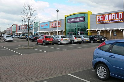
Fosse Shopping Park Address: Fosse Park Avenue street in Blaby
Popular routes to Fosse Shopping Park, Blaby
Popular routes from Fosse Shopping Park, Blaby
Attractions near Fosse Shopping Park
Regatta,Ifix Lab,Isha,Levi's,TEXACO,Zizzi,Fosse Park Centre Leicester,Dabbs Fish,L'Occitane,Holland & Barrett,MSFX@Fosse Park,Clinton Cards,Food Central,Sketchers,JD Sports Fashion,Mac Cosmetics Boots Leicester Fosse Park,THAI EXPRESS,DHL,Bubble Ci-Tea,Chaiiwala Fosse ParkHow to get to popular attractions in Blaby with public transportation
East Midlands Designer Outlet, Bolsover,National Express Coach Station, Nottingham,Boots, Nottingham,Passenger Drop-Off, Derby,West Nottinghamshire College, Mansfield,Mam Tor,Wootton, Northampton,Brimington Crematorium, Chesterfield,National Grid Training Centre, Newark And Sherwood,Hackleton, South Northamptonshire,Campion School, South Northamptonshire,Notcutts Garden Centre - Wheatcroft, Rushcliffe,Gypsum Close Recycling Centre, Leicester,Springfields Outlet Shopping (Springfields Outlet Centre), South Holland,Gate 2 Hucknall Road North Gate, Nottingham,The Mary Potter Centre, Nottingham,Market Bosworth, Hinckley And Bosworth,Donut Roundabout Car Park, Chesterfield,London Road, Leicester,Orton Hall Spa, PeterboroughGet around East Midlands by public transport!
Travelling around East Midlands has never been so easy. See step by step directions as you travel to any attraction, street or major public transport station. View bus and train timetables, arrival times, service alerts and detailed routes on a map, so you know exactly how to get to anywhere in East Midlands.
When travelling to any destination around East Midlands use Moovit's Live Directions with Get Off Notifications to know exactly where and how far to walk, how long to wait for your line , and how many stops are left. Moovit will alert you when it’s time to get off — no need to constantly re-check whether yours is the next stop.
Wondering how to use public transport in East Midlands or how to pay for public transport in East Midlands? Moovit public transport app can help you navigate your way with public transport easily, and at minimum cost. It includes public transport fees, ticket prices, and costs. Looking for a map of East Midlands public transport lines? Moovit public transport app shows all public transport maps in East Midlands with all Bus, Train and Light rail routes and stops on an interactive map.
East Midlands has 3 transport type(s), including: Bus, Train and Light rail, operated by several transport agencies, including National Rail, Ashbourne Community Transport, Delaine Buses, Arriva Midlands, Centrebus, Our Centre, Hulleys of Baslow, D & G Bus, Stagecoach East Midlands, North Lincolnshire Council, Roberts Coaches, Lawson's of Corby, Hawkes Coaches, East Yorkshire, Soar Valley Community Bus