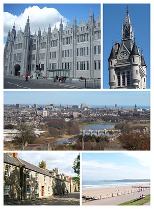
See Aberdeen, Scotland, on the map
Directions to Aberdeen (Scotland) with public transport
The following transport lines have routes that pass near Aberdeen
 Bus:
Bus: - Train:
How to get to Aberdeen by bus?
Click on the bus route to see step by step directions with maps, line arrival times and updated time schedules.
How to get to Aberdeen by train?
Click on the train route to see step by step directions with maps, line arrival times and updated time schedules.
Bus stations near Aberdeen in Scotland
- Blackfriars Street, Aberdeen (P1),1 min walk,
- Wallace Statue, Aberdeen (N3),2 min walk,
Bus lines to Aberdeen in Scotland
- 12,Torry,
- 10B,Inverurie,
- 10C,Insch,
- 59,Northfield,
What are the nearest stations to Aberdeen?
The nearest stations to Aberdeen are:
- Blackfriars Street, Aberdeen (P1) is 75 meters away, 1 min walk.
- Wallace Statue, Aberdeen (N3) is 98 meters away, 2 min walk.
Which bus lines stop near Aberdeen?
These bus lines stop near Aberdeen: 3, 59, 727, X7.
Which train line stops near Aberdeen?
SCOTRAIL
What’s the nearest bus stop to Aberdeen in Scotland?
The nearest bus stop to Aberdeen in Scotland is Blackfriars Street, Aberdeen (P1). It’s a 1 min walk away.
See Aberdeen, Scotland, on the map
Public Transit to Aberdeen in Scotland
Wondering how to get to Aberdeen in Scotland, United Kingdom? Moovit helps you find the best way to get to Aberdeen with step-by-step directions from the nearest public transit station.
Moovit provides free maps and live directions to help you navigate through your city. View schedules, routes, timetables, and find out how long does it take to get to Aberdeen in real time.
Looking for the nearest stop or station to Aberdeen? Check out this list of stops closest to your destination: Blackfriars Street; Wallace Statue.
Bus:Train:
Want to see if there’s another route that gets you there at an earlier time? Moovit helps you find alternative routes or times. Get directions from and directions to Aberdeen easily from the Moovit App or Website.
We make riding to Aberdeen easy, which is why over 1.5 million users, including users in Scotland, trust Moovit as the best app for public transit. You don’t need to download an individual bus app or train app, Moovit is your all-in-one transit app that helps you find the best bus time or train time available.
For information on prices of bus and train, costs and ride fares to Aberdeen, please check the Moovit app.
Use the app to navigate to popular places including to the airport, hospital, stadium, grocery store, mall, coffee shop, school, college, and university.
Location: Scotland
Attractions near Aberdeen
Bon Accord Street,Tolbooth Museum,Cowdray Hall,Wallace Statue (Stop N3), Aberdeen,Spa Street,Aberdeen Art Gallery & Museum,Superdrug,Lower Denburn,1906,Robert Gordon'S College,Aberdeen Art Gallery,Exodus,Triple Kirks,Citymoves,Robert Gordons's Side gate,Exodus : The Triplekirks,His Majesty'S Theatre,Armed Forces Careers,Robert Gordon University,Jack WillsHow to get to popular attractions in Scotland with public transportation
Corstorphine, Edinburgh,McEwan Square, Edinburgh,Kirkcaldy Bus Station, Kirkcaldy And Dysart,Peebles, Peebles,Paisley Gilmour Street Railway Station (PYG), Paisley,Fort William, Fort William,Tynecastle Park, Edinburgh,Edinburgh Castle, Edinburgh,East Kilbride Shopping Centre, East Kilbride,Drumgelloch Railway Station (DRU), Airdrie,Western General Hospital (Edinburgh), Edinburgh,Bearsden, Bearsden,Motherwell Railway Station (MTH), Motherwell,Costco Wholesale, Glasgow,Virgin Active, Glasgow,Asda, Aberdeen,The Three Sisters, Edinburgh,Ayr Railway Station (AYR), Ayr,Dunfermline Bus Station, Dunfermline,New Gorbals, GlasgowGet around Scotland by public transport!
Travelling around Scotland has never been so easy. See step by step directions as you travel to any attraction, street or major public transport station. View bus and train timetables, arrival times, service alerts and detailed routes on a map, so you know exactly how to get to anywhere in Scotland.
When travelling to any destination around Scotland use Moovit's Live Directions with Get Off Notifications to know exactly where and how far to walk, how long to wait for your line , and how many stops are left. Moovit will alert you when it’s time to get off — no need to constantly re-check whether yours is the next stop.
Wondering how to use public transport in Scotland or how to pay for public transport in Scotland? Moovit public transport app can help you navigate your way with public transport easily, and at minimum cost. It includes public transport fees, ticket prices, and costs. Looking for a map of Scotland public transport lines? Moovit public transport app shows all public transport maps in Scotland with all bus or train routes and stops on an interactive map.
Scotland has 2 transport type(s), including: bus or train, operated by several transport agencies, including First Greater Glasgow, First Aberdeen, Lothian Buses, McGill's Bus Service, Stagecoach East Scotland, Stagecoach Bluebird, Xplore Dundee, Community Transport Glasgow, Prentice Westwood, McCall's Coaches, J P Minibus, National Rail, R Robertson & Son, Burnbrae Garage and Ember