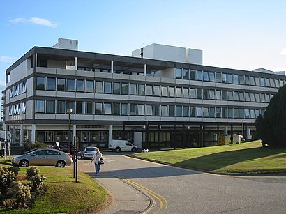
See Aberdeen Royal Infirmary on the map
Directions to Aberdeen Royal Infirmary with public transportation
The following transport lines have routes that pass near Aberdeen Royal Infirmary
 Bus:
Bus: - Train:
How to get to Aberdeen Royal Infirmary by bus?
Click on the bus route to see step by step directions with maps, line arrival times and updated time schedules.
How to get to Aberdeen Royal Infirmary by train?
Click on the train route to see step by step directions with maps, line arrival times and updated time schedules.
Bus stations near Aberdeen Royal Infirmary
- Blackfriars Street, Aberdeen (P2),3 min walk,
Bus routes to Aberdeen Royal Infirmary
- 10B,Inverurie,
- 10C,Insch,
- 12,Torry,
- 59,Northfield,
What are the nearest stations to Aberdeen Royal Infirmary?
The nearest stations to Aberdeen Royal Infirmary are:
- Blackfriars Street, Aberdeen (P2) is 150 meters away, 3 min walk.
Which bus lines stop near Aberdeen Royal Infirmary?
These bus lines stop near Aberdeen Royal Infirmary: 14, 3, 37, 59, X7.
Which train line stops near Aberdeen Royal Infirmary?
SCOTRAIL
What’s the nearest bus stop to Aberdeen Royal Infirmary?
The nearest bus stop to Aberdeen Royal Infirmary is Blackfriars Street, Aberdeen (P2). It’s a 3 min walk away.
See Aberdeen Royal Infirmary on the map
Public Transportation to Aberdeen Royal Infirmary
Wondering how to get to Aberdeen Royal Infirmary, United Kingdom? Moovit helps you find the best way to get to Aberdeen Royal Infirmary with step-by-step directions from the nearest public transit station.
Moovit provides free maps and live directions to help you navigate through your city. View schedules, routes, timetables, and find out how long does it take to get to Aberdeen Royal Infirmary in real time.
Looking for the nearest stop or station to Aberdeen Royal Infirmary? Check out this list of stops closest to your destination: Blackfriars Street.
Bus:Train:
Want to see if there’s another route that gets you there at an earlier time? Moovit helps you find alternative routes or times. Get directions from and directions to Aberdeen Royal Infirmary easily from the Moovit App or Website.
We make riding to Aberdeen Royal Infirmary easy, which is why over 1.5 million users, including users in Aberdeen, trust Moovit as the best app for public transit. You don’t need to download an individual bus app or train app, Moovit is your all-in-one transit app that helps you find the best bus time or train time available.
For information on prices of bus and train, costs and ride fares to Aberdeen Royal Infirmary, please check the Moovit app.
Use the app to navigate to popular places including to the airport, hospital, stadium, grocery store, mall, coffee shop, school, college, and university.
Location: Aberdeen, Scotland
Attractions near Aberdeen Royal Infirmary
Grampian AIDS Line,Robert Gordons's Side gate,Cafe Neo,Briarcliff Manor,Aberdeen City Council,Lecture Theatre A12,Bon Accord Street,Lower Denburn,His Majesty'S Theatre,Fusion Bar & Bistro,RGU: LIbrary,1906,Aberdeen St Mark'S Church Of Scotland,Woolmanhill Hospital,His Majesty's Theatre (HMT),St. Andrew Street Building,Blackfriars Street (Stop P2), Aberdeen,GORDONS CHEMISTS,William Wallace Statue,WoolmanhillHow to get to popular attractions in Aberdeen with public transportation
Partick Railway Station (PTK), Glasgow,Buchanan Bus Station, Glasgow,Forth Bridge,Langside, Glasgow,Tynecastle Park, Edinburgh,EICC, Edinburgh,Nuffield Health Glasgow Central Fitness & Wellbeing Gym, Glasgow,The Sir John Moore (Wetherspoon), Glasgow,Asda, Glasgow,Edinburgh Zoo, Edinburgh,Bruntsfield Links, Edinburgh,The Three Sisters, Edinburgh,Thornliebank, Thornliebank,Corstorphine, Edinburgh,Inverness Railway Station (INV), Inverness,Brandon Parade, Motherwell,Tesco, Stirling,Virgin Active, Glasgow,Dalry, Edinburgh,South Queensferry, QueensferryGet around Aberdeen by public transport!
Travelling around Aberdeen has never been so easy. See step by step directions as you travel to any attraction, street or major public transport station. View bus and train timetables, arrival times, service alerts and detailed routes on a map, so you know exactly how to get to anywhere in Aberdeen.
When travelling to any destination around Aberdeen use Moovit's Live Directions with Get Off Notifications to know exactly where and how far to walk, how long to wait for your line , and how many stops are left. Moovit will alert you when it’s time to get off — no need to constantly re-check whether yours is the next stop.
Wondering how to use public transport in Aberdeen or how to pay for public transport in Aberdeen? Moovit public transport app can help you navigate your way with public transport easily, and at minimum cost. It includes public transport fees, ticket prices, and costs. Looking for a map of Aberdeen public transport lines? Moovit public transport app shows all public transport maps in Aberdeen with all bus or train routes and stops on an interactive map.
Aberdeen has 2 transport type(s), including: bus or train, operated by several transport agencies, including First Greater Glasgow, First Aberdeen, Lothian Buses, McGill's Bus Service, Stagecoach East Scotland, Stagecoach Bluebird, Xplore Dundee, Community Transport Glasgow, Prentice Westwood, McCall's Coaches, J P Minibus, National Rail, R Robertson & Son, Burnbrae Garage and Ember