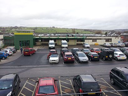
See Airedale Hospital, Steeton With Eastburn, on the map
Directions to Airedale Hospital (Steeton With Eastburn) with public transport
The following transport lines have routes that pass near Airedale Hospital
 Bus:
Bus: - Train:
How to get to Airedale Hospital by bus?
Click on the bus route to see step by step directions with maps, line arrival times and updated time schedules.
How to get to Airedale Hospital by train?
Click on the train route to see step by step directions with maps, line arrival times and updated time schedules.
Bus stations near Airedale Hospital in Steeton With Eastburn
- Sutton Lane End,2 min walk,
- Eastburn Bridge,7 min walk,
- Thornhill Road,9 min walk,
Train stations near Airedale Hospital in Steeton With Eastburn
- Cononley,38 min walk,
Bus lines to Airedale Hospital in Steeton With Eastburn
- M4,Keighley - Burnley,
- 62,Ilkley - Keighley,
- 66,Keighley - Skipton,
- 71,Bradleys Both - Steeton With Eastburn,
- 78A,Skipton - Steeton With Eastburn,
- 440,Glusburn And Cross Hills - Keighley,
- 866,Keighley - Malham,
- 975,Skipton,
- 903,Silsden,
What are the nearest stations to Airedale Hospital?
The nearest stations to Airedale Hospital are:
- Sutton Lane End is 109 meters away, 2 min walk.
- Eastburn Bridge is 516 meters away, 7 min walk.
- Thornhill Road is 638 meters away, 9 min walk.
- Cononley is 2937 meters away, 38 min walk.
Which bus lines stop near Airedale Hospital?
These bus lines stop near Airedale Hospital: 66, 903, M4.
Which train line stops near Airedale Hospital?
NORTHERN
What’s the nearest bus stop to Airedale Hospital in Steeton With Eastburn?
The nearest bus stop to Airedale Hospital in Steeton With Eastburn is Sutton Lane End. It’s a 2 min walk away.
What time is the first train to Airedale Hospital in Steeton With Eastburn?
The NORTHERN is the first train that goes to Airedale Hospital in Steeton With Eastburn. It stops nearby at 05:46.
What time is the last train to Airedale Hospital in Steeton With Eastburn?
The NORTHERN is the last train that goes to Airedale Hospital in Steeton With Eastburn. It stops nearby at 23:57.
What time is the first bus to Airedale Hospital in Steeton With Eastburn?
The 62 is the first bus that goes to Airedale Hospital in Steeton With Eastburn. It stops nearby at 05:35.
What time is the last bus to Airedale Hospital in Steeton With Eastburn?
The 66 is the last bus that goes to Airedale Hospital in Steeton With Eastburn. It stops nearby at 23:57.
How much is the train fare to Airedale Hospital?
The train fare to Airedale Hospital costs about £3.20 - £10.90.
See Airedale Hospital, Steeton With Eastburn, on the map
Public Transit to Airedale Hospital in Steeton With Eastburn
Wondering how to get to Airedale Hospital in Steeton With Eastburn, United Kingdom? Moovit helps you find the best way to get to Airedale Hospital with step-by-step directions from the nearest public transit station.
Moovit provides free maps and live directions to help you navigate through your city. View schedules, routes, timetables, and find out how long does it take to get to Airedale Hospital in real time.
Looking for the nearest stop or station to Airedale Hospital? Check out this list of stops closest to your destination: Sutton Lane End; Eastburn Bridge; Thornhill Road; Cononley.
Bus:Train:
Want to see if there’s another route that gets you there at an earlier time? Moovit helps you find alternative routes or times. Get directions from and directions to Airedale Hospital easily from the Moovit App or Website.
We make riding to Airedale Hospital easy, which is why over 1.5 million users, including users in Steeton With Eastburn, trust Moovit as the best app for public transit. You don’t need to download an individual bus app or train app, Moovit is your all-in-one transit app that helps you find the best bus time or train time available.
For information on prices of bus and train, costs and ride fares to Airedale Hospital, please check the Moovit app.
Use the app to navigate to popular places including to the airport, hospital, stadium, grocery store, mall, coffee shop, school, college, and university.
Location: Steeton With Eastburn, Yorkshire
Attractions near Airedale Hospital
Airedale Centre For Mental Health,Viking Environmental,Wise Baby,Airedale General Hospital,Eastburn Bradford England,Co OP,Quantum Driveways & Patios,Amazon Counter-Post Office Eastburn,Avc S,Airedale Hospital,D C Cleaning Solutions Limited,Capstick Construction,Airedale Hospital (Stop C), Keighley,Paws for Pets Supplies,Airedale General Hospital-A&E,Utley Cemetery & Crematoria,Jai Freestyle,Nina Medical Services,Wilman & Lodge,CJC Fire Safety ConsultancyHow to get to popular attractions in Steeton With Eastburn with public transportation
The Bankers Draft (Wetherspoon), Sheffield,University Of Leeds (West Campus), Leeds,Hillsborough Stadium, Sheffield,PwC Leeds, Leeds,Middlewood Tram Stop, Sheffield,Clifton Green, York,Doncaster Sheffield International Airport, Finningley,Huddersfield Royal Infirmary, Huddersfield,Skeldergate Bridge, York,Roundhay Park, Leeds,Leeds Conservatoire, Leeds,The Cherry Tree (Wetherspoon), Huddersfield,Beverley, Beverley,Wadsley Park Village, Bradfield,Valley Centertainment Tram Stop, Sheffield,York College, York,The 72 Bus - Bradford To Leeds, Leeds,Sainsbury's Leeds Colton, Leeds,Whitby Harbour, Whitby,Asos, Little HoughtonGet around Steeton With Eastburn by public transport!
Travelling around Steeton With Eastburn has never been so easy. See step by step directions as you travel to any attraction, street or major public transport station. View bus and train timetables, arrival times, service alerts and detailed routes on a map, so you know exactly how to get to anywhere in Steeton With Eastburn.
When travelling to any destination around Steeton With Eastburn use Moovit's Live Directions with Get Off Notifications to know exactly where and how far to walk, how long to wait for your line , and how many stops are left. Moovit will alert you when it’s time to get off — no need to constantly re-check whether yours is the next stop.
Wondering how to use public transport in Steeton With Eastburn or how to pay for public transport in Steeton With Eastburn? Moovit public transport app can help you navigate your way with public transport easily, and at minimum cost. It includes public transport fees, ticket prices, and costs. Looking for a map of Steeton With Eastburn public transport lines? Moovit public transport app shows all public transport maps in Steeton With Eastburn with all bus or train routes and stops on an interactive map.
Steeton With Eastburn has 2 transport type(s), including: bus or train, operated by several transport agencies, including First Leeds, First South Yorkshire, First York, First West Yorkshire Ltd, Arriva Yorkshire, Stagecoach Yorkshire, National Rail, First Bradford, First Halifax, Calder Valley & Huddersfield, East Yorkshire, The Keighley Bus Company, South Yorkshire Future Tram, The Harrogate Bus Company, National Rail and TM Travel