See Albany Creek on the map
Directions to Albany Creek with public transportation
The following transport lines have routes that pass near Albany Creek
 Bus:
Bus:
How to get to Albany Creek by bus?
Click on the bus route to see step by step directions with maps, line arrival times and updated time schedules.
Bus stations near Albany Creek
- Albany Creek Rd at Hawkins,5 min walk,
- Old Northern Rd at Leisure Centre,14 min walk,
- South Pine Rd at Hylacola,22 min walk,
Bus routes to Albany Creek
- 350,Aspley Hypermarket,
- 358,Brendale St Near Currajon St,
- 357,Brendale St Near Gowrie St,
- 359,City, Queen St,
What are the nearest stations to Albany Creek?
The nearest stations to Albany Creek are:
- Albany Creek Rd at Hawkins is 388 meters away, 5 min walk.
- Old Northern Rd at Leisure Centre is 1025 meters away, 14 min walk.
- South Pine Rd at Hylacola is 1687 meters away, 22 min walk.
Which bus lines stop near Albany Creek?
These bus lines stop near Albany Creek: 338, 359.
What’s the nearest bus stop to Albany Creek?
The nearest bus stop to Albany Creek is Albany Creek Rd at Hawkins. It’s a 5 min walk away.
What time is the first bus to Albany Creek?
The 357 is the first bus that goes to Albany Creek. It stops nearby at 06:08.
What time is the last bus to Albany Creek?
The 350 is the last bus that goes to Albany Creek. It stops nearby at 00:12.
How much is the train fare to Albany Creek?
The train fare to Albany Creek costs about $3.55 - $4.34.
How much is the bus fare to Albany Creek?
The bus fare to Albany Creek costs about $2.84 - $4.34.
See Albany Creek on the map
Public Transportation to Albany Creek
Wondering how to get to Albany Creek, Australia? Moovit helps you find the best way to get to Albany Creek with step-by-step directions from the nearest public transit station.
Moovit provides free maps and live directions to help you navigate through your city. View schedules, routes, timetables, and find out how long does it take to get to Albany Creek in real time.
Looking for the nearest stop or station to Albany Creek? Check out this list of stops closest to your destination: Albany Creek Rd at Hawkins; Old Northern Rd at Leisure Centre; South Pine Rd at Hylacola.
Bus:
Want to see if there’s another route that gets you there at an earlier time? Moovit helps you find alternative routes or times. Get directions from and directions to Albany Creek easily from the Moovit App or Website.
We make riding to Albany Creek easy, which is why over 1.5 million users, including users in Brisbane, trust Moovit as the best app for public transit. You don’t need to download an individual bus app or train app, Moovit is your all-in-one transit app that helps you find the best bus time or train time available.
For information on prices of bus and train, costs and ride fares to Albany Creek, please check the Moovit app.
Use the app to navigate to popular places including to the airport, hospital, stadium, grocery store, mall, coffee shop, school, college, and university.
Location: Brisbane
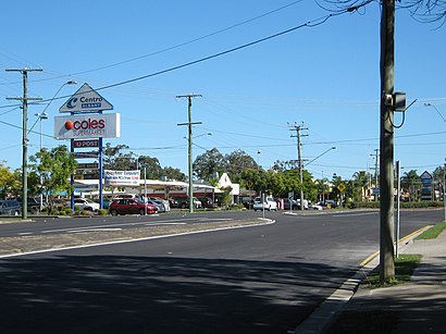
Albany Creek is a southern suburb in the City of Moreton Bay, Queensland, Australia. In the 2021 census, Albany Creek had a population of 16,385 people.Wiki
Popular routes to Albany Creek
Popular routes from Albany Creek
Attractions near Albany Creek
Geekspro,Skateaway,Bargain Corner,Zambrero Albany Creek,Itp Accounting Professionals,Plate 4 Plate,Emsella Urinary Incontinence Treatment,Menders & Makers,The Lott,Optimal Strength & Performance,Centro Albany,Dna Quality Fencing,next,Cara Bergmann Properties,Millies Fas & Acc Pl,Nexus,Suncorp Gio,Albany Creek Doctors,A Lovely Florists,Oz Skate CentresHow to get to popular attractions in Brisbane with public transportation
Landmark Restaurant, Robertson,State Library Of Queensland, South Brisbane,Mooloolaba, Mooloolaba,Caboolture, Caboolture,Sundale Bridge,Noosaville, Noosaville,Peregian Beach,Grand Plaza, Browns Plains,Burleigh Heads, Burleigh Heads,Ashmore, Ashmore,Pick'N Pay Hypermarket, Aspley,Rbw Hospital, Herston,Warner Bros. Movie World, Oxenford,The Giant Drop, Coomera,Labrador, Labrador,Griffith University Mount Gravatt Campus (Queensland Institute Of Business And Technology), Mount Gravatt,Browns Plains, Browns Plains,Mt Coot-Tha Lookout, Mount Coot-Tha,Queensland University Of Technology, City,BulimbaGet around Brisbane by public transport!
Travelling around Brisbane has never been so easy. See step by step directions as you travel to any attraction, street or major public transport station. View bus and train timetables, arrival times, service alerts and detailed routes on a map, so you know exactly how to get to anywhere in Brisbane.
When travelling to any destination around Brisbane use Moovit's Live Directions with Get Off Notifications to know exactly where and how far to walk, how long to wait for your line , and how many stops are left. Moovit will alert you when it’s time to get off — no need to constantly re-check whether yours is the next stop.
Wondering how to use public transport in Brisbane or how to pay for public transport in Brisbane? Moovit public transport app can help you navigate your way with public transport easily, and at minimum cost. It includes public transport fees, ticket prices, and costs. Looking for a map of Brisbane public transport lines? Moovit public transport app shows all public transport maps in Brisbane with all bus or train routes and stops on an interactive map.
Brisbane has 2 transport type(s), including: bus or train, operated by several transport agencies, including TransLink SEQ, TransLink, TransLink, TransLink, Christensens Bus and Coach, North Stradbroke Island Buses and Griffith Uni Intercampus bus