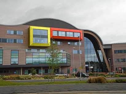
Alder Hey Hospital stop - Sunday schedule
| Line | Direction | Time |
|---|---|---|
| 61B | Bootle New Strand Station | 06:40 |
| 61B | Bootle New Strand Station | 07:10 |
| 10A | St Helens Bridge St | 07:14 |
| 61B | Bootle New Strand Station | 07:41 |
| 10A | Church Street | 07:43 |
| 10A | St Helens Bridge St | 07:59 |
| 61B | Bootle New Strand Station | 08:11 |
| 10A | Church Street | 08:13 |
| 10A | St Helens Bridge St | 08:29 |
| 10 | Church Street | 08:30 |
| 61B | Bootle New Strand Station | 08:42 |
| 10A | Church Street | 08:43 |
| 10A | St Helens Bridge St | 08:59 |
| 10 | Church Street | 09:00 |
| 10A | Church Street | 09:13 |
| 61B | Bootle New Strand Station | 09:14 |
| 10A | St Helens Bridge St | 09:29 |
| 10 | Church Street | 09:30 |
| 61B | Bootle New Strand Station | 09:44 |
| 10A | Church Street | 09:44 |
| 10A | St Helens Bridge St | 09:59 |
| 10 | Church Street | 10:00 |
| 204 | Belle Vale Bus Station | 10:01 |
| 61B | Bootle New Strand Station | 10:14 |
| 10A | Church Street | 10:14 |
Directions to Alder Hey Hospital stop (North West) with public transport
The following transport lines have routes that pass near Alder Hey Hospital
How to get to Alder Hey Hospital stop by bus?
Click on the bus route to see step by step directions with maps, line arrival times and updated time schedules.
How to get to Alder Hey Hospital stop by train?
Click on the train route to see step by step directions with maps, line arrival times and updated time schedules.
Bus stops near Alder Hey Hospital stop in North West
- Meadowcroft Park, 3 min walk,
- Rudyard Road, 4 min walk,
- East Prescot Road, 4 min walk,
- Eaton Road, 4 min walk,
- Pilch Lane, 8 min walk,
Bus lines to Alder Hey Hospital stop in North West
- 61, Munster Road,
- 61A, Ashfield Road,
- 61B, Ashfield Road,
- 102, Page Moss,
- 8, Queen Square Bus Station,
- 8E, Bolan Street,
- 9, Bolan Street,
- 10, Queen Square Bus Station,
- 10A, St Helens Bridge St,
- 10A, Church Street,
- 10B, Queen Square Bus Station,
- 10S, Evans Street,
- C42, Milton Road, Halton College,
- 204, Belle Vale Bus Station,
- 611, Broadgreen International School,
- 15, Queen Square Bus Station,
- 827, Kirkby Admin,
- 870, Huyton Indust Est,
- 7, Bus Interchange,
What are the nearest stations to Alder Hey Hospital?
The nearest stations to Alder Hey Hospital are:
- Meadowcroft Park is 225 meters away, 3 min walk.
- Rudyard Road is 255 meters away, 4 min walk.
- East Prescot Road is 270 meters away, 4 min walk.
- Eaton Road is 272 meters away, 4 min walk.
- Pilch Lane is 537 meters away, 8 min walk.
Which bus lines stop near Alder Hey Hospital?
These bus lines stop near Alder Hey Hospital: 10, 102, 10A, 7, 8.
Which train line stops near Alder Hey Hospital?
NORTHERN (Wigan North Western)
What’s the nearest bus station to Alder Hey Hospital in North West?
The nearest bus station to Alder Hey Hospital in North West is Meadowcroft Park. It’s a 3 min walk away.
What time is the first bus to Alder Hey Hospital in North West?
The 10A is the first bus that goes to Alder Hey Hospital in North West. It stops nearby at 04:35.
What time is the last bus to Alder Hey Hospital in North West?
The 10A is the last bus that goes to Alder Hey Hospital in North West. It stops nearby at 00:40.
See Alder Hey Hospital stop, North West, on the map
Public transport to Alder Hey Hospital stop (ID: mergpdpm) in North West
Looking for directions to Alder Hey Hospital in North West, United Kingdom?
Download the Moovit App to find the current schedule and step-by-step directions for Bus or Train routes that pass through Alder Hey Hospital.
Looking for the nearest stops closest to Alder Hey Hospital ? Check out this list of closest stops to your destination: Meadowcroft Park; Rudyard Road; East Prescot Road; Eaton Road; Pilch Lane.
Bus: 10, 102, 10A, 7, 8, 61, 61A, 61B, 8E, 9, 15, 827, 870.Train: NORTHERN.
We make riding on public transit to Alder Hey Hospital easy, which is why over 1.5 million users, including users in North West trust Moovit as the best app for public transit.
Use the app to navigate to popular places including to the airport, hospital, stadium, grocery store, mall, coffee shop, school, college, and university.
Alder Hey Hospital stop’s code is mergpdpm
The first line to this stop is 61B, at 06:40, and the last line is 10A at 00:40.
This stop serves Arriva North West, Huyton Travel, Warrington's Own Buses and Stagecoach Merseyside and South Lancashire’s lines
Popular routes from Alder Hey Hospital stop, North West
Bus stops near Alder Hey Hospital stop
Popular public transport stations in North West
Get around North West by public transport!
Travelling around North West has never been so easy. See step by step directions as you travel to any attraction, street or major public transport station. View bus and train timetables, arrival times, service alerts and detailed routes on a map, so you know exactly how to get to anywhere in North West.
When travelling to any destination around North West use Moovit's Live Directions with Get Off Notifications to know exactly where and how far to walk, how long to wait for your line , and how many stops are left. Moovit will alert you when it’s time to get off — no need to constantly re-check whether yours is the next stop.
Wondering how to use public transport in North West or how to pay for public transport in North West? Moovit public transport app can help you navigate your way with public transport easily, and at minimum cost. It includes public transport fees, ticket prices, and costs. Looking for a map of North West public transport lines? Moovit public transport app shows all public transport maps in North West with all Bus, Train, Light rail and Ferry routes and stops on an interactive map.
North West has 4 transport type(s), including: Bus, Train, Light rail and Ferry, operated by several transport agencies, including Arriva North West, Stagecoach Merseyside and South Lancashire, Stagecoach Cumbria and North Lancashire, First Halifax, National Express, Warrington's Own Buses, First Potteries, Rosso, Blackpool Transport, The Blackburn Bus Company, The Burnley Bus Company, Vision Bus, National Rail, Huyton Travel and Stotts Tours