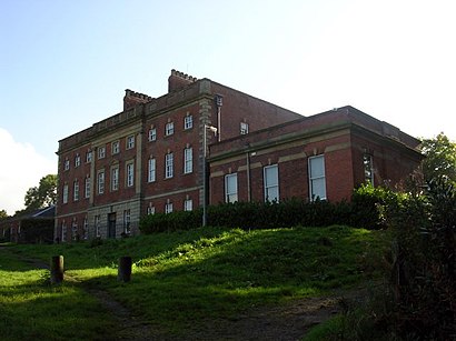
See Alkrington Hall, Middleton, on the map
Directions to Alkrington Hall (Middleton) with public transport
The following transport lines have routes that pass near Alkrington Hall
 Bus:
Bus: - Train:
How to get to Alkrington Hall by bus?
Click on the bus route to see step by step directions with maps, line arrival times and updated time schedules.
How to get to Alkrington Hall by train?
Click on the train route to see step by step directions with maps, line arrival times and updated time schedules.
Bus stations near Alkrington Hall in Middleton
- Alkrington Hall Road North,5 min walk,
- Limefield Park,10 min walk,
- Middleton,11 min walk,
Light Rail stations near Alkrington Hall in Middleton
- Bowker Vale (Manchester Metrolink),15 min walk,
Bus lines to Alkrington Hall in Middleton
- 17,Manchester - Rochdale,
- 17A,Rochdale - Manchester,
- 18,Middleton - Manchester,
- 41,Sale - Manchester,
- 115,Middleton,
- 116,Middleton,
- 125,Middleton,
- 159,Middleton - Oldham,
- 163,Bury - Manchester,
- 794,Middleton - Shaw,
- 59,Oldham Mumps,
- 125,Birch,
- 156,Shudehill,
- 112,Manchester - Middleton,
- 113,Middleton - Manchester,
- 129,Middleton,
- 396,Ashton Under Lyne - Middleton,
- 415,Oldham - Middleton,
- 434,Middleton - Rochdale,
- 809,Shaw - Middleton,
What are the nearest stations to Alkrington Hall?
The nearest stations to Alkrington Hall are:
- Alkrington Hall Road North is 294 meters away, 5 min walk.
- Limefield Park is 683 meters away, 10 min walk.
- Middleton is 784 meters away, 11 min walk.
- Bowker Vale (Manchester Metrolink) is 1144 meters away, 15 min walk.
Which bus lines stop near Alkrington Hall?
These bus lines stop near Alkrington Hall: 163, 17, 18, 59.
Which train line stops near Alkrington Hall?
NORTHERN
What’s the nearest light rail station to Alkrington Hall in Middleton?
The nearest light rail station to Alkrington Hall in Middleton is Bowker Vale (Manchester Metrolink). It’s a 15 min walk away.
What’s the nearest bus stop to Alkrington Hall in Middleton?
The nearest bus stop to Alkrington Hall in Middleton is Alkrington Hall Road North. It’s a 5 min walk away.
What time is the first light rail to Alkrington Hall in Middleton?
The GREEN LINE is the first light rail that goes to Alkrington Hall in Middleton. It stops nearby at 05:22.
What time is the last light rail to Alkrington Hall in Middleton?
The YELLOW LINE is the last light rail that goes to Alkrington Hall in Middleton. It stops nearby at 00:42.
What time is the first bus to Alkrington Hall in Middleton?
The 17 is the first bus that goes to Alkrington Hall in Middleton. It stops nearby at 04:00.
What time is the last bus to Alkrington Hall in Middleton?
The 17 is the last bus that goes to Alkrington Hall in Middleton. It stops nearby at 01:01.
How much is the train fare to Alkrington Hall?
The train fare to Alkrington Hall costs about £5.60.
See Alkrington Hall, Middleton, on the map
Public Transit to Alkrington Hall in Middleton
Wondering how to get to Alkrington Hall in Middleton, United Kingdom? Moovit helps you find the best way to get to Alkrington Hall with step-by-step directions from the nearest public transit station.
Moovit provides free maps and live directions to help you navigate through your city. View schedules, routes, timetables, and find out how long does it take to get to Alkrington Hall in real time.
Looking for the nearest stop or station to Alkrington Hall? Check out this list of stops closest to your destination: Alkrington Hall Road North; Limefield Park; Middleton; Bowker Vale (Manchester Metrolink).
Bus:Train:
Want to see if there’s another route that gets you there at an earlier time? Moovit helps you find alternative routes or times. Get directions from and directions to Alkrington Hall easily from the Moovit App or Website.
We make riding to Alkrington Hall easy, which is why over 1.5 million users, including users in Middleton, trust Moovit as the best app for public transit. You don’t need to download an individual bus app or train app, Moovit is your all-in-one transit app that helps you find the best bus time or train time available.
For information on prices of bus, train and light rail, costs and ride fares to Alkrington Hall, please check the Moovit app.
Use the app to navigate to popular places including to the airport, hospital, stadium, grocery store, mall, coffee shop, school, college, and university.
Alkrington Hall Address: Stuart Walk street in Middleton
Attractions near Alkrington Hall
Connor Investment Group,Powerhouse Nutrients,Richardson Plumbing Limited,Hendon Investments Uk Limited,CP Plastics Limited,Avro FC,Martin Tynan Driving School,All That Sparkles Vintage Tea Room,Alkrington Podiatry,Club 3000 Bingo Middleton,Limefield Leisure Park,Middleton Masonic Lodge,Dave Brogan Photo,Middleton Masonic Hall,Metro,Middleton Archer Pub & Function Room,WLGL Limited,Limetrees,Middleton Police Station,Middleton Shopping CentreHow to get to popular attractions in Middleton with public transportation
All Saints Park, Manchester,Pennington Flash, Leigh,Bolton Town Hall, Bolton,Murdishaw, Runcorn,Merseyway Shopping Centre, Stockport,VVV Health and Leisure Club, Hest Bank,Withington Library, Manchester,Tyldesley, Tyldesley,West Kirby Beach, West Kirby,Chorlton Street, Manchester,Ormskirk Hospital, Ormskirk,Haughton Green, Denton,Piccadilly, Manchester,Sycamore Farm, Burnley,Sapporo Teppanyaki, Manchester,Tickled Trout Hotel Preston, Preston,Salford Shopping Centre, Salford,Chorlton High School, Manchester,Darwin Building, UCLan, Preston,University Dental Hospital Of Manchester, ManchesterGet around Middleton by public transport!
Travelling around Middleton has never been so easy. See step by step directions as you travel to any attraction, street or major public transport station. View bus and train timetables, arrival times, service alerts and detailed routes on a map, so you know exactly how to get to anywhere in Middleton.
When travelling to any destination around Middleton use Moovit's Live Directions with Get Off Notifications to know exactly where and how far to walk, how long to wait for your line , and how many stops are left. Moovit will alert you when it’s time to get off — no need to constantly re-check whether yours is the next stop.
Wondering how to use public transport in Middleton or how to pay for public transport in Middleton? Moovit public transport app can help you navigate your way with public transport easily, and at minimum cost. It includes public transport fees, ticket prices, and costs. Looking for a map of Middleton public transport lines? Moovit public transport app shows all public transport maps in Middleton with all bus, train or light rail routes and stops on an interactive map.
Middleton has 3 transport type(s), including: bus, train or light rail, operated by several transport agencies, including Stagecoach Manchester, Arriva North West, Diamond Bus North West, Stagecoach Merseyside and South Lancashire, Stagecoach Cumbria and North Lancashire, First Greater Manchester, First Halifax, National Express, Warrington's Own Buses, First Potteries, Rosso, Blackpool Transport, The Blackburn Bus Company, The Burnley Bus Company and Vision Bus