See Altrincham Interchange on the map
Directions to Altrincham Interchange with public transportation
The following transport lines have routes that pass near Altrincham Interchange
 Bus:
Bus: - Train:
- Light rail:
How to get to Altrincham Interchange by bus?
Click on the bus route to see step by step directions with maps, line arrival times and updated time schedules.
How to get to Altrincham Interchange by train?
Click on the train route to see step by step directions with maps, line arrival times and updated time schedules.
How to get to Altrincham Interchange by light rail?
Click on the light rail route to see step by step directions with maps, line arrival times and updated time schedules.
Bus stations near Altrincham Interchange
- Altrincham Interchange,1 min walk,
- Stamford Way (Stop A),2 min walk,
- Altrincham,2 min walk,
- Station House (Stop B),2 min walk,
- Cresta Court Hotel,6 min walk,
- The Downs,7 min walk,
- Hazel Road,7 min walk,
- Sainsbury's,8 min walk,
Light Rail stations near Altrincham Interchange
- Altrincham (Manchester Metrolink),12 min walk,
Bus routes to Altrincham Interchange
- 11,Altrincham,
- 19,Altrincham,
- 44,Piccadilly Gardens,
- 245,Altrincham,
- 247,The Trafford Centre,
- 263,Altrincham,
- 280,Altrincham,
- 280,Partington,
- 280,Dunham Town,
- 281,Sale,
- 282,Oldfield Brow,
- 283,Warburton Green,
- 284,Warburton Green,
- 285,Timperley Grange,
- 286,Timperley Grange,
- 288,Manchester Airport,
- 370,Stockport,
- 370,Altrincham,
- 371,Stockport,
- 759,John Leigh Park,
What are the nearest stations to Altrincham Interchange?
The nearest stations to Altrincham Interchange are:
- Altrincham Interchange is 45 meters away, 1 min walk.
- Stamford Way (Stop A) is 107 meters away, 2 min walk.
- Altrincham is 113 meters away, 2 min walk.
- Station House (Stop B) is 134 meters away, 2 min walk.
- Cresta Court Hotel is 436 meters away, 6 min walk.
- The Downs is 475 meters away, 7 min walk.
- Hazel Road is 484 meters away, 7 min walk.
- Sainsbury's is 605 meters away, 8 min walk.
- Altrincham (Manchester Metrolink) is 932 meters away, 12 min walk.
Which bus lines stop near Altrincham Interchange?
These bus lines stop near Altrincham Interchange: 11, 247, 263, 370, 371.
Which train line stops near Altrincham Interchange?
NORTHERN
Which light rail line stops near Altrincham Interchange?
GREEN LINE
What’s the nearest light rail station to Altrincham Interchange?
The nearest light rail station to Altrincham Interchange is Altrincham (Manchester Metrolink). It’s a 12 min walk away.
What’s the nearest bus stop to Altrincham Interchange?
The nearest bus stop to Altrincham Interchange is Altrincham Interchange. It’s a 1 min walk away.
What time is the first light rail to Altrincham Interchange?
The GREEN LINE is the first light rail that goes to Altrincham Interchange. It stops nearby at 05:45.
What time is the last light rail to Altrincham Interchange?
The PURPLE LINE is the last light rail that goes to Altrincham Interchange. It stops nearby at 01:16.
What time is the first train to Altrincham Interchange?
The NORTHERN is the first train that goes to Altrincham Interchange. It stops nearby at 06:36.
What time is the last train to Altrincham Interchange?
The NORTHERN is the last train that goes to Altrincham Interchange. It stops nearby at 23:53.
What time is the first bus to Altrincham Interchange?
The 247 is the first bus that goes to Altrincham Interchange. It stops nearby at 04:50.
What time is the last bus to Altrincham Interchange?
The 263 is the last bus that goes to Altrincham Interchange. It stops nearby at 00:54.
See Altrincham Interchange on the map
Public Transportation to Altrincham Interchange
Wondering how to get to Altrincham Interchange, United Kingdom? Moovit helps you find the best way to get to Altrincham Interchange with step-by-step directions from the nearest public transit station.
Moovit provides free maps and live directions to help you navigate through your city. View schedules, routes, timetables, and find out how long does it take to get to Altrincham Interchange in real time.
Looking for the nearest stop or station to Altrincham Interchange? Check out this list of stops closest to your destination: Altrincham Interchange; Stamford Way (Stop A); Altrincham; Station House (Stop B); Cresta Court Hotel; The Downs; Hazel Road; Sainsbury's; Altrincham (Manchester Metrolink).
Bus:Train:Light rail:
Want to see if there’s another route that gets you there at an earlier time? Moovit helps you find alternative routes or times. Get directions from and directions to Altrincham Interchange easily from the Moovit App or Website.
We make riding to Altrincham Interchange easy, which is why over 1.5 million users, including users in Altrincham, trust Moovit as the best app for public transit. You don’t need to download an individual bus app or train app, Moovit is your all-in-one transit app that helps you find the best bus time or train time available.
For information on prices of light rail, bus and train, costs and ride fares to Altrincham Interchange, please check the Moovit app.
Use the app to navigate to popular places including to the airport, hospital, stadium, grocery store, mall, coffee shop, school, college, and university.
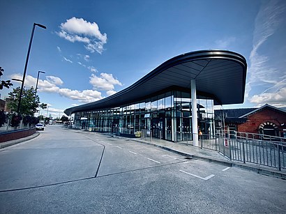
Altrincham Interchange Address: Stamford New Road street in Altrincham
Attractions near Altrincham Interchange
2 George Street,Stamford Quarter Car Park,Altrincham Library,Altrincham Metrolink Station,Bubble Tea Cafe,Stamford New Road,Wa14 1en,Planet Ice,Doctor Newmans Clinic,Leisure Centre Car Park,WA15 8EW,Planet Ice,Nando's,Laundry B,Cousin Thelmas Coffee Shop,St Ann's Hospice,Whittard of Chelsea Plc,Marks & Spencer,The Old Roebuck,Wa14 1qdHow to get to popular attractions in Altrincham with public transportation
James Parsons Building, Liverpool,Lowry, Salford,All Saints Park, Manchester,Salford Royal Nhs Foundation Trust, Salford,Blackpool Tower, Ballroom And Circus, Blackpool,Uppermill, Saddleworth,Newton Heath, Manchester,Central Pier, Blackpool,Haughton Green, Denton,Deansgate, Manchester,Prescot, St Helens,O2 Apollo Manchester, Manchester,Heaton Park, Prestwich,Sale Moor, Sale,Hilton Blackpool, Blackpool,Sycamore Farm, Burnley,Eccles College (Salford City College), Swinton,Vue Cinema, Lancaster,Royal Northern College Of Music, Manchester,Bury College, BuryGet around Altrincham by public transport!
Travelling around Altrincham has never been so easy. See step by step directions as you travel to any attraction, street or major public transport station. View bus and train timetables, arrival times, service alerts and detailed routes on a map, so you know exactly how to get to anywhere in Altrincham.
When travelling to any destination around Altrincham use Moovit's Live Directions with Get Off Notifications to know exactly where and how far to walk, how long to wait for your line , and how many stops are left. Moovit will alert you when it’s time to get off — no need to constantly re-check whether yours is the next stop.
Wondering how to use public transport in Altrincham or how to pay for public transport in Altrincham? Moovit public transport app can help you navigate your way with public transport easily, and at minimum cost. It includes public transport fees, ticket prices, and costs. Looking for a map of Altrincham public transport lines? Moovit public transport app shows all public transport maps in Altrincham with all light rail, bus or train routes and stops on an interactive map.
Altrincham has 3 transport type(s), including: light rail, bus or train, operated by several transport agencies, including Stagecoach Manchester, Arriva North West, Diamond Bus North West, Stagecoach Merseyside and South Lancashire, Stagecoach Cumbria and North Lancashire, First Greater Manchester, First Halifax, National Express, Warrington's Own Buses, First Potteries, Rosso, Blackpool Transport, The Blackburn Bus Company, The Burnley Bus Company and Vision Bus