Directions to Angus Folk Museum with public transportation
The following transport lines have routes that pass near Angus Folk Museum
How to get to Angus Folk Museum by bus?
Click on the bus route to see step by step directions with maps, line arrival times and updated time schedules.
Bus stations near Angus Folk Museum
- Mary Countess Way, Glamis, 7 min walk,
- Glamis Castle, Glamis, 24 min walk,
Bus routes to Angus Folk Museum
- K7, Glamis Primary School - Upper Middleton,
- 20C, Dundee - Kirriemuir or Stracathro,
- 22, Dundee bus station - Kirriemuir Square,
- K28, Kirriemuir Schools - Charleston,
- 125, Forfar,
What are the nearest stations to Angus Folk Museum?
The nearest stations to Angus Folk Museum are:
- Mary Countess Way, Glamis is 486 meters away, 7 min walk.
- Glamis Castle, Glamis is 1825 meters away, 24 min walk.
Which bus lines stop near Angus Folk Museum?
These bus lines stop near Angus Folk Museum: 125, 22.
What’s the nearest bus stop to Angus Folk Museum?
The nearest bus stop to Angus Folk Museum is Mary Countess Way, Glamis. It’s a 7 min walk away.
See Angus Folk Museum on the map
Public Transportation to Angus Folk Museum
Wondering how to get to Angus Folk Museum, United Kingdom? Moovit helps you find the best way to get to Angus Folk Museum with step-by-step directions from the nearest public transit station.
Moovit provides free maps and live directions to help you navigate through your city. View schedules, routes, timetables, and find out how long does it take to get to Angus Folk Museum in real time.
Looking for the nearest stop or station to Angus Folk Museum? Check out this list of stops closest to your destination: Mary Countess Way; Glamis Castle.
Bus: 125, 22, K7, 20C, K28.
Want to see if there’s another route that gets you there at an earlier time? Moovit helps you find alternative routes or times. Get directions from and directions to Angus Folk Museum easily from the Moovit App or Website.
We make riding to Angus Folk Museum easy, which is why over 1.5 million users, including users in Angus, trust Moovit as the best app for public transit. You don’t need to download an individual bus app or train app, Moovit is your all-in-one transit app that helps you find the best bus time or train time available.
For information on prices of bus and train, costs and ride fares to Angus Folk Museum, please check the Moovit app.
Use the app to navigate to popular places including to the airport, hospital, stadium, grocery store, mall, coffee shop, school, college, and university.
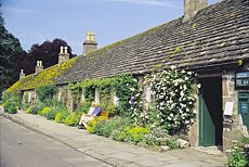
Angus Folk Museum Address: Kirkwynd Glamis Forfar DD8 1RT street in Angus
Attractions near Angus Folk Museum
Glamis Tourist Information,The Strathmore Arms,Glamis,J & J S Lyburn,Charleston Dundee,Glen Ogilvie,Glamis,Château de Glamis,Glamiseko gaztelua,Замок Глэмис,Glamis Castle,グラームス城,Angus,Glamis Castle Restaurant,Glamis Castle,Glamis Castle,Glamis Castle, Glamis,Deanbank Cottages, Glamis,Newton of Glamis, Glamis,Dd8 1sbHow to get to popular attractions in Angus with public transportation
Paisley Gilmour Street Railway Station (PYG), Paisley,Hillhead Subway Station, Glasgow,Asda, Edinburgh,Bruntsfield Links, Edinburgh,Nuffield Health, Edinburgh,Glasgow Green, Glasgow,EICC, Edinburgh,Annandale Water Motorway Services (RoadChef), Dumfries And Galloway,Virgin Active, Glasgow,Newton Mearns, Newton Mearns,The Queen Elizabeth University Hospital Campus, Glasgow,Hard Rock Cafe Edinburgh, Edinburgh,Buchanan Street Bus Station, Glasgow,Dundee Seagate Bus Station, Dundee,Glasgow Airport, Paisley,Croy Railway Station (CRO), North Lanarkshire,Asda, Glasgow,Glasgow Central Railway Station (GLC), Glasgow,Glasgow Marriott Hotel, Glasgow,Andersonian Library, GlasgowGet around Scotland by public transport!
Travelling around Scotland has never been so easy. See step by step directions as you travel to any attraction, street or major public transport station. View bus and train timetables, arrival times, service alerts and detailed routes on a map, so you know exactly how to get to anywhere in Scotland.
When travelling to any destination around Scotland use Moovit's Live Directions with Get Off Notifications to know exactly where and how far to walk, how long to wait for your line , and how many stops are left. Moovit will alert you when it’s time to get off — no need to constantly re-check whether yours is the next stop.
Wondering how to use public transport in Scotland or how to pay for public transport in Scotland? Moovit public transport app can help you navigate your way with public transport easily, and at minimum cost. It includes public transport fees, ticket prices, and costs. Looking for a map of Scotland public transport lines? Moovit public transport app shows all public transport maps in Scotland with all Bus, Train, Light rail and Ferry routes and stops on an interactive map.
Scotland has 4 transport type(s), including: Bus, Train, Light rail and Ferry, operated by several transport agencies, including First Greater Glasgow, First Aberdeen, Lothian Buses, McGill's Bus Service, Stagecoach East Scotland, Stagecoach Bluebird, Xplore Dundee, Community Transport Glasgow, Prentice Westwood, McCall's Coaches, J P Minibus, National Rail, R Robertson & Son, Burnbrae Garage, Ember