See Armada Arndale, Kilkenny, on the map
Directions to Armada Arndale (Kilkenny) with public transport
The following transport lines have routes that pass near Armada Arndale
 Bus:
Bus: - Train:
How to get to Armada Arndale by bus?
Click on the bus route to see step by step directions with maps, line arrival times and updated time schedules.
How to get to Armada Arndale by train?
Click on the train route to see step by step directions with maps, line arrival times and updated time schedules.
Bus stations near Armada Arndale in Kilkenny
- Stop 22 Regency Rd - North side,3 min walk,
- Stop 12 David Tce - West side,4 min walk,
- Zone F Arndale Interchange,5 min walk,
- Zone E Arndale Interchange,5 min walk,
- Stop 24A First Ave - North side,8 min walk,
- Zone D Arndale Interchange,10 min walk,
- Zone A Arndale Interchange,10 min walk,
- Stop 25 Torrens Rd - South West side,11 min walk,
Train stations near Armada Arndale in Kilkenny
- Kilkenny,8 min walk,
- Woodville,18 min walk,
Bus lines to Armada Arndale in Kilkenny
- AO16,Adelaide Oval,
- 230,City,
- 232,City,
- 300,Arndale,
- 300C,Urrbrae,
- 300G,Glenelg,
- 300H,Glen Osmond,
- J8,West Lakes,
- 994,Arndale (School Bus),
- 251,Mansfield Park,
- 252,Port Adelaide,
- 253,Mansfield Park,
- 253X,City,
- 254,Port Adelaide,
- N254,City,
- 254X,City,
- 239,Arndale,
- 251A,Mansfield Park to Arndale Centre Interchange,
- 252A,Port Adelaide Interchange to Arndale Centre Interchange,
- 100,Glen Osmond,
What are the nearest stations to Armada Arndale?
The nearest stations to Armada Arndale are:
- Stop 22 Regency Rd - North side is 181 meters away, 3 min walk.
- Stop 12 David Tce - West side is 237 meters away, 4 min walk.
- Zone F Arndale Interchange is 324 meters away, 5 min walk.
- Zone E Arndale Interchange is 349 meters away, 5 min walk.
- Kilkenny is 588 meters away, 8 min walk.
- Stop 24A First Ave - North side is 614 meters away, 8 min walk.
- Zone D Arndale Interchange is 712 meters away, 10 min walk.
- Zone A Arndale Interchange is 713 meters away, 10 min walk.
- Stop 25 Torrens Rd - South West side is 803 meters away, 11 min walk.
- Woodville is 1419 meters away, 18 min walk.
Which bus lines stop near Armada Arndale?
These bus lines stop near Armada Arndale: 232, 251, 254X, 300, J8.
Which train lines stop near Armada Arndale?
These train lines stop near Armada Arndale: GRNG, OUTHA.
What’s the nearest train station to Armada Arndale in Kilkenny?
The nearest train station to Armada Arndale in Kilkenny is Kilkenny. It’s a 8 min walk away.
What’s the nearest bus stop to Armada Arndale in Kilkenny?
The nearest bus stop to Armada Arndale in Kilkenny is Stop 22 Regency Rd - North side. It’s a 3 min walk away.
What time is the first train to Armada Arndale in Kilkenny?
The OUTHA is the first train that goes to Armada Arndale in Kilkenny. It stops nearby at 04:43.
What time is the last train to Armada Arndale in Kilkenny?
The OUTHA is the last train that goes to Armada Arndale in Kilkenny. It stops nearby at 01:29.
What time is the first bus to Armada Arndale in Kilkenny?
The 230 is the first bus that goes to Armada Arndale in Kilkenny. It stops nearby at 05:23.
What time is the last bus to Armada Arndale in Kilkenny?
The 230 is the last bus that goes to Armada Arndale in Kilkenny. It stops nearby at 00:16.
How much is the train fare to Armada Arndale?
The train fare to Armada Arndale costs about $2.40 - $4.25.
How much is the bus fare to Armada Arndale?
The bus fare to Armada Arndale costs about $2.40 - $4.25.
See Armada Arndale, Kilkenny, on the map
Public Transit to Armada Arndale in Kilkenny
Wondering how to get to Armada Arndale in Kilkenny, Australia? Moovit helps you find the best way to get to Armada Arndale with step-by-step directions from the nearest public transit station.
Moovit provides free maps and live directions to help you navigate through your city. View schedules, routes, timetables, and find out how long does it take to get to Armada Arndale in real time.
Looking for the nearest stop or station to Armada Arndale? Check out this list of stops closest to your destination: Stop 22 Regency Rd - North side; Stop 12 David Tce - West side; Zone F Arndale Interchange; Zone E Arndale Interchange; Kilkenny; Stop 24A First Ave - North side; Zone D Arndale Interchange; Zone A Arndale Interchange; Stop 25 Torrens Rd - South West side; Woodville.
Bus:Train:
Want to see if there’s another route that gets you there at an earlier time? Moovit helps you find alternative routes or times. Get directions from and directions to Armada Arndale easily from the Moovit App or Website.
We make riding to Armada Arndale easy, which is why over 1.5 million users, including users in Kilkenny, trust Moovit as the best app for public transit. You don’t need to download an individual bus app or train app, Moovit is your all-in-one transit app that helps you find the best bus time or train time available.
For information on prices of bus and train, costs and ride fares to Armada Arndale, please check the Moovit app.
Use the app to navigate to popular places including to the airport, hospital, stadium, grocery store, mall, coffee shop, school, college, and university.
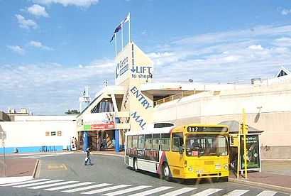
Armada Arndale Address: 470 Torrens Rd street in Kilkenny
Attractions near Armada Arndale
Armada Arndale,Amplifon Arndale,The Lott,Acesox,Pharmasave,The Machine,Beme,house,Maxmix Home & Gift,Shoe Express Arndale Shopping Centre Near Best&Less and Eb Games,EC Living,The Artist Ark,Apm Employment Services Kilkenny,Kilkenny Lottery Kiosk,Park,Sycorp Investments P,Strandbags 575,H&R Block Tax Accountants Arndale,OP Beauty,Miniso Adelaide Pty LHow to get to popular attractions in Kilkenny with public transportation
Gepps Cross, Gepps Cross,Hallett Cove Shopping Centre, Hallett Cove,Mount Lofty, Crafers,Happy Valley, Happy Valley,Modbury Hospital, Modbury,Stirling, Stirling,Central Markets, Adelaide,Ingle Farm Shopping Centre, Ingle Farm,Blackwood Interchange, Blackwood,Adelaide Oval, North Adelaide,Adelaide, Adelaide,Victoria Square/Tartanyangga, Adelaide,Coromandel Railway Station, Blackwood,Salisbury, Salisbury,Northpark Shopping Centre, Prospect,Armada Arndale, Kilkenny,Watermark Hotel, Glenelg North,Immanuel College, Novar Gardens,Alberton Railway Station, Alberton,Domestic & International Terminal, Adelaide AirportGet around Kilkenny by public transport!
Travelling around Kilkenny has never been so easy. See step by step directions as you travel to any attraction, street or major public transport station. View bus and train timetables, arrival times, service alerts and detailed routes on a map, so you know exactly how to get to anywhere in Kilkenny.
When travelling to any destination around Kilkenny use Moovit's Live Directions with Get Off Notifications to know exactly where and how far to walk, how long to wait for your line , and how many stops are left. Moovit will alert you when it’s time to get off — no need to constantly re-check whether yours is the next stop.
Wondering how to use public transport in Kilkenny or how to pay for public transport in Kilkenny? Moovit public transport app can help you navigate your way with public transport easily, and at minimum cost. It includes public transport fees, ticket prices, and costs. Looking for a map of Kilkenny public transport lines? Moovit public transport app shows all public transport maps in Kilkenny with all bus or train routes and stops on an interactive map.
Kilkenny has 2 transport type(s), including: bus or train, operated by several transport agencies, including Adelaide Metro (Busways), SouthLink, Torrens Transit, Adelaide Metro Train, Adelaide Metro (Torrens Connect), Adelaide Metro (Industrial Service - Torrens Transit), Adelaide Metro (School Service - SouthLink), Adelaide Metro (School Service - Torrens Transit) and Adelaide Metro (School Service - Busways)