Directions to Ashley Green (Chiltern) with public transport
The following transport lines have routes that pass near Ashley Green
How to get to Ashley Green by bus?
Click on the bus route to see step by step directions with maps, line arrival times and updated time schedules.
How to get to Ashley Green by train?
Click on the train route to see step by step directions with maps, line arrival times and updated time schedules.
Bus stations near Ashley Green in Chiltern
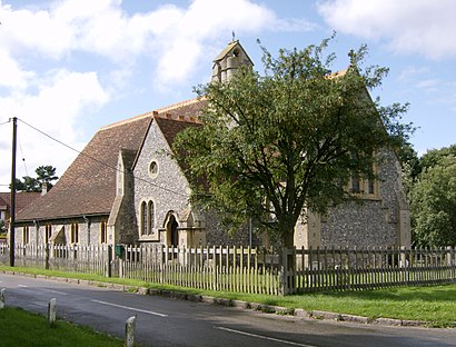
- St John's Church, Ashley Green, 2 min walk,
Tube stations near Ashley Green in Chiltern
- Chesham, 53 min walk,
Bus lines to Ashley Green in Chiltern
- 354, Chesham,
What are the nearest stations to Ashley Green?
The nearest stations to Ashley Green are:
- St John's Church, Ashley Green is 86 meters away, 2 min walk.
- Chesham is 4081 meters away, 53 min walk.
Which bus lines stop near Ashley Green?
These bus lines stop near Ashley Green: 1, 501.
Which train line stops near Ashley Green?
WEST MIDLANDS RAILWAY
What’s the nearest bus stop to Ashley Green in Chiltern?
The nearest bus stop to Ashley Green in Chiltern is St John's Church, Ashley Green. It’s a 2 min walk away.
What time is the first Tube to Ashley Green in Chiltern?
The METROPOLITAN is the first Tube that goes to Ashley Green in Chiltern. It stops nearby at 07:15.
What time is the last Tube to Ashley Green in Chiltern?
The METROPOLITAN is the last Tube that goes to Ashley Green in Chiltern. It stops nearby at 01:17.
See Ashley Green, Chiltern, on the map
Public Transit to Ashley Green in Chiltern
Wondering how to get to Ashley Green in Chiltern, United Kingdom? Moovit helps you find the best way to get to Ashley Green with step-by-step directions from the nearest public transit station.
Moovit provides free maps and live directions to help you navigate through your city. View schedules, routes, timetables, and find out how long does it take to get to Ashley Green in real time.
Looking for the nearest stop or station to Ashley Green? Check out this list of stops closest to your destination: St John's Church; Chesham.
Bus: 1, 501, 354.Train: WEST MIDLANDS RAILWAY.Tube: METROPOLITAN.
Want to see if there’s another route that gets you there at an earlier time? Moovit helps you find alternative routes or times. Get directions from and directions to Ashley Green easily from the Moovit App or Website.
We make riding to Ashley Green easy, which is why over 1.5 million users, including users in Chiltern, trust Moovit as the best app for public transit. You don’t need to download an individual bus app or train app, Moovit is your all-in-one transit app that helps you find the best bus time or train time available.
For information on prices of bus, train and Tube, costs and ride fares to Ashley Green, please check the Moovit app.
Use the app to navigate to popular places including to the airport, hospital, stadium, grocery store, mall, coffee shop, school, college, and university.
Ashley Green Address: Ashley Green Road street in Chiltern
Attractions near Ashley Green
Ashley Green Wastewater Treatment Works,The Lazy Pig in the Pantry,The Lazy Pig in the Pantry,House of Tree,Total Uk,The Vale Vale Road,GNG Consulting,The Glebe Cafe Limited,Lye Green,Bfi National Archive,Chesham Vale,Boxmore Garage Servives,Twp Bespoke,Energy Capital Holdings,Magnum Meter Finance,Langtry House Limited,Nigel Cobb Consulting,Berkhamsted School Playing Fields,Wired Communications,Crisis Control Consultants LimitedHow to get to popular attractions in Chiltern with public transportation
Bicester North Railway Station (BCS), Bicester,Ikea, Neasden,Borough Market, Borough,Whetstone Audi, Whetstone,Wembley, Wembley,Catford, Catford,Starbucks, Chiswick,Camden Market Hall, Camden Town,British Museum, Bloomsbury,Covent Garden Station, Covent Garden,Wembley Stadium, Wembley,Crystal Palace, Crystal Palace,Stansted Airport, Stansted,Marble Arch, Mayfair,Middlesex University, Hendon,IKEA, Bletchley (M Keynes),Sainsbury's, Chiswick,Portobello Road Market, Notting Hill,High Wycombe Bus Station, High Wycombe,Kensington Palace, KensingtonGet around London by public transport!
Travelling around London has never been so easy. See step by step directions as you travel to any attraction, street or major public transport station. View bus and train timetables, arrival times, service alerts and detailed routes on a map, so you know exactly how to get to anywhere in London.
When travelling to any destination around London use Moovit's Live Directions with Get Off Notifications to know exactly where and how far to walk, how long to wait for your line , and how many stops are left. Moovit will alert you when it’s time to get off — no need to constantly re-check whether yours is the next stop.
Wondering how to use public transport in London or how to pay for public transport in London? Moovit public transport app can help you navigate your way with public transport easily, and at minimum cost. It includes public transport fees, ticket prices, and costs. Looking for a map of London public transport lines? Moovit public transport app shows all public transport maps in London with all Bus, Train, Tube, Tramlink, River Bus and DLR routes and stops on an interactive map.
London has 6 transport type(s), including: Bus, Train, Tube, Tramlink, River Bus and DLR, operated by several transport agencies, including London Underground, London Buses, Transport for London, London Tramlink, National Rail, Bluestar, Berry's Coaches, Oxford Bus Company, Stagecoach West, Community First Wessex, Cresta Coaches, D & P Boat Hire, First Portsmouth, Fareham & Gosport, FYTbus, IFS Cloud Cable Car