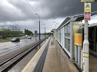
Directions to Ashton Moss tram stop (Ashton Under Lyne) with public transport
The following transport lines have routes that pass near Ashton Moss tram stop
How to get to Ashton Moss tram stop by bus?
Click on the bus route to see step by step directions with maps, line arrival times and updated time schedules.
How to get to Ashton Moss tram stop by train?
Click on the train route to see step by step directions with maps, line arrival times and updated time schedules.
How to get to Ashton Moss tram stop by light rail?
Click on the light rail route to see step by step directions with maps, line arrival times and updated time schedules.
Light Rail stations near Ashton Moss tram stop in Ashton Under Lyne
- Ashton Moss (Manchester Metrolink),1 min walk,
Bus stations near Ashton Moss tram stop in Ashton Under Lyne
- Ashton Moss Metrolink (Stop D),3 min walk,
- Ashton Moss (Stop B),8 min walk,
Bus lines to Ashton Moss tram stop in Ashton Under Lyne
- 7,Gorton,
- 217,Manchester City Centre,
- 216,Piccadilly Gardens,
- 771,Clayton,
What are the nearest stations to Ashton Moss tram stop?
The nearest stations to Ashton Moss tram stop are:
- Ashton Moss (Manchester Metrolink) is 10 meters away, 1 min walk.
- Ashton Moss Metrolink (Stop D) is 203 meters away, 3 min walk.
- Ashton Moss (Stop B) is 543 meters away, 8 min walk.
Which bus lines stop near Ashton Moss tram stop?
These bus lines stop near Ashton Moss tram stop: 216, 7.
Which train line stops near Ashton Moss tram stop?
NORTHERN
Which light rail line stops near Ashton Moss tram stop?
BLUE LINE
What’s the nearest light rail station to Ashton Moss tram stop in Ashton Under Lyne?
The nearest light rail station to Ashton Moss tram stop in Ashton Under Lyne is Ashton Moss (Manchester Metrolink). It’s a 1 min walk away.
What’s the nearest bus stop to Ashton Moss tram stop in Ashton Under Lyne?
The nearest bus stop to Ashton Moss tram stop in Ashton Under Lyne is Ashton Moss Metrolink (Stop D). It’s a 3 min walk away.
What time is the first light rail to Ashton Moss tram stop in Ashton Under Lyne?
The BLUE LINE is the first light rail that goes to Ashton Moss tram stop in Ashton Under Lyne. It stops nearby at 05:43.
What time is the last light rail to Ashton Moss tram stop in Ashton Under Lyne?
The BLUE LINE is the last light rail that goes to Ashton Moss tram stop in Ashton Under Lyne. It stops nearby at 00:30.
What time is the first bus to Ashton Moss tram stop in Ashton Under Lyne?
The 216 is the first bus that goes to Ashton Moss tram stop in Ashton Under Lyne. It stops nearby at 04:29.
What time is the last bus to Ashton Moss tram stop in Ashton Under Lyne?
The 216 is the last bus that goes to Ashton Moss tram stop in Ashton Under Lyne. It stops nearby at 00:35.
See Ashton Moss tram stop, Ashton Under Lyne, on the map
Public Transit to Ashton Moss tram stop in Ashton Under Lyne
Wondering how to get to Ashton Moss tram stop in Ashton Under Lyne, United Kingdom? Moovit helps you find the best way to get to Ashton Moss tram stop with step-by-step directions from the nearest public transit station.
Moovit provides free maps and live directions to help you navigate through your city. View schedules, routes, timetables, and find out how long does it take to get to Ashton Moss tram stop in real time.
Looking for the nearest stop or station to Ashton Moss tram stop? Check out this list of stops closest to your destination: Ashton Moss (Manchester Metrolink); Ashton Moss Metrolink (Stop D); Ashton Moss (Stop B).
Bus:2167217771Train:NORTHERNLight rail:BLUE LINE
Want to see if there’s another route that gets you there at an earlier time? Moovit helps you find alternative routes or times. Get directions from and directions to Ashton Moss tram stop easily from the Moovit App or Website.
We make riding to Ashton Moss tram stop easy, which is why over 1.5 million users, including users in Ashton Under Lyne, trust Moovit as the best app for public transit. You don’t need to download an individual bus app or train app, Moovit is your all-in-one transit app that helps you find the best bus time or train time available.
For information on prices of bus, light rail and train, costs and ride fares to Ashton Moss tram stop, please check the Moovit app.
Use the app to navigate to popular places including to the airport, hospital, stadium, grocery store, mall, coffee shop, school, college, and university.
Location: Ashton Under Lyne, North West
Attractions near Ashton Moss tram stop
Ashton Moss,Bicycle Parking,Carshop,M&S,Notcutts Ashton Park Garden Centre (Cafe),Notcutts Garden Centre,Nottcuts Ashton Park Garden Centre,City Plumbing Supplies,Toolstation,Carshop Manchester,Screwfix,Arco,Ashton Moss Park And Ride,Mockingridge Garden Nursery,Nexus House,Lord Sheldon Way (Stop A), Ashton under Lyne,OL7 0QN,Mockridge Nurseries,Travelodge Ashton Under Lyne Hotel Ashton-Under-Lyne,The Sheldon ArmsHow to get to popular attractions in Ashton Under Lyne with public transportation
James Parsons Building, Liverpool,Merseyway Shopping Centre, Stockport,Etihad Stadium, Manchester,The Village Hotel, Cheadle,Salford Quays, Salford,BT Dial House, Salford,Tesco Extra, Manchester,Harpurhey, Manchester,Widnes Market, Widnes,Cheetham Hill, Manchester,Halewood Park Environmental Centre, Halewood,Old Trafford Stadium, Trafford Bar,The Printworks, Manchester,Wythenshawe Hospital, Manchester,Shena Simon Campus, Manchester,Boots, Trafford Park,Manchester Aquatics Centre, Manchester,Pear Mill, Bredbury,Primark, Preston,Blackpool Tower, Ballroom And Circus, BlackpoolGet around Ashton Under Lyne by public transport!
Travelling around Ashton Under Lyne has never been so easy. See step by step directions as you travel to any attraction, street or major public transport station. View bus and train timetables, arrival times, service alerts and detailed routes on a map, so you know exactly how to get to anywhere in Ashton Under Lyne.
When travelling to any destination around Ashton Under Lyne use Moovit's Live Directions with Get Off Notifications to know exactly where and how far to walk, how long to wait for your line , and how many stops are left. Moovit will alert you when it’s time to get off — no need to constantly re-check whether yours is the next stop.
Wondering how to use public transport in Ashton Under Lyne or how to pay for public transport in Ashton Under Lyne? Moovit public transport app can help you navigate your way with public transport easily, and at minimum cost. It includes public transport fees, ticket prices, and costs. Looking for a map of Ashton Under Lyne public transport lines? Moovit public transport app shows all public transport maps in Ashton Under Lyne with all bus, light rail or train routes and stops on an interactive map.
Ashton Under Lyne has 3 transport type(s), including: bus, light rail or train, operated by several transport agencies, including Stagecoach Manchester, Arriva North West, Diamond Bus North West, Stagecoach Merseyside and South Lancashire, Stagecoach Cumbria and North Lancashire, First Greater Manchester, First Halifax, National Express, Warrington's Own Buses, First Potteries, Rosso, Blackpool Transport, Blackpool Transport, The Blackburn Bus Company and The Burnley Bus Company