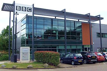
See BBC Cambridge on the map
Directions to BBC Cambridge with public transportation
The following transport lines have routes that pass near BBC Cambridge
 Bus:
Bus: - Train:
How to get to BBC Cambridge by bus?
Click on the bus route to see step by step directions with maps, line arrival times and updated time schedules.
How to get to BBC Cambridge by train?
Click on the train route to see step by step directions with maps, line arrival times and updated time schedules.
Bus stations near BBC Cambridge
- Science Park, Cambridge,2 min walk,
- Driving Test Centre, Cambridge,4 min walk,
- The Busway Science Park, Cambridge,5 min walk,
- Scarsdale Close, Chesterton,7 min walk,
- Cambridge North,15 min walk,
- Cambridge,63 min walk,
Bus routes to BBC Cambridge
- PR5,Cambridge City Centre - Milton Park&Ride,
- 9,Cambridge - Littleport,
- 9,Cambridge - Ely - Littleport,
- 2,Milton,
- X9,Littleport,
- B,Hinchingbrooke Park,
- 606,Cambridge,
- GREAT NORTHERN,London Kings Cross,
- GREATER ANGLIA,Stansted Airport,
- CROSSCOUNTRY,Cambridge,
- GREAT NORTHERN,Bus Replacement: Royston,
- THAMESLINK,Brighton,
What are the nearest stations to BBC Cambridge?
The nearest stations to BBC Cambridge are:
- Science Park, Cambridge is 118 meters away, 2 min walk.
- Driving Test Centre, Cambridge is 249 meters away, 4 min walk.
- The Busway Science Park, Cambridge is 306 meters away, 5 min walk.
- Scarsdale Close, Chesterton is 523 meters away, 7 min walk.
- Cambridge North is 1094 meters away, 15 min walk.
- Cambridge is 4886 meters away, 63 min walk.
Which bus lines stop near BBC Cambridge?
These bus lines stop near BBC Cambridge: 2|CITI, 9, MILTON ROAD PARK & RIDE.
Which train lines stop near BBC Cambridge?
These train lines stop near BBC Cambridge: GREAT NORTHERN, GREATER ANGLIA.
What’s the nearest bus stop to BBC Cambridge?
The nearest bus stop to BBC Cambridge is Science Park, Cambridge. It’s a 2 min walk away.
See BBC Cambridge on the map
Public Transportation to BBC Cambridge
Wondering how to get to BBC Cambridge, United Kingdom? Moovit helps you find the best way to get to BBC Cambridge with step-by-step directions from the nearest public transit station.
Moovit provides free maps and live directions to help you navigate through your city. View schedules, routes, timetables, and find out how long does it take to get to BBC Cambridge in real time.
Looking for the nearest stop or station to BBC Cambridge? Check out this list of stops closest to your destination: Science Park; Driving Test Centre; The Busway Science Park; Scarsdale Close; Cambridge North; Cambridge.
Bus:Train:
Want to see if there’s another route that gets you there at an earlier time? Moovit helps you find alternative routes or times. Get directions from and directions to BBC Cambridge easily from the Moovit App or Website.
We make riding to BBC Cambridge easy, which is why over 1.5 million users, including users in Cambridge, trust Moovit as the best app for public transit. You don’t need to download an individual bus app or train app, Moovit is your all-in-one transit app that helps you find the best bus time or train time available.
For information on prices of bus and train, costs and ride fares to BBC Cambridge, please check the Moovit app.
Use the app to navigate to popular places including to the airport, hospital, stadium, grocery store, mall, coffee shop, school, college, and university.
Location: Cambridge, East Anglia
Attractions near BBC Cambridge
Cambridge Science Park / Milton Road,RP Fitness,CSC,c4 carbides,Cambridge Business Park,Cambridge Science Park,Nuffield Road,RP Fitness - Cambridge,Beko R&D Centre Cambridge Science Park,F Vindis and Sons Cambridge,Cb4 0fb,EMG (Cambridge),EMG Motor Group-Cambridge,Riverbed Technology,Jagex Games Studio,The Palace,Cb4 0ga,Golden Hind,Cowley road Park and Ride,Sherbourne Close, CambridgeHow to get to popular attractions in Cambridge with public transportation
Newnham College, Cambridge,Wensum Lodge - Norfolk County Council Adult Education, Norwich,Huntingdon Regional College, Huntingdonshire,The Cellar House, Norwich,John Lewis at Home, Ipswich,Netherhall School and Sixth Form College, Cambridge,Sir Harry Smith Community College, Fenland,Lensfield Hotel, Cambridge,Hunstanton,Lammas Land, Cambridge,Aldi, Norwich,Mulbarton, South Norfolk,Chemistry and Pharmacy Building UEA, Norwich,Thickthorn Sevices A11 / A47 Interchange, South Norfolk,UEA Congregation Hall, Norwich,GO Outdoors, Norwich,Thickthorn Park and Ride, South Norfolk,Downham Market, King'S Lynn And West Norfolk,BeWILDerwood, North Norfolk,Belstead Brook Hotel, IpswichGet around Cambridge by public transport!
Travelling around Cambridge has never been so easy. See step by step directions as you travel to any attraction, street or major public transport station. View bus and train timetables, arrival times, service alerts and detailed routes on a map, so you know exactly how to get to anywhere in Cambridge.
When travelling to any destination around Cambridge use Moovit's Live Directions with Get Off Notifications to know exactly where and how far to walk, how long to wait for your line , and how many stops are left. Moovit will alert you when it’s time to get off — no need to constantly re-check whether yours is the next stop.
Wondering how to use public transport in Cambridge or how to pay for public transport in Cambridge? Moovit public transport app can help you navigate your way with public transport easily, and at minimum cost. It includes public transport fees, ticket prices, and costs. Looking for a map of Cambridge public transport lines? Moovit public transport app shows all public transport maps in Cambridge with all bus or train routes and stops on an interactive map.
Cambridge has 2 transport type(s), including: bus or train, operated by several transport agencies, including National Rail, Ambassador Travel, Harwich Harbour Ferry, Stephensons of Essex, Villager Minibus Sharnbrook, The Voluntary Network, Dews Coaches, Lord's Travel, Felixstowe Ferry Boat Yard, Hadleigh Community Transport, Beestons, Fenland Association for Community Transport, First Norfolk & Suffolk, National Rail and Mulleys Motorways