Directions to Barangaroo ferry wharf (Sydney) with public transport
The following transport lines have routes that pass near Barangaroo ferry wharf
How to get to Barangaroo ferry wharf by bus?
Click on the bus route to see step by step directions with maps, line arrival times and updated time schedules.
How to get to Barangaroo ferry wharf by train?
Click on the train route to see step by step directions with maps, line arrival times and updated time schedules.
Ferry stations near Barangaroo ferry wharf in Sydney
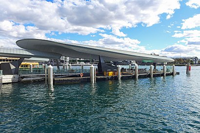
- Barangaroo Wharf 1,2 min walk,
- Barangaroo Wharf 2,3 min walk,
- Darling Harbour Wharf,4 min walk,
Bus stations near Barangaroo ferry wharf in Sydney
- Hickson Rd opp Barangaroo South,3 min walk,
- Sussex St before Erskine St,3 min walk,
- Wynyard Station, Kent St, Stand V,4 min walk,
- Wynyard Station, Clarence St, Stand R,5 min walk,
- Wynyard Station, Clarence St, Stand Q,5 min walk,
- Wynyard Station, Clarence St, Stand S,6 min walk,
- Wynyard Station, Jamison St, Stand U,6 min walk,
- Wynyard Station, York St, Stand M,6 min walk,
- Wynyard Station, Clarence St, Stand T,7 min walk,
- Wynyard Station, York St, Stand L,7 min walk,
Train stations near Barangaroo ferry wharf in Sydney
- Wynyard Station,3 min walk,
Bus lines to Barangaroo ferry wharf in Sydney
- 311,City Millers Point,
- 324,City Walsh Bay,
- 325,Watsons Bay,
- 288,Macquarie University to City Erskine St via Freeway,
- 290,Epping to City Erskine St via North Sydney (Night Service),
- 292,Marsfield to City Erskine St via Macquarie Park, Lane Cove North & Freeway,
- 620X,Dural to City Wynyard via Cherrybrook (Express Service),
- 642X,Dural to City Wynyard (Express Service),
- 652X,West Pennant Hills to City Wynyard (Express Service),
- N90,Hornsby to City Town Hall via Chatswood (Night Service),
- N91,City Town Hall to Macquarie Centre (Night Service),
- N92,Tallawong to City Town Hall via Macquarie Park (Night Service),
- 120,Chatswood to City QVB (Loop Service),
- 251,Lane Cove West to City Wynyard via Freeway,
- 253,Riverview to City Wynyard via Freeway,
- 285,Lane Cove West to City Wynyard via Freeway,
- 293,Marsfield to City Wynyard via Lane Cove Tunnel,
- 297,Denistone East to City Wynyard via Lane Cove Tunnel,
- 607X,Bella Vista Station,
- 610X,Castle Hill,
What are the nearest stations to Barangaroo ferry wharf?
The nearest stations to Barangaroo ferry wharf are:
- Barangaroo Wharf 1 is 150 meters away, 2 min walk.
- Hickson Rd opp Barangaroo South is 211 meters away, 3 min walk.
- Sussex St before Erskine St is 212 meters away, 3 min walk.
- Barangaroo Wharf 2 is 214 meters away, 3 min walk.
- Wynyard Station is 217 meters away, 3 min walk.
- Wynyard Station, Kent St, Stand V is 261 meters away, 4 min walk.
- Darling Harbour Wharf is 273 meters away, 4 min walk.
- Wynyard Station, Clarence St, Stand R is 327 meters away, 5 min walk.
- Wynyard Station, Clarence St, Stand Q is 359 meters away, 5 min walk.
- Wynyard Station, Clarence St, Stand S is 386 meters away, 6 min walk.
- Wynyard Station, Jamison St, Stand U is 405 meters away, 6 min walk.
- Wynyard Station, York St, Stand M is 432 meters away, 6 min walk.
- Wynyard Station, Clarence St, Stand T is 465 meters away, 7 min walk.
- Wynyard Station, York St, Stand L is 467 meters away, 7 min walk.
Which bus lines stop near Barangaroo ferry wharf?
These bus lines stop near Barangaroo ferry wharf: 168X, 288, 293, 392X, 437, 642X.
Which train lines stop near Barangaroo ferry wharf?
These train lines stop near Barangaroo ferry wharf: T1, T2, T3.
What’s the nearest train station to Barangaroo ferry wharf in Sydney?
The nearest train station to Barangaroo ferry wharf in Sydney is Wynyard Station. It’s a 3 min walk away.
What’s the nearest bus stop to Barangaroo ferry wharf in Sydney?
The nearest bus stops to Barangaroo ferry wharf in Sydney are Hickson Rd opp Barangaroo South and Sussex St before Erskine St. The closest one is a 3 min walk away.
What’s the nearest ferry station to Barangaroo ferry wharf in Sydney?
The nearest ferry station to Barangaroo ferry wharf in Sydney is Barangaroo Wharf 1. It’s a 2 min walk away.
What time is the first train to Barangaroo ferry wharf in Sydney?
The T8 is the first train that goes to Barangaroo ferry wharf in Sydney. It stops nearby at 04:23.
What time is the last train to Barangaroo ferry wharf in Sydney?
The T1 is the last train that goes to Barangaroo ferry wharf in Sydney. It stops nearby at 00:46.
What time is the first bus to Barangaroo ferry wharf in Sydney?
The N92 is the first bus that goes to Barangaroo ferry wharf in Sydney. It stops nearby at 03:13.
What time is the last bus to Barangaroo ferry wharf in Sydney?
The BN1 is the last bus that goes to Barangaroo ferry wharf in Sydney. It stops nearby at 03:21.
What time is the first ferry to Barangaroo ferry wharf in Sydney?
The F4 is the first ferry that goes to Barangaroo ferry wharf in Sydney. It stops nearby at 06:19.
What time is the last ferry to Barangaroo ferry wharf in Sydney?
The F4 is the last ferry that goes to Barangaroo ferry wharf in Sydney. It stops nearby at 00:09.
How much is the train fare to Barangaroo ferry wharf?
The train fare to Barangaroo ferry wharf costs about $2.80 - $7.65.
How much is the bus fare to Barangaroo ferry wharf?
The bus fare to Barangaroo ferry wharf costs about $2.24 - $5.33.
How much is the ferry fare to Barangaroo ferry wharf?
The ferry fare to Barangaroo ferry wharf costs about $9.90.
See Barangaroo ferry wharf, Sydney, on the map
Public Transit to Barangaroo ferry wharf in Sydney
Wondering how to get to Barangaroo ferry wharf in Sydney, Australia? Moovit helps you find the best way to get to Barangaroo ferry wharf with step-by-step directions from the nearest public transit station.
Moovit provides free maps and live directions to help you navigate through your city. View schedules, routes, timetables, and find out how long does it take to get to Barangaroo ferry wharf in real time.
Looking for the nearest stop or station to Barangaroo ferry wharf? Check out this list of stops closest to your destination: Barangaroo Wharf 1; Hickson Rd opp Barangaroo South; Sussex St before Erskine St; Barangaroo Wharf 2; Wynyard Station; Wynyard Station; Darling Harbour Wharf; Wynyard Station; Wynyard Station; Wynyard Station; Wynyard Station; Wynyard Station; Wynyard Station; Wynyard Station.
Bus:168X288293392X437642X290292311324325620X652XN90N91N92120251Train:T1T2T3CCNT8Ferry:F3F10
Want to see if there’s another route that gets you there at an earlier time? Moovit helps you find alternative routes or times. Get directions from and directions to Barangaroo ferry wharf easily from the Moovit App or Website.
We make riding to Barangaroo ferry wharf easy, which is why over 1.5 million users, including users in Sydney, trust Moovit as the best app for public transit. You don’t need to download an individual bus app or train app, Moovit is your all-in-one transit app that helps you find the best bus time or train time available.
For information on prices of train, bus and ferry, costs and ride fares to Barangaroo ferry wharf, please check the Moovit app.
Use the app to navigate to popular places including to the airport, hospital, stadium, grocery store, mall, coffee shop, school, college, and university.
Location: Sydney
Attractions near Barangaroo ferry wharf
Barangaroo Wharf 1 Side B,Lotus Barangaroo,Barangaroo, Wharf 1,Love Fish,Muum Maam,Anadara,Anason,Watermans Cove,Streets Of Barangaroo - Shipwright Walk,The Butchers Block,International Towers Sydney,The Meat & Wine Co,Barangaroo Ferry Wharf,New Orleans Smokehouse.,Streets of Barangaroo - Mercantile Walk,pwc,The Meat & Wine Co.,Born by Tapavino,Facebook,ST.George Branch Sydney, BarangarooHow to get to popular attractions in Sydney with public transportation
Ichi-ban Boshi (一番星), Sydney,Sydney Airport (SYD), Mascot,University of Wollongong, Keiraville,The Clock Hotel, Surry Hills,Petersham Station, Petersham,Penrith Station, Penrith,Shady Pines Saloon, Darlinghurst,Kingsford Smith Airport - International Terminal, Mascot,The Sheaf, Double Bay,The Dolphin Hotel, Surry Hills,Westfield Tuggerah, Tuggerah,Lidcombe Station (Platforms 2 & 3), Lidcombe,Kogarah Station, Kogarah,West Ryde Station, West Ryde,University Of Newcastle (Callaghan Campus), Callaghan,Broadway Shopping Centre, Glebe (NSW),Manly Beach, Manly (NSW),Blue Mountains National Park, Katoomba,Wynyard, Sydney,Castle Towers, Castle Hill (NSW)Get around Sydney by public transport!
Travelling around Sydney has never been so easy. See step by step directions as you travel to any attraction, street or major public transport station. View bus and train timetables, arrival times, service alerts and detailed routes on a map, so you know exactly how to get to anywhere in Sydney.
When travelling to any destination around Sydney use Moovit's Live Directions with Get Off Notifications to know exactly where and how far to walk, how long to wait for your line , and how many stops are left. Moovit will alert you when it’s time to get off — no need to constantly re-check whether yours is the next stop.
Wondering how to use public transport in Sydney or how to pay for public transport in Sydney? Moovit public transport app can help you navigate your way with public transport easily, and at minimum cost. It includes public transport fees, ticket prices, and costs. Looking for a map of Sydney public transport lines? Moovit public transport app shows all public transport maps in Sydney with all train, bus or ferry routes and stops on an interactive map.
Sydney has 3 transport type(s), including: train, bus or ferry, operated by several transport agencies, including Sydney Metro, Sydney Trains, Sydney Light Rail, Sydney Ferries, Intercity Trains, Intercity Train, NSW TrainLink, CDC NSW R14, U-Go Mobility, Keolis Downer Northern Beaches, Manly Fast Ferry, Transdev John Holland Buses, Busways, Busways North West and Dysons Buslines