Directions to Barnes Park station (Sunderland) with public transport
The following transport lines have routes that pass near Barnes Park
How to get to Barnes Park station by bus?
Click on the bus route to see step by step directions with maps, line arrival times and updated time schedules.
How to get to Barnes Park station by train?
Click on the train route to see step by step directions with maps, line arrival times and updated time schedules.
How to get to Barnes Park station by underground?
Click on the underground route to see step by step directions with maps, line arrival times and updated time schedules.
Bus stops near Barnes Park in Sunderland
- Barnes Park Road-Chatsworth Close, Barnes Park, 5 min walk,
- Durham Road - Barnes Park Road, Barnes Park, 8 min walk,
- Cleveland Road-Colchester Terrace, High Barnes, 9 min walk,
Underground station near Barnes Park in Sunderland
- St Peter's, 12 min walk,
Bus lines to Barnes Park station in Sunderland
- 32, Low Moorsley,
- 99, Hylton Castle,
- S451, Fatfield,
- S452, Barnes Park,
- X1, Doxford Park - Sunderland,
- 3, Castletown - Farringdon,
- 4, Downhill - Doxford Park,
- ED4, Peterlee - Castletown,
- 18A, Grangetown - Sunderland,
- 20, Sunderland - Durham,
- 20A, Durham - Sunderland,
- X20, Langley Park - Sunderland,
- 23, Seaburn Dene - Thorney Close,
- 8, East End,
What are the nearest stations to Barnes Park?
The nearest stations to Barnes Park are:
- Barnes Park Road-Chatsworth Close, Barnes Park is 311 meters away, 5 min walk.
- Durham Road - Barnes Park Road, Barnes Park is 532 meters away, 8 min walk.
- Cleveland Road-Colchester Terrace, High Barnes is 603 meters away, 9 min walk.
- St Peter's is 774 meters away, 12 min walk.
Which bus lines stop near Barnes Park?
These bus lines stop near Barnes Park: 23, 32, 4, 78, X24.
Which train line stops near Barnes Park?
NORTHERN (Middlesbrough)
Which underground line stops near Barnes Park?
GRN (South Hylton)
What’s the nearest underground station to Barnes Park in Sunderland?
The nearest underground station to Barnes Park in Sunderland is St Peter's. It’s a 12 min walk away.
What’s the nearest bus stop to Barnes Park in Sunderland?
The nearest bus stop to Barnes Park in Sunderland is Barnes Park Road-Chatsworth Close, Barnes Park. It’s a 5 min walk away.
What time is the first underground to Barnes Park in Sunderland?
The GRN is the first underground that goes to Barnes Park in Sunderland. It stops nearby at 05:40.
What time is the last underground to Barnes Park in Sunderland?
The GRN is the last underground that goes to Barnes Park in Sunderland. It stops nearby at 23:59.
What time is the first bus to Barnes Park in Sunderland?
The 32 is the first bus that goes to Barnes Park in Sunderland. It stops nearby at 05:28.
What time is the last bus to Barnes Park in Sunderland?
The 20 is the last bus that goes to Barnes Park in Sunderland. It stops nearby at 00:49.
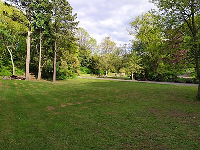
See Barnes Park, Sunderland, on the map
Public Transit to Barnes Park in Sunderland
Wondering how to get to Barnes Park in Sunderland, United Kingdom? Moovit helps you find the best way to get to Barnes Park with step-by-step directions from the nearest public transit station.
Moovit provides free maps and live directions to help you navigate through your city. View schedules, routes, timetables, and find out how long does it take to get to Barnes Park in real time.
Looking for the nearest stop or station to Barnes Park? Check out this list of stops closest to your destination: Barnes Park Road-Chatsworth Close; Durham Road - Barnes Park Road; Cleveland Road-Colchester Terrace; St Peter's.
Bus: 23, 32, 4, 78, X24, 99, S451, S452, X1, 3, ED4, 18A, 8.Train: NORTHERN.Underground: GRN.
Want to see if there’s another route that gets you there at an earlier time? Moovit helps you find alternative routes or times. Get directions from and directions to Barnes Park easily from the Moovit App or Website.
We make riding to Barnes Park easy, which is why over 1.5 million users, including users in Sunderland, trust Moovit as the best app for public transit. You don’t need to download an individual bus app or train app, Moovit is your all-in-one transit app that helps you find the best bus time or train time available.
For information on prices of bus, underground and train, costs and ride fares to Barnes Park, please check the Moovit app.
Use the app to navigate to popular places including to the airport, hospital, stadium, grocery store, mall, coffee shop, school, college, and university.
Barnes Park Address: Barnes View street in Sunderland
Places Near Barnes Park (Sunderland)
How to get to popular places in North East and Cumbria with public transport
Get around Sunderland by public transport!
Travelling around Sunderland has never been so easy. See step by step directions as you travel to any attraction, street or major public transport station. View bus and train timetables, arrival times, service alerts and detailed routes on a map, so you know exactly how to get to anywhere in Sunderland.
When travelling to any destination around Sunderland use Moovit's Live Directions with Get Off Notifications to know exactly where and how far to walk, how long to wait for your line , and how many stops are left. Moovit will alert you when it’s time to get off — no need to constantly re-check whether yours is the next stop.
Wondering how to use public transport in Sunderland or how to pay for public transport in Sunderland? Moovit public transport app can help you navigate your way with public transport easily, and at minimum cost. It includes public transport fees, ticket prices, and costs. Looking for a map of Sunderland public transport lines? Moovit public transport app shows all public transport maps in Sunderland with all Bus, Train, Underground and Ferry routes and stops on an interactive map.
North East and Cumbria has 4 transport type(s), including: Bus, Train, Underground and Ferry, operated by several transport agencies, including National Rail, Stanley Travel, Stagecoach Cumbria and North Lancashire, Stagecoach North East, Peter Hogg of Jedburgh, JH Coaches, Go North East, Arriva North East, Hodgsons, Borders Buses, Tyne and Wear Metro, Upper Coquetdale Community Transport, Paul's Travel, Wright Brothers Coaches and Glen Valley Tours