Directions to Barrack Road (Newcastle Upon Tyne) with public transport
The following transport lines have routes that pass near Barrack Road
How to get to Barrack Road by bus?
Click on the bus route to see step by step directions with maps, line arrival times and updated time schedules.
How to get to Barrack Road by underground?
Click on the underground route to see step by step directions with maps, line arrival times and updated time schedules.
Bus stops near Barrack Road in Newcastle Upon Tyne
- Barrack Road-St James Park, Newcastle upon Tyne, 1 min walk,
- Strawberry Place, Newcastle upon Tyne, 2 min walk,
- Newcastle St James, Newcastle upon Tyne, 3 min walk,
- Newcastle Newgate Street, Newcastle upon Tyne, 5 min walk,
- Barrack Road-Leazes Park, Newcastle upon Tyne, 5 min walk,
- Westgate Road-Westgate Hill, Newcastle upon Tyne, 6 min walk,
- Westgate Rd-Rutherford St, Newcastle upon Tyne, 6 min walk,
- Newcastle Percy Street, Newcastle upon Tyne, 6 min walk,
Underground station near Barrack Road in Newcastle Upon Tyne
- Haymarket (Tyne And Wear Metro Station), Newcastle upon Tyne, 17 min walk,
Train station near Barrack Road in Newcastle Upon Tyne
- Newcastle, 59 min walk,
Bus lines to Barrack Road in Newcastle Upon Tyne
- 12, Wallsend - Fenham,
- 39, Walker - Lemington,
- 40, Wallsend - Chapel House,
- 62, Killingworth - Throckley,
- 63, Callerton - Killingworth,
- 71, North Walbottle - Newcastle upon Tyne,
- 72, Chapel House - Newcastle upon Tyne,
- 72A, Chapel House - Newcastle upon Tyne,
- 87, Newcastle upon Tyne - Slatyford,
- 787, Airport - Newcastle upon Tyne,
- TOON, Newcastle upon Tyne,
- 685, Newcastle upon Tyne,
- 685, Hexham,
- X82, Newcastle upon Tyne - Denton Burn,
- X85, Hexham - Newcastle upon Tyne,
- 684, Newcastle upon Tyne - Hexham,
- 21, Brandon,
- E3, Lobley Hill,
- 10, North Kenton - Lemington,
- 11, Chapel House - North Kenton,
What are the nearest stations to Barrack Road?
The nearest stations to Barrack Road are:
- Barrack Road-St James Park, Newcastle upon Tyne is 72 meters away, 1 min walk.
- Strawberry Place, Newcastle upon Tyne is 134 meters away, 2 min walk.
- Newcastle St James, Newcastle upon Tyne is 159 meters away, 3 min walk.
- Newcastle Newgate Street, Newcastle upon Tyne is 361 meters away, 5 min walk.
- Barrack Road-Leazes Park, Newcastle upon Tyne is 369 meters away, 5 min walk.
- Westgate Road-Westgate Hill, Newcastle upon Tyne is 394 meters away, 6 min walk.
- Westgate Rd-Rutherford St, Newcastle upon Tyne is 401 meters away, 6 min walk.
- Newcastle Percy Street, Newcastle upon Tyne is 402 meters away, 6 min walk.
- Haymarket (Tyne And Wear Metro Station), Newcastle upon Tyne is 1266 meters away, 17 min walk.
- Newcastle is 4512 meters away, 59 min walk.
Which bus lines stop near Barrack Road?
These bus lines stop near Barrack Road: 27, 309, 62, 684, X1, X34, X7.
Which underground line stops near Barrack Road?
YEL (Newcastle upon Tyne)
What’s the nearest underground station to Barrack Road in Newcastle Upon Tyne?
The nearest underground station to Barrack Road in Newcastle Upon Tyne is Haymarket (Tyne And Wear Metro Station), Newcastle upon Tyne. It’s a 17 min walk away.
What’s the nearest bus station to Barrack Road in Newcastle Upon Tyne?
The nearest bus station to Barrack Road in Newcastle Upon Tyne is Barrack Road-St James Park, Newcastle upon Tyne. It’s a 1 min walk away.
What time is the first underground to Barrack Road in Newcastle Upon Tyne?
The YEL is the first underground that goes to Barrack Road in Newcastle Upon Tyne. It stops nearby at 05:07.
What time is the last underground to Barrack Road in Newcastle Upon Tyne?
The GRN is the last underground that goes to Barrack Road in Newcastle Upon Tyne. It stops nearby at 00:29.
What time is the first train to Barrack Road in Newcastle Upon Tyne?
The TRANSPENNINE EXPRESS is the first train that goes to Barrack Road in Newcastle Upon Tyne. It stops nearby at 04:21.
What time is the last train to Barrack Road in Newcastle Upon Tyne?
The LONDON NORTH EASTERN RAILWAY is the last train that goes to Barrack Road in Newcastle Upon Tyne. It stops nearby at 01:53.
What time is the first bus to Barrack Road in Newcastle Upon Tyne?
The 787 is the first bus that goes to Barrack Road in Newcastle Upon Tyne. It stops nearby at 03:20.
What time is the last bus to Barrack Road in Newcastle Upon Tyne?
The 787 is the last bus that goes to Barrack Road in Newcastle Upon Tyne. It stops nearby at 02:52.
See Barrack Road, Newcastle Upon Tyne, on the map
Public Transit to Barrack Road in Newcastle Upon Tyne
How to get to Barrack Road in Newcastle Upon Tyne, United Kingdom?
It’s easy with Moovit. Type in your street address and Moovit’s route finder will locate the fastest way to get you there! Not sure where to get off on the street? Download the Moovit App to find live directions (including where to get off on Barrack Road), see timetables and get the estimated arrival times for your favourite bus or underground lines.
Looking for the nearest stop or station to Barrack Road? Check out this list of closest stops available to your destination: Barrack Road-St James Park; Strawberry Place; Newcastle St James; Newcastle Newgate Street; Barrack Road-Leazes Park; Westgate Road-Westgate Hill; Westgate Rd-Rutherford St; Newcastle Percy Street; Haymarket (Tyne And Wear Metro Station); Newcastle.
Bus: 27, 309, 62, 684, X1, X34, X7, 12, 39, 40, 63, TOON, 685, 685, X82, X85.Train: CROSSCOUNTRY, LONDON NORTH EASTERN RAILWAY, NORTHERN, TRANSPENNINE EXPRESS.Underground: YEL, GRN, GRN, GRN, GRN, GRN.
Download the Moovit App to see the current schedule and routes available for Newcastle Upon Tyne. No need to install a special bus app to check the bus time or a train app to get train time. Moovit is the only all-in-one transport app that helps you get where you need to go.
We make riding on public transit to Barrack Road easy, which is why over 1.5 million users, including users in Newcastle Upon Tyne trust Moovit as the best app for public transport.
Use the app to navigate to popular places including to the airport, hospital, stadium, grocery store, mall, coffee shop, school, college, and university.
Location: Newcastle Upon Tyne, North East and Cumbria
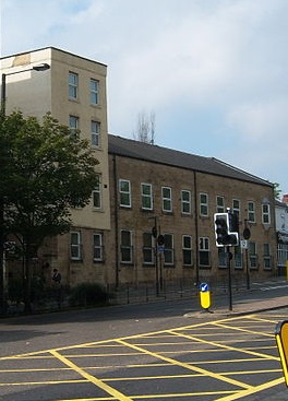
The Barrack Road drill hall is a former military installation in Newcastle upon TyneWiki
Streets near Barrack Road, Newcastle Upon Tyne
Get around Newcastle Upon Tyne by public transport!
Travelling around Newcastle Upon Tyne has never been so easy. See step by step directions as you travel to any attraction, street or major public transport station. View bus and train timetables, arrival times, service alerts and detailed routes on a map, so you know exactly how to get to anywhere in Newcastle Upon Tyne.
When travelling to any destination around Newcastle Upon Tyne use Moovit's Live Directions with Get Off Notifications to know exactly where and how far to walk, how long to wait for your line , and how many stops are left. Moovit will alert you when it’s time to get off — no need to constantly re-check whether yours is the next stop.
Wondering how to use public transport in Newcastle Upon Tyne or how to pay for public transport in Newcastle Upon Tyne? Moovit public transport app can help you navigate your way with public transport easily, and at minimum cost. It includes public transport fees, ticket prices, and costs. Looking for a map of Newcastle Upon Tyne public transport lines? Moovit public transport app shows all public transport maps in Newcastle Upon Tyne with all Bus, Train, Underground and Ferry routes and stops on an interactive map.
North East and Cumbria has 4 transport type(s), including: Bus, Train, Underground and Ferry, operated by several transport agencies, including Go North East, Stagecoach North East, Stagecoach Cumbria and North Lancashire, Arriva North East, Gateshead Central Buses, JH Coaches, Weardale Motor Services, Borders Buses, Stanley Travel, Cumbria Classic Coaches, Peter Hogg of Jedburgh, Hodgsons, Tyne and Wear Metro, Ferryhill Village Travel and Upper Coquetdale Community Transport