Directions to Bastion Point (Orakei North) with public transport
The following transport lines have routes that pass near Bastion Point
 Bus: TMK, 774, 775, 781, 782.
- Train: EAST.
How to get to Bastion Point by bus?
Click on the bus route to see step by step directions with maps, line arrival times and updated time schedules.
How to get to Bastion Point by train?
Click on the train route to see step by step directions with maps, line arrival times and updated time schedules.
Bus stops near Bastion Point in Orakei North
- Stop B Mission Bay, 2 min walk,
- Stop D Mission Bay, 2 min walk,
Train station near Bastion Point in Orakei North
- Orakei Train Station, 43 min walk,
Bus lines to Bastion Point in Orakei North
- TMK, Britomart To Glen Innes Via Tamaki Dr And St Heliers,
- 774, Britomart To West Tamaki Rd Via Tamaki Dr And Long Dr,
- 775, Britomart To Glendowie Via Tamaki Dr,
- 781, Mission Bay To Newmarket Via Orakei,
- 782, Mission Bay To Sylvia Park Via Meadowbank And Ellerslie,
- 783, Eastern Bays Circuit Anticlockwise,
What are the nearest stations to Bastion Point?
The nearest stations to Bastion Point are:
- Stop B Mission Bay is 84 meters away, 2 min walk.
- Stop D Mission Bay is 107 meters away, 2 min walk.
- Orakei Train Station is 3338 meters away, 43 min walk.
Which bus line stops near Bastion Point?
TMK (Britomart To Glen Innes Via Tamaki Dr And St Heliers)
Which train line stops near Bastion Point?
EAST (Brit 1 To Manukau 1 Via Panmure And Otahuhu 3)
What’s the nearest bus station to Bastion Point in Orakei North?
The nearest bus stations to Bastion Point in Orakei North are Stop B Mission Bay and Stop D Mission Bay. The closest one is a 2 min walk away.
What time is the first train to Bastion Point in Orakei North?
The EAST is the first train that goes to Bastion Point in Orakei North. It stops nearby at 06:23.
What time is the last train to Bastion Point in Orakei North?
The EAST is the last train that goes to Bastion Point in Orakei North. It stops nearby at 21:03.
What time is the first bus to Bastion Point in Orakei North?
The TMK is the first bus that goes to Bastion Point in Orakei North. It stops nearby at 03:10.
What time is the last bus to Bastion Point in Orakei North?
The TMK is the last bus that goes to Bastion Point in Orakei North. It stops nearby at 00:07.
See Bastion Point, Orakei North, on the map
Public Transit to Bastion Point in Orakei North
Wondering how to get to Bastion Point in Orakei North? Moovit helps you find the best way to get to Bastion Point with step-by-step directions from the nearest public transit station.
Moovit provides free maps and live directions to help you navigate through your city. View schedules, routes, timetables, and find out how long does it take to get to Bastion Point in real time.
Looking for the nearest stop or station to Bastion Point? Check out this list of stops closest to your destination: Stop B Mission Bay; Stop D Mission Bay; Orakei Train Station.
Bus: TMK, 774, 775, 781, 782, 783.Train: EAST.
Want to see if there’s another route that gets you there at an earlier time? Moovit helps you find alternative routes or times. Get directions from and directions to Bastion Point easily from the Moovit App or Website.
We make riding to Bastion Point easy, which is why over 1.5 million users, including users in Orakei North, trust Moovit as the best app for public transit. You don’t need to download an individual bus app or train app, Moovit is your all-in-one transit app that helps you find the best bus time or train time available.
For information on prices of bus and train, costs and ride fares to Bastion Point, please check the Moovit app.
Use the app to navigate to popular places including to the airport, hospital, stadium, grocery store, mall, coffee shop, school, college, and university.
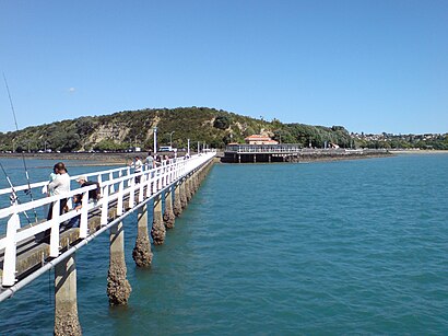
Bastion Point Address: off Tamaki Drive street in Orakei North
- Michael Joseph Savage Memorial Park,
- Tamaki Dr Near Tamaki Yacht Club,
- Gimmy's Hair Design,
- E-Sarn Wok,
- Orakei Marae,
- Tamaki Dr Near Hapimana St,
- Trevor Moss Davis Memorial Fountain,
- Mission Bay Tennis Club,
- Mamma Mia,
- Mar Massage & Wellne,
- Asb Bank,
- Bus Stop 7329,
- Mission Bay Pharmacy,
- Good George Brewing,
- Asb,
- Am1,
- G E Williamson,
- Bayside Medical Practice,
- Ray White,
- Parking Lot
Places Near Bastion Point (Orakei North)
- Mudbrick Vineyard & Restaurant, Waiheke Island,
- 誠臻儒院 Cheng Zhen Buddhist Temple, Puhinui South,
- John Bing Muay Thai Boxing Gym, St Lukes,
- Piha Beach, Auckland Central West,
- Eden Park, Kingsland,
- Paramount Muay Thai Gym, Manurewa Central,
- Auckland City Hospital, Grafton East,
- Sylvia Park Shopping Centre, Mt Wellington South,
- Ward 4 & 5 (AT & R) - Middlemore Hospital, Middlemore,
- Cosco, Auckland Central West,
- Ward 75 Orthopaedic Sugery Ward, Grafton East,
- Commerce A, Building 114, Room G10, Auckland Central East,
- Ward 76 - General Surgical, Auckland Hospital, Grafton East,
- Auckland Hospital Main Building, Grafton East,
- Westlake Boys High School, Westlake,
- Middlemore Hospital, Middlemore,
- Poderi Crisci, Waiheke Island,
- OGGB Lecture Theatre 260-115 (Fisher & Paykel Appliances Auditorium), Auckland Central East,
- Greenlane hospital, One Tree Hill Central,
- Science Centre Room G75 (303S-G75), Auckland Central East
How to get to popular places in Auckland and Hamilton with public transport
Get around Orakei North by public transport!
Travelling around Orakei North has never been so easy. See step by step directions as you travel to any attraction, street or major public transport station. View bus and train timetables, arrival times, service alerts and detailed routes on a map, so you know exactly how to get to anywhere in Orakei North.
When travelling to any destination around Orakei North use Moovit's Live Directions with Get Off Notifications to know exactly where and how far to walk, how long to wait for your line , and how many stops are left. Moovit will alert you when it’s time to get off — no need to constantly re-check whether yours is the next stop.
Wondering how to use public transport in Orakei North or how to pay for public transport in Orakei North? Moovit public transport app can help you navigate your way with public transport easily, and at minimum cost. It includes public transport fees, ticket prices, and costs. Looking for a map of Orakei North public transport lines? Moovit public transport app shows all public transport maps in Orakei North with all Bus, Train and Ferry routes and stops on an interactive map.
Auckland and Hamilton has 3 transport type(s), including: Bus, Train and Ferry, operated by several transport agencies, including AT Metro, AT Metro Bus, Fullers360, SeaLink Pine Harbour, Belaire Ferries, Tranzit Group Ltd, New Zealand Bus, Bayes Coachlines, Howick and Eastern, Ritchies Transport, Waiheke Bus Company, Mahu City Express, Go Bus, Busit and SeaLink