Directions to Westlake Boys High School with public transportation
The following transport lines have routes that pass near Westlake Boys High School
 Bus: 871, 94, 906, 941, 901.
How to get to Westlake Boys High School by bus?
Click on the bus route to see step by step directions with maps, line arrival times and updated time schedules.
Bus stops near Westlake Boys High School
- Westlake Boys High School, 4 min walk,
- Bunnings Warehouse Glenfield, 7 min walk,
- Wairau Road/Archers Road, 8 min walk,
- Waterloo Road, 13 min walk,
Bus routes to Westlake Boys High School
- 871, Constellation Station To Takapuna Via Forrest Hill Rd,
- 94, Takapuna To Beach Haven & Smales Farm Clockwise (Late Night),
- 906, Constellation To Smales Farm Via Windy Ridge And Archers Rd,
- 941, Takapuna To Beach Haven Smales Farm Station And Glenfield,
- 901, Constellation Station To Smales Farm Via Wairau Rd,
- 845, Milford To Takapuna Via North Shore Hospital,
What are the nearest stations to Westlake Boys High School?
The nearest stations to Westlake Boys High School are:
- Westlake Boys High School is 199 meters away, 4 min walk.
- Bunnings Warehouse Glenfield is 536 meters away, 7 min walk.
- Wairau Road/Archers Road is 608 meters away, 8 min walk.
- Waterloo Road is 885 meters away, 13 min walk.
Which bus line stops near Westlake Boys High School?
871 (Takapuna To Constellation Station Via Forrest Hill Rd)
What’s the nearest bus station to Westlake Boys High School?
The nearest bus station to Westlake Boys High School is Westlake Boys High School. It’s a 4 min walk away.
What time is the first bus to Westlake Boys High School?
The 941 is the first bus that goes to Westlake Boys High School. It stops nearby at 03:26.
What time is the last bus to Westlake Boys High School?
The 871 is the last bus that goes to Westlake Boys High School. It stops nearby at 00:06.
See Westlake Boys High School on the map
Public Transportation to Westlake Boys High School
Wondering how to get to Westlake Boys High School? Moovit helps you find the best way to get to Westlake Boys High School with step-by-step directions from the nearest public transit station.
Moovit provides free maps and live directions to help you navigate through your city. View schedules, routes, timetables, and find out how long does it take to get to Westlake Boys High School in real time.
Looking for the nearest stop or station to Westlake Boys High School? Check out this list of stops closest to your destination: Westlake Boys High School; Bunnings Warehouse Glenfield; Wairau Road/Archers Road; Waterloo Road.
Bus: 871, 94, 906, 941, 901, 845.
Want to see if there’s another route that gets you there at an earlier time? Moovit helps you find alternative routes or times. Get directions from and directions to Westlake Boys High School easily from the Moovit App or Website.
We make riding to Westlake Boys High School easy, which is why over 1.5 million users, including users in Westlake, trust Moovit as the best app for public transit. You don’t need to download an individual bus app or train app, Moovit is your all-in-one transit app that helps you find the best bus time or train time available.
For information on prices of bus, costs and ride fares to Westlake Boys High School, please check the Moovit app.
Use the app to navigate to popular places including to the airport, hospital, stadium, grocery store, mall, coffee shop, school, college, and university.
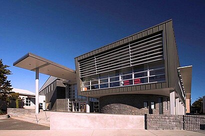
Westlake Boys High School Address: Forrest Hill Road street in Westlake
- C Block,
- Student Services, Uniform Shop, Staff Room, Deans Suite,
- Helicopter Landing Pad,
- Westlake,
- Peter Rea Auditorium,
- Facebook,
- Saams Turf,
- Cintura,
- M2 Math Milford,
- Supreme Tilers,
- Auckland Homemade Sweets,
- Marketerdude,
- Shosha Wairau Valley - Specialist Vape Shop & Hookah,
- Drive N Save Cars,
- Jaded Tans and Nails,
- Elegant Ride,
- ChargeNet,
- North Shore Motor Holdings,
- Continental Cars Mini Service Centre,
- Continental Motorrad
Places Near Westlake Boys High School
- Auckland Zoo, Westmere,
- Mission Bay, Mission Bay,
- Auckland Hospital Main Building, Grafton East,
- Eden Park, Kingsland,
- Science Centre Room G75 (303S-G75), Auckland Central East,
- Westlake Boys High School, Westlake,
- Cosco, Auckland Central West,
- Auckland City Hospital, Grafton East,
- Greenlane hospital, One Tree Hill Central,
- Sylvia Park Shopping Centre, Mt Wellington South,
- Mudbrick Vineyard & Restaurant, Waiheke Island,
- Stonyridge Vineyard, Waiheke Island,
- Middlemore Hospital, Middlemore,
- Batch Winery, Waiheke Island,
- Cable Bay Winery, Waiheke Island,
- Ward 4 & 5 (AT & R) - Middlemore Hospital, Middlemore,
- Ward 75 Orthopaedic Sugery Ward, Grafton East,
- Ward 76 - General Surgical, Auckland Hospital, Grafton East,
- Poderi Crisci, Waiheke Island,
- Piha Beach, Auckland Central West
How to get to popular places in Auckland and Hamilton with public transport
Get around Westlake by public transport!
Travelling around Westlake has never been so easy. See step by step directions as you travel to any attraction, street or major public transport station. View bus and train timetables, arrival times, service alerts and detailed routes on a map, so you know exactly how to get to anywhere in Westlake.
When travelling to any destination around Westlake use Moovit's Live Directions with Get Off Notifications to know exactly where and how far to walk, how long to wait for your line , and how many stops are left. Moovit will alert you when it’s time to get off — no need to constantly re-check whether yours is the next stop.
Wondering how to use public transport in Westlake or how to pay for public transport in Westlake? Moovit public transport app can help you navigate your way with public transport easily, and at minimum cost. It includes public transport fees, ticket prices, and costs. Looking for a map of Westlake public transport lines? Moovit public transport app shows all public transport maps in Westlake with all Bus, Train and Ferry routes and stops on an interactive map.
Auckland and Hamilton has 3 transport type(s), including: Bus, Train and Ferry, operated by several transport agencies, including AT Metro, AT Metro Bus, Fullers360, SeaLink Pine Harbour, Belaire Ferries, Tranzit Group Ltd, New Zealand Bus, Bayes Coachlines, Howick and Eastern, Ritchies Transport, Waiheke Bus Company, Mahu City Express, Go Bus, Busit and SeaLink