
Find the best routes to Beaminster Tunnel, West Dorset

See Beaminster Tunnel, West Dorset, on the map

Directions to Beaminster Tunnel (West Dorset) with public transport

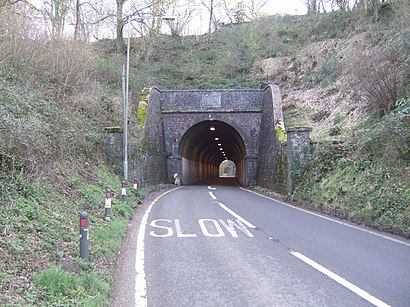
The following transport lines have routes that pass near Beaminster Tunnel

  • BusBus:
  • TrainTrain:

Bus stations near Beaminster Tunnel in West Dorset

  • The Fire Station, Beaminster,28 min walk,
  • Red Lion, Beaminster,31 min walk,
  • Mosterton Cross, Mosterton,34 min walk,

Bus lines to Beaminster Tunnel in West Dorset

  • 2,Crewkerne - Kingston Maurward College,
  • CB3,Bridport - Beaminster - Yeovil,
  • B5,Bridport - Beaminster School,
  • CR6,Bridport - Yeovil,
  • B2,Dorchester - Beaminster School,
  • 6A,Salwayash - Beaminster,
  • B1,Frampton - Beaminster School,
  • B4,Holywell Cross - Beaminster,
Questions & Answers
  • What are the nearest stations to Beaminster Tunnel?

    The nearest stations to Beaminster Tunnel are:

    • The Fire Station, Beaminster is 2181 meters away, 28 min walk.
    • Red Lion, Beaminster is 2402 meters away, 31 min walk.
    • Mosterton Cross, Mosterton is 2664 meters away, 34 min walk.
  • Which Bus lines stop near Beaminster Tunnel?

    These Bus lines stop near Beaminster Tunnel: 40

  • Which Train lines stop near Beaminster Tunnel?

    These Train lines stop near Beaminster Tunnel: SOUTH WEST TRAINS

See Beaminster Tunnel, West Dorset, on the map

The Most Popular Urban Mobility App in West Dorset.
All local mobility options in one app

Public Transit to Beaminster Tunnel in West Dorset

How to get to Beaminster Tunnel in West Dorset, United Kingdom?

It’s easy with Moovit. Type in your street address and Moovit’s route finder will locate the fastest way to get you there! Not sure where to get off on the street? Download the Moovit App to find live directions (including where to get off on Beaminster Tunnel), see timetables and get the estimated arrival times for your favourite Train or Bus lines.

Looking for the nearest stop or station to Beaminster Tunnel? Check out this list of closest stops available to your destination: The Fire Station; Red Lion; Mosterton Cross.

Bus:Train:

Download the Moovit App to see the current schedule and routes available for West Dorset. No need to install a special bus app to check the bus time or a train app to get train time. Moovit is the only all-in-one transport app that helps you get where you need to go.

We make riding on public transit to Beaminster Tunnel easy, which is why over 1.5 million users, including users in West Dorset trust Moovit as the best app for public transport.

Use the app to navigate to popular places including to the airport, hospital, stadium, grocery store, mall, coffee shop, school, college, and university.

Location: West Dorset, South West

Beaminster Tunnel, West Dorset
Beaminster Tunnel, West DorsetBeaminster Tunnel or Horn Hill Tunnel is a 345-foot-long (105 m) road tunnel on the A3066 road between Beaminster and Mosterton in Dorset, England. The tunnel was constructed between 1830–1832; it was one of the first road tunnels built in Britain, and is the only pre-railway road tunnel in the country still in use. It was built to take a toll road underneath a steep hill to the north of Beaminster and make it easier for horse-drawn traffic to travel from the coast to the hinterland of Dorset. It underwent significant repairs in 1968 and again in 2009, but in 2012 a torrential rainstorm caused a landslide that resulted in the partial collapse of the tunnel's north entrance and the deaths of two people.
How to get to Beaminster Tunnel with public transport- About the place

Public transport routes with stations closest to Beaminster Tunnel in West Dorset

Bus lines with stations closest to Beaminster Tunnel in West Dorset

Easier to get to Beaminster Tunnel in…