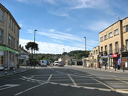
Bear Flat stop - Tuesday schedule
| Line | Direction | Time |
|---|---|---|
| SB | Lower Bristol Road | 04:43 |
| SB | Lower Bristol Road | 05:13 |
| SB | Lower Bristol Road | 05:43 |
| 4A | Fox Hill | 05:58 |
| SB | Lower Bristol Road | 06:13 |
| 4A | Fox Hill | 06:26 |
| 522 | Bristol | 06:35 |
| 174 | Wells | 06:39 |
| 173 | Haybridge | 06:48 |
| D2 | Frome | 06:49 |
| 4A | Fox Hill | 06:52 |
| 172 | Bristol | 07:03 |
| 174 | Wells | 07:24 |
| 4A | Fox Hill | 07:25 |
| 172 | Bristol | 07:32 |
| 4A | Fox Hill | 07:48 |
| 173 | Wells | 07:50 |
| 172 | Bristol | 08:02 |
| D2 | Frome | 08:04 |
| 522 | Bristol | 08:15 |
| 172 | Bristol | 08:17 |
| 4A | Fox Hill | 08:18 |
| 174 | Wells | 08:26 |
| 173 | Wells | 08:50 |
| 4A | Fox Hill | 08:54 |
See Bear Flat, South West, on the map
Directions to Bear Flat (South West) with public transport
The following transport lines have routes that pass near Bear Flat
Bus:
Train:
How to get to Bear Flat by Bus?
Click on the Bus route to see step by step directions with maps, line arrival times and updated time schedules.
How to get to Bear Flat by Train?
Click on the Train route to see step by step directions with maps, line arrival times and updated time schedules.
Bus stations near Bear Flat in South West
- Bear Flat,1 min walk,
- Oldfield Road, Oldfield Park,5 min walk,
Train stations near Bear Flat in South West
- Oldfield Park,22 min walk,
Bus lines to Bear Flat in South West
- R3,Southdown - Ralph Allen School,
- 4,Weston, Haviland Park - Odd Down P&r,
- 4B,Weston, Haviland Park - Foxhill, Kewstoke Road,
- 41,Odd Down Park & Ride - Bath City Centre,
- SB,Lower Bristol Road,
- D2,Frome,
- 4A,Fox Hill,
- 171,Wells,
- 172,Bristol,
- 173,Haybridge,
- 174,Wells,
- 522,Bristol,
- 8,Bath City Centre,
What are the nearest stations to Bear Flat?
The nearest stations to Bear Flat are:
- Bear Flat is 36 meters away, 1 min walk.
- Oldfield Road, Oldfield Park is 313 meters away, 5 min walk.
- Oldfield Park is 1669 meters away, 22 min walk.
Which Bus lines stop near Bear Flat?
These Bus lines stop near Bear Flat: 19, 4, 41, 4A, 522
Which Train lines stop near Bear Flat?
These Train lines stop near Bear Flat: GREAT WESTERN RAILWAY
What’s the nearest train station to Bear Flat in South West?
The nearest train station to Bear Flat in South West is Oldfield Park. It’s a 22 min walk away.
What’s the nearest bus stop to Bear Flat in South West?
The nearest bus stop to Bear Flat in South West is Bear Flat. It’s a 1 min walk away.
What time is the first Train to Bear Flat in South West?
The GREAT WESTERN RAILWAY is the first Train that goes to Bear Flat in South West. It stops nearby at 09:13.
What time is the last Train to Bear Flat in South West?
The GREAT WESTERN RAILWAY is the last Train that goes to Bear Flat in South West. It stops nearby at 22:49.
What time is the first Bus to Bear Flat in South West?
The 4 is the first Bus that goes to Bear Flat in South West. It stops nearby at 06:27.
What time is the last Bus to Bear Flat in South West?
The 4B is the last Bus that goes to Bear Flat in South West. It stops nearby at 00:22.
See Bear Flat, South West, on the map

Public transport to Bear Flat stop (ID: bthjgwd) in South West
Looking for directions to Bear Flat in South West, United Kingdom?
Download the Moovit App to find the current schedule and step-by-step directions for Bus or Train routes that pass through Bear Flat.
Looking for the nearest stops closest to Bear Flat ? Check out this list of closest stops to your destination: Bear Flat; Oldfield Road; Oldfield Park.
Bus:Train:
We make riding on public transit to Bear Flat easy, which is why over 1.5 million users, including users in South West trust Moovit as the best app for public transit.
Use the app to navigate to popular places including to the airport, hospital, stadium, grocery store, mall, coffee shop, school, college, and university.
Bear Flat stop’s code is bthjgwd
The first line to this stop is SB, at 04:43, and the last line is 171 at 00:14.
This stop serves First Bristol, Bath & the West’s lines

Bus stops near Bear Flat
Train stations near Bear Flat
Popular public transport stations in South West
- South Bridge, Wareham
- Pilning
- St Clare Street, Penzance
- Farmer Palmers, Organford
- Darklake View, Glenholt
- Mercedes Garage, Tresillian
- Infocus, Countess Wear
- Affinity Devon Outlet, Bideford
- Dobbies Garden Centre, Lelant
- Windsor Road, Ellacombe
- Gratton Way, Roundswell
- Langdon Hospital, Dawlish
- Wincanton Racecourse, Wincanton
- The Parade, Taunton
- St Andrews Road
- St Mary's Park, Collaton St Mary
- Cossham Hospital, Hillfields
- Dorset County Hospital, Dorchester
- Broad Walk Shops, Knowle
- Ambury, Bath City Centre