See Beckenham Crematorium and Cemetery, Anerley, on the map
Directions to Beckenham Crematorium and Cemetery (Anerley) with public transport
The following transport lines have routes that pass near Beckenham Crematorium and Cemetery
 Bus:
Bus: - Train:
- Tramlink:
How to get to Beckenham Crematorium and Cemetery by bus?
Click on the bus route to see step by step directions with maps, line arrival times and updated time schedules.
How to get to Beckenham Crematorium and Cemetery by train?
Click on the train route to see step by step directions with maps, line arrival times and updated time schedules.
Bus stations near Beckenham Crematorium and Cemetery in Anerley
- Beckenham Crematorium (BK),5 min walk,
Train stations near Beckenham Crematorium and Cemetery in Anerley
- Birkbeck,5 min walk,
Tramlink stations near Beckenham Crematorium and Cemetery in Anerley
- Birkbeck Tram Stop,6 min walk,
Bus lines to Beckenham Crematorium and Cemetery in Anerley
- 354,Penge,
- 356,Upper Sydenham,
What are the nearest stations to Beckenham Crematorium and Cemetery?
The nearest stations to Beckenham Crematorium and Cemetery are:
- Beckenham Crematorium (BK) is 293 meters away, 5 min walk.
- Birkbeck is 362 meters away, 5 min walk.
- Birkbeck Tram Stop is 379 meters away, 6 min walk.
Which bus lines stop near Beckenham Crematorium and Cemetery?
These bus lines stop near Beckenham Crematorium and Cemetery: 197, 354, 356, 75.
Which train lines stop near Beckenham Crematorium and Cemetery?
These train lines stop near Beckenham Crematorium and Cemetery: SOUTHEASTERN, SOUTHERN.
Which Tramlink line stops near Beckenham Crematorium and Cemetery?
TRAM
What’s the nearest Tramlink station to Beckenham Crematorium and Cemetery in Anerley?
The nearest Tramlink station to Beckenham Crematorium and Cemetery in Anerley is Birkbeck Tram Stop. It’s a 6 min walk away.
What’s the nearest train station to Beckenham Crematorium and Cemetery in Anerley?
The nearest train station to Beckenham Crematorium and Cemetery in Anerley is Birkbeck. It’s a 5 min walk away.
What’s the nearest bus stop to Beckenham Crematorium and Cemetery in Anerley?
The nearest bus stop to Beckenham Crematorium and Cemetery in Anerley is Beckenham Crematorium (BK). It’s a 5 min walk away.
What time is the first Tramlink to Beckenham Crematorium and Cemetery in Anerley?
The TRAM is the first Tramlink that goes to Beckenham Crematorium and Cemetery in Anerley. It stops nearby at 04:55.
What time is the last Tramlink to Beckenham Crematorium and Cemetery in Anerley?
The TRAM is the last Tramlink that goes to Beckenham Crematorium and Cemetery in Anerley. It stops nearby at 01:18.
What time is the first train to Beckenham Crematorium and Cemetery in Anerley?
The SOUTHERN is the first train that goes to Beckenham Crematorium and Cemetery in Anerley. It stops nearby at 06:34.
What time is the last train to Beckenham Crematorium and Cemetery in Anerley?
The SOUTHERN is the last train that goes to Beckenham Crematorium and Cemetery in Anerley. It stops nearby at 23:16.
What time is the first bus to Beckenham Crematorium and Cemetery in Anerley?
The 356 is the first bus that goes to Beckenham Crematorium and Cemetery in Anerley. It stops nearby at 05:57.
What time is the last bus to Beckenham Crematorium and Cemetery in Anerley?
The 356 is the last bus that goes to Beckenham Crematorium and Cemetery in Anerley. It stops nearby at 00:43.
See Beckenham Crematorium and Cemetery, Anerley, on the map
Public Transit to Beckenham Crematorium and Cemetery in Anerley
Wondering how to get to Beckenham Crematorium and Cemetery in Anerley, United Kingdom? Moovit helps you find the best way to get to Beckenham Crematorium and Cemetery with step-by-step directions from the nearest public transit station.
Moovit provides free maps and live directions to help you navigate through your city. View schedules, routes, timetables, and find out how long does it take to get to Beckenham Crematorium and Cemetery in real time.
Looking for the nearest stop or station to Beckenham Crematorium and Cemetery? Check out this list of stops closest to your destination: Beckenham Crematorium (BK); Birkbeck; Birkbeck Tram Stop.
Bus:Train:Tramlink:
Want to see if there’s another route that gets you there at an earlier time? Moovit helps you find alternative routes or times. Get directions from and directions to Beckenham Crematorium and Cemetery easily from the Moovit App or Website.
We make riding to Beckenham Crematorium and Cemetery easy, which is why over 1.5 million users, including users in Anerley, trust Moovit as the best app for public transit. You don’t need to download an individual bus app or train app, Moovit is your all-in-one transit app that helps you find the best bus time or train time available.
For information on prices of bus, train and Tramlink, costs and ride fares to Beckenham Crematorium and Cemetery, please check the Moovit app.
Use the app to navigate to popular places including to the airport, hospital, stadium, grocery store, mall, coffee shop, school, college, and university.
Location: Anerley, London
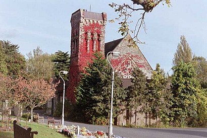
Beckenham Crematorium and Cemetery is a cemetery in the London Borough of Bromley, opened in 1876.Wiki
Attractions near Beckenham Crematorium and Cemetery
Beckenham Cemetery,Beckenham Crematorium,Elmers End Beckenham Crematorium,Chesham Autos Popular van Hire,Graces,BSM Approved Driving Instructor James Ellis,Harrington Road,Harrington Road Tram Stop,Elmers Kebab,Elmers End Road,Mosaic,Br3 4sy,Lake Conan,Birkbeck Station (Stop Ba), London,Beckenham Crematorium & Cemetery,JPRM Contractors Limited,Cleaniebin Uk Limited,South Norwood Country Park,GKC van Hire Beckenham,Goals BeckenhamHow to get to popular attractions in Anerley with public transportation
Westbourne Studios, Westbourne Park,Cranfield Airport, Central Bedfordshire,Royal Observatory Greenwich, Greenwich,Asda, Park Royal,Dover Beach, Dover,Southgate, Southgate,Wimbledon, Wimbledon,Stratford Centre, Stratford,Camden Market Hall, Camden Town,The Whittington Hospital, Upper Holloway,Goring-on-Thames, South Oxfordshire,Southall Police Station, Southall,Hayes Railway Station, Hayes (Kent),Brookwood Railway Station (BKO), Woking,Park Plaza Westminster Bridge, Waterloo,Departure Lounge, Stansted,Queen Mary's Hospital, Sidcup,Ferney Road, East Barnet,Redbridge Roundabout, Clayhall,Oxford Brookes University Gipsy Lane Site, OxfordGet around Anerley by public transport!
Travelling around Anerley has never been so easy. See step by step directions as you travel to any attraction, street or major public transport station. View bus and train timetables, arrival times, service alerts and detailed routes on a map, so you know exactly how to get to anywhere in Anerley.
When travelling to any destination around Anerley use Moovit's Live Directions with Get Off Notifications to know exactly where and how far to walk, how long to wait for your line , and how many stops are left. Moovit will alert you when it’s time to get off — no need to constantly re-check whether yours is the next stop.
Wondering how to use public transport in Anerley or how to pay for public transport in Anerley? Moovit public transport app can help you navigate your way with public transport easily, and at minimum cost. It includes public transport fees, ticket prices, and costs. Looking for a map of Anerley public transport lines? Moovit public transport app shows all public transport maps in Anerley with all bus, train or Tramlink routes and stops on an interactive map.
Anerley has 3 transport type(s), including: bus, train or Tramlink, operated by several transport agencies, including London Underground, London Buses, Transport for London, London Tramlink, Transport for London, National Rail, Bluestar, Berry's Coaches, Oxford Bus Company, Stagecoach West, Community First Wessex, Cresta Coaches, D & P Boat Hire, First Portsmouth, Fareham & Gosport and FYTbus