Directions to Beeston Centre (Broxtowe) with public transport
The following transport lines have routes that pass near Beeston Centre
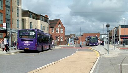
How to get to Beeston Centre by bus?
Click on the bus route to see step by step directions with maps, line arrival times and updated time schedules.
How to get to Beeston Centre by train?
Click on the train route to see step by step directions with maps, line arrival times and updated time schedules.
Bus stations near Beeston Centre in Broxtowe
- Beeston Bus & Tram Interchange, Beeston, 2 min walk,
- Nether Street, Beeston, 3 min walk,
- Church Street, Beeston, 3 min walk,
- Jessamine Court, Beeston, 4 min walk,
Light Rail stations near Beeston Centre in Broxtowe
- Beeston Centre Tram Stop, Beeston, 2 min walk,
Bus lines to Beeston Centre in Broxtowe
- N34, Beeston,
- 36, Nottingham,
- 36U, Chilwell,
- 18, Nottingham - Beeston - Stapleford,
- 18A, Nottingham - Beeston - Wollaton,
- 18B, Nottingham - Beeston,
- 510|NOTTSBUS ECONNECT, Beeston - Toton - Stapleford,
- 536|NOTTSBUS CONNECT, Chilwell,
- INDIGO, Long Eaton,
- 904, Royal Derby Hospital,
What are the nearest stations to Beeston Centre?
The nearest stations to Beeston Centre are:
- Beeston Bus & Tram Interchange, Beeston is 127 meters away, 2 min walk.
- Beeston Centre Tram Stop, Beeston is 143 meters away, 2 min walk.
- Nether Street, Beeston is 199 meters away, 3 min walk.
- Church Street, Beeston is 204 meters away, 3 min walk.
- Jessamine Court, Beeston is 235 meters away, 4 min walk.
Which bus lines stop near Beeston Centre?
These bus lines stop near Beeston Centre: 36, INDIGO, SKYLINK NOTTINGHAM.
Which train line stops near Beeston Centre?
EAST MIDLANDS RAILWAY
Which light rail line stops near Beeston Centre?
TRAM
What’s the nearest light rail station to Beeston Centre in Broxtowe?
The nearest light rail station to Beeston Centre in Broxtowe is Beeston Centre Tram Stop, Beeston. It’s a 2 min walk away.
What’s the nearest bus stop to Beeston Centre in Broxtowe?
The nearest bus stop to Beeston Centre in Broxtowe is Beeston Bus & Tram Interchange, Beeston. It’s a 2 min walk away.
What time is the first light rail to Beeston Centre in Broxtowe?
The TRAM is the first light rail that goes to Beeston Centre in Broxtowe. It stops nearby at 05:43.
What time is the last light rail to Beeston Centre in Broxtowe?
The TRAM is the last light rail that goes to Beeston Centre in Broxtowe. It stops nearby at 00:16.
What time is the first bus to Beeston Centre in Broxtowe?
The INDIGO is the first bus that goes to Beeston Centre in Broxtowe. It stops nearby at 03:07.
What time is the last bus to Beeston Centre in Broxtowe?
The N34 is the last bus that goes to Beeston Centre in Broxtowe. It stops nearby at 03:12.
See Beeston Centre, Broxtowe, on the map
Public Transit to Beeston Centre in Broxtowe
Wondering how to get to Beeston Centre in Broxtowe, United Kingdom? Moovit helps you find the best way to get to Beeston Centre with step-by-step directions from the nearest public transit station.
Moovit provides free maps and live directions to help you navigate through your city. View schedules, routes, timetables, and find out how long does it take to get to Beeston Centre in real time.
Looking for the nearest stop or station to Beeston Centre? Check out this list of stops closest to your destination: Beeston Bus & Tram Interchange; Beeston Centre Tram Stop; Nether Street; Church Street; Jessamine Court.
Bus: 36, INDIGO, SKYLINK NOTTINGHAM, N34, 36U, 536|NOTTSBUS CONNECT, 18, 18A, 18B, 510|NOTTSBUS ECONNECT, 904.Train: EAST MIDLANDS RAILWAY.Light rail: TRAM.
Want to see if there’s another route that gets you there at an earlier time? Moovit helps you find alternative routes or times. Get directions from and directions to Beeston Centre easily from the Moovit App or Website.
We make riding to Beeston Centre easy, which is why over 1.5 million users, including users in Broxtowe, trust Moovit as the best app for public transit. You don’t need to download an individual bus app or train app, Moovit is your all-in-one transit app that helps you find the best bus time or train time available.
For information on prices of bus, light rail and train, costs and ride fares to Beeston Centre, please check the Moovit app.
Use the app to navigate to popular places including to the airport, hospital, stadium, grocery store, mall, coffee shop, school, college, and university.
Beeston Centre Address: Styring Street street in Broxtowe
Attractions near Beeston Centre
Arc Cinema,Village Cross,Tesco Extra (Yo! Nottingham Beeston Tesco Kiosk),The Arc Cinema - Beeston,Broxtowe Borough Council,Beeston Library,Tesco Beeston cafe,Last Post (The Last Post),Oxjam Beeston Music Festival,Chilwell Road,Ashley Peake,Rassams Creamery,Pure Gym,Sisu Emotional Health and Coaching,Chilwell & Beeston Cab Line,Beeston Street Art,The Atic Beeson,Little Tiger Cubs Nottingham,Yellow Wood Cafe,MKL Catering Consultants LimitedHow to get to popular attractions in Broxtowe with public transportation
Wootton, Northampton,Rutland Water, Rutland,Wicksteed Park, Kettering,Skegness Raceway - Stadium, East Lindsey,Great Bear Markham Vale 2, Chesterfield,Center Parcs Sherwood Forest, Newark And Sherwood,Rolls-Royce, Derby,Leicester College: Freeman's Park Campus, Leicester,Melbourne Water Treatment Works, South Derbyshire,Derby Arena, Derby,Wyvern Business Park, Derby,Corby Town Centre, Corby,Crematorium, Northampton, Northampton,Planet Ice Peterborough, Peterborough,Upper Parliament Street Car Park, Nottingham,Wollaton Hall, Nottingham,Harvey Hadden Sports Village, Nottingham,Blundell Park (Grimsby Town Football Club), North East Lincolnshire,The Pink Rose Suite, North East Lincolnshire,Clifton Campus, NottinghamGet around East Midlands by public transport!
Travelling around East Midlands has never been so easy. See step by step directions as you travel to any attraction, street or major public transport station. View bus and train timetables, arrival times, service alerts and detailed routes on a map, so you know exactly how to get to anywhere in East Midlands.
When travelling to any destination around East Midlands use Moovit's Live Directions with Get Off Notifications to know exactly where and how far to walk, how long to wait for your line , and how many stops are left. Moovit will alert you when it’s time to get off — no need to constantly re-check whether yours is the next stop.
Wondering how to use public transport in East Midlands or how to pay for public transport in East Midlands? Moovit public transport app can help you navigate your way with public transport easily, and at minimum cost. It includes public transport fees, ticket prices, and costs. Looking for a map of East Midlands public transport lines? Moovit public transport app shows all public transport maps in East Midlands with all Bus, Train and Light rail routes and stops on an interactive map.
East Midlands has 3 transport type(s), including: Bus, Train and Light rail, operated by several transport agencies, including National Rail, Ashbourne Community Transport, Delaine Buses, Arriva Midlands, Centrebus, Our Centre, Hulleys of Baslow, D & G Bus, Stagecoach East Midlands, North Lincolnshire Council, Roberts Coaches, Lawson's of Corby, Hawkes Coaches, East Yorkshire, Soar Valley Community Bus