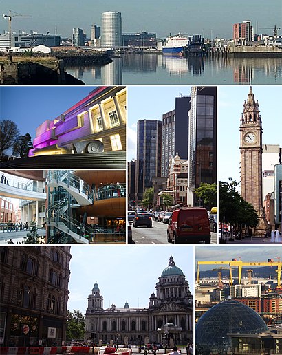
See Belfast on the map
Directions to Belfast with public transportation
The following transport lines have routes that pass near Belfast
Bus:
How to get to Belfast by Bus?
Click on the Bus route to see step by step directions with maps, line arrival times and updated time schedules.
Bus stations near Belfast
- Donegall Square South,1 min walk,
- Donegall Square East,2 min walk,
- Adelaide St.,2 min walk,
- Donegall Square West,2 min walk,
- Wellington Place,3 min walk,
- Bedford Street,4 min walk,
- Donegall Square North,4 min walk,
- Donegall Place,5 min walk,
- City Centre,5 min walk,
{{TRANSIT_TYPE}#Capitalized} routes to Belfast
- 600,Europa Buscentre - City Centre - Belfast City Airport,
- 600A,Europa Buscentre - City Centre - Belfast City Airport,
- 600B,Europa Buscentre - City Centre - Belfast City Airport,
- 9A,City Centre - Conway,
- 9B,City Centre - Balmoral (Sicily Park),
- 9C,City Centre - Balmoral (Sicily Park) - Conway,
- 6C,City Centre - Belvoir - Beechill Road - Newtownbreda Tesco,
- 5A,City Centre - Braniel,
- 5B,Braniel - City Centre,
- 18,City Centre - Gilnahirk,
- 19,City Centre - Tullycarnet - Dundonald,
- 19A,City Centre - Tullycarnet - Millmount,
- 31,City Centre - Forestside,
- 8A,City Centre - Stranmillis - Malone,
- 8B,City Centre - Malone - Erinvale,
- 8C,City Centre - Malone - Ladybrook,
- 8D,City Centre - Stranmillis,
- 93,City Centre - Newforge Lane,
- 64,Abbeycentre - Downview - City Centre,
- 64B,Downview - City Centre,
What are the nearest stations to Belfast?
The nearest stations to Belfast are:
- Donegall Square South is 54 meters away, 1 min walk.
- Donegall Square East is 97 meters away, 2 min walk.
- Adelaide St. is 115 meters away, 2 min walk.
- Donegall Square West is 129 meters away, 2 min walk.
- Wellington Place is 173 meters away, 3 min walk.
- Bedford Street is 244 meters away, 4 min walk.
- Donegall Square North is 257 meters away, 4 min walk.
- Donegall Place is 279 meters away, 5 min walk.
- City Centre is 292 meters away, 5 min walk.
Which Bus lines stop near Belfast?
These Bus lines stop near Belfast: 10H, 13, 2C, 2G, 4A, 9A
What’s the nearest bus stop to Belfast?
The nearest bus stop to Belfast is Donegall Square South. It’s a 1 min walk away.
What time is the first Bus to Belfast?
The 5B is the first Bus that goes to Belfast. It stops nearby at 05:40.
What time is the last Bus to Belfast?
The 7A is the last Bus that goes to Belfast. It stops nearby at 23:15.
See Belfast on the map

Public Transportation to Belfast
Wondering how to get to Belfast, United Kingdom? Moovit helps you find the best way to get to Belfast with step-by-step directions from the nearest public transit station.
Moovit provides free maps and live directions to help you navigate through your city. View schedules, routes, timetables, and find out how long does it take to get to Belfast in real time.
Looking for the nearest stop or station to Belfast? Check out this list of stops closest to your destination: Donegall Square South; Donegall Square East; Adelaide St.; Donegall Square West; Wellington Place; Bedford Street; Donegall Square North; Donegall Place; City Centre.
Bus:
Want to see if there’s another route that gets you there at an earlier time? Moovit helps you find alternative routes or times. Get directions from and directions to Belfast easily from the Moovit App or Website.
We make riding to Belfast easy, which is why over 1.5 million users, including users in Belfast, trust Moovit as the best app for public transit. You don’t need to download an individual bus app or train app, Moovit is your all-in-one transit app that helps you find the best bus time or train time available.
For information on prices of Bus, costs and ride fares to Belfast, please check the Moovit app.
Use the app to navigate to popular places including to the airport, hospital, stadium, grocery store, mall, coffee shop, school, college, and university.
Belfast Address: Donegall Square South street in Belfast

Popular routes to Belfast
From Woodvale Road (Twaddell)From Bradbury PlaceFrom BelfastFrom Mayo StreetFrom Ulster MuseumFrom Duncrue Street (Powerplant Trade)From Woodvale ParkFrom Duncrue Street (Mckee Building)From University RoadFrom Mount Eden CourtPopular routes from Belfast
To BelfastTo BelfastTo SparTo BelfastTo BelfastTo BelfastTo BelfastTo BelfastTo BelfastTo BelfastAttractions near Belfast
- Belfast City Hall
- Northern Ireland Regional Passport Office
- Donegall Square
- Council Chamber
- Ten Square Hotel
- Linenhall Street / Donegall Square South
- Belfast Donegall Square South
- Linenhall Street
- Ten Square Hotel Belfast
- Continental Christmas Market
- Belfast City Centre
- City Hall
- Location X
- CoCo
- Space.Nk
- Metro Ticket Sales
- Adelaide Street Bus Stop
- 9 Donegall Square North
- Optilase Clinic Belfast (Laser Eye Surgery)
- Bus Stop, Donegall Square North
How to get to popular attractions in Belfast with public transportation
- Elmwood Hall, Belfast
- Ardenlee, Belfast
- Knocknagoney, Belfast
- DFS, Belfast
- NI Dental Care, Belfast
- Regional Endocrinology & Diabetes Centre, Belfast
- Belfast Docks, Belfast
- Carrick-A-Rede Rope Bridge, Belfast
- Dufferin Building BCH, Belfast
- New Mossley, Newtownabbey
- Belfast, Northern Ireland, Belfast
- Westwood Shopping Centre, Belfast
- Charles Hurst, Belfast
- Emeleus Lecture Theatre, Belfast
- T13, Titanic Quarter, Belfast
- YAHI, Belfast
- M1, Belfast
- Radisson Blu, Belfast
- RVH Car Park, Belfast
- Stormont Castle, Belfast