Directions to Belgrave Walk tram stop (Mitcham) with public transport
The following transport lines have routes that pass near Belgrave Walk tram stop
How to get to Belgrave Walk tram stop by bus?
Click on the bus route to see step by step directions with maps, line arrival times and updated time schedules.
How to get to Belgrave Walk tram stop by train?
Click on the train route to see step by step directions with maps, line arrival times and updated time schedules.
How to get to Belgrave Walk tram stop by Tube?
Click on the Tube route to see step by step directions with maps, line arrival times and updated time schedules.
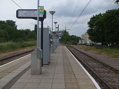
Tramlink stations near Belgrave Walk tram stop in Mitcham
- Belgrave Walk Tram Stop,2 min walk,
Bus stations near Belgrave Walk tram stop in Mitcham
- Belgrave Walk Tram Stop (M),4 min walk,
- Gedge Court (S),11 min walk,
Tube stations near Belgrave Walk tram stop in Mitcham
- Morden,33 min walk,
Bus lines to Belgrave Walk tram stop in Mitcham
- 201,Morden,
- N44,Aldwych,
- 118,Morden,
- N133,Mitcham,
- 280,Tooting, St. George's Hospital,
What are the nearest stations to Belgrave Walk tram stop?
The nearest stations to Belgrave Walk tram stop are:
- Belgrave Walk Tram Stop is 77 meters away, 2 min walk.
- Belgrave Walk Tram Stop (M) is 259 meters away, 4 min walk.
- Gedge Court (S) is 811 meters away, 11 min walk.
- Morden is 2517 meters away, 33 min walk.
Which bus line stops near Belgrave Walk tram stop?
201
Which train lines stop near Belgrave Walk tram stop?
These train lines stop near Belgrave Walk tram stop: SOUTHERN, THAMESLINK.
Which Tube line stops near Belgrave Walk tram stop?
NORTHERN
Which Tramlink line stops near Belgrave Walk tram stop?
TRAM
What’s the nearest Tramlink station to Belgrave Walk tram stop in Mitcham?
The nearest Tramlink station to Belgrave Walk tram stop in Mitcham is Belgrave Walk Tram Stop. It’s a 2 min walk away.
What’s the nearest bus stop to Belgrave Walk tram stop in Mitcham?
The nearest bus stop to Belgrave Walk tram stop in Mitcham is Belgrave Walk Tram Stop (M). It’s a 4 min walk away.
What time is the first Tramlink to Belgrave Walk tram stop in Mitcham?
The TRAM is the first Tramlink that goes to Belgrave Walk tram stop in Mitcham. It stops nearby at 05:30.
What time is the last Tramlink to Belgrave Walk tram stop in Mitcham?
The TRAM is the last Tramlink that goes to Belgrave Walk tram stop in Mitcham. It stops nearby at 00:50.
What time is the first Tube to Belgrave Walk tram stop in Mitcham?
The NORTHERN is the first Tube that goes to Belgrave Walk tram stop in Mitcham. It stops nearby at 05:15.
What time is the last Tube to Belgrave Walk tram stop in Mitcham?
The NORTHERN is the last Tube that goes to Belgrave Walk tram stop in Mitcham. It stops nearby at 00:57.
What time is the first bus to Belgrave Walk tram stop in Mitcham?
The N133 is the first bus that goes to Belgrave Walk tram stop in Mitcham. It stops nearby at 03:11.
What time is the last bus to Belgrave Walk tram stop in Mitcham?
The N133 is the last bus that goes to Belgrave Walk tram stop in Mitcham. It stops nearby at 03:51.
See Belgrave Walk tram stop, Mitcham, on the map
Public Transit to Belgrave Walk tram stop in Mitcham
Wondering how to get to Belgrave Walk tram stop in Mitcham, United Kingdom? Moovit helps you find the best way to get to Belgrave Walk tram stop with step-by-step directions from the nearest public transit station.
Moovit provides free maps and live directions to help you navigate through your city. View schedules, routes, timetables, and find out how long does it take to get to Belgrave Walk tram stop in real time.
Looking for the nearest stop or station to Belgrave Walk tram stop? Check out this list of stops closest to your destination: Belgrave Walk Tram Stop; Belgrave Walk Tram Stop (M); Gedge Court (S); Morden.
Bus:201N44118N133280Train:SOUTHERNTHAMESLINKTube:NORTHERNTramlink:TRAM
Want to see if there’s another route that gets you there at an earlier time? Moovit helps you find alternative routes or times. Get directions from and directions to Belgrave Walk tram stop easily from the Moovit App or Website.
We make riding to Belgrave Walk tram stop easy, which is why over 1.5 million users, including users in Mitcham, trust Moovit as the best app for public transit. You don’t need to download an individual bus app or train app, Moovit is your all-in-one transit app that helps you find the best bus time or train time available.
For information on prices of bus, train, Tube and Tramlink, costs and ride fares to Belgrave Walk tram stop, please check the Moovit app.
Use the app to navigate to popular places including to the airport, hospital, stadium, grocery store, mall, coffee shop, school, college, and university.
Location: Mitcham, London
Attractions near Belgrave Walk tram stop
Belgrave Walk Tram,Cr4 4ny,Darren O Beirne,Morden Road (morden road and Deer Park Gardens),The Vet Morden,Faren Chemical Ind,The Vet,Ravensbury Park,Ravensbury Park Medical Centre,Post Office,Post Office B de C,Mitcham Parish Church,Church Road Post Office,St Peter And St Paul,Church Road,Mitcham Parish Cemetery,Superior Landscapes,Phipps Bridge Tram Stop, London,8 Taplow Court,Ahoufe TouchHow to get to popular attractions in Mitcham with public transportation
Romford Market, Romford,Waitrose, Beckenham,Heathrow Terminal 5, Heathrow,Glades Shopping Centre, Bromley,Queen's Club, West Kensington,The Whittington Hospital, Upper Holloway,Bellerbys College, Brighton And Hove,Westbourne Studios, Westbourne Park,High Street, Hounslow,Redbridge Roundabout, Clayhall,Westfield Stratford City, Stratford,Terminal 4, Heathrow,Cassiobury Park, Watford,Southgate, Southgate,ESCP Europe London Campus, West Hampstead,Clapton Pond, Clapton,Stratford Station, Stratford,Costco Wholesale, South Croydon,Southall Police Station, Southall,Oxford Brookes University Gipsy Lane Site, OxfordGet around Mitcham by public transport!
Travelling around Mitcham has never been so easy. See step by step directions as you travel to any attraction, street or major public transport station. View bus and train timetables, arrival times, service alerts and detailed routes on a map, so you know exactly how to get to anywhere in Mitcham.
When travelling to any destination around Mitcham use Moovit's Live Directions with Get Off Notifications to know exactly where and how far to walk, how long to wait for your line , and how many stops are left. Moovit will alert you when it’s time to get off — no need to constantly re-check whether yours is the next stop.
Wondering how to use public transport in Mitcham or how to pay for public transport in Mitcham? Moovit public transport app can help you navigate your way with public transport easily, and at minimum cost. It includes public transport fees, ticket prices, and costs. Looking for a map of Mitcham public transport lines? Moovit public transport app shows all public transport maps in Mitcham with all bus, train, Tube or Tramlink routes and stops on an interactive map.
Mitcham has 4 transport type(s), including: bus, train, Tube or Tramlink, operated by several transport agencies, including London Underground, London Buses, Transport for London, London Tramlink, Transport for London, National Rail, Bluestar, Berry's Coaches, Oxford Bus Company, Stagecoach West, Community First Wessex, Cresta Coaches, D & P Boat Hire, First Portsmouth, Fareham & Gosport and FYTbus