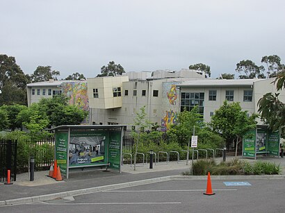
See Bialik College, Hawthorn East, on the map
Directions to Bialik College (Hawthorn East) with public transport
The following transport lines have routes that pass near Bialik College
 Bus:
Bus: - Train:
How to get to Bialik College by bus?
Click on the bus route to see step by step directions with maps, line arrival times and updated time schedules.
How to get to Bialik College by train?
Click on the train route to see step by step directions with maps, line arrival times and updated time schedules.
Bus stations near Bialik College in Hawthorn East
- Cato St/Tooronga Rd (Hawthorn East),4 min walk,
Train stations near Bialik College in Hawthorn East
- Tooronga,15 min walk,
Tram stations near Bialik College in Hawthorn East
- 55-Middle Rd/Burke Rd (Hawthorn East),16 min walk,
Bus lines to Bialik College in Hawthorn East
- 624,Kew,
What are the nearest stations to Bialik College?
The nearest stations to Bialik College are:
- Cato St/Tooronga Rd (Hawthorn East) is 227 meters away, 4 min walk.
- Tooronga is 1116 meters away, 15 min walk.
- 55-Middle Rd/Burke Rd (Hawthorn East) is 1175 meters away, 16 min walk.
Which bus lines stop near Bialik College?
These bus lines stop near Bialik College: 604, 624, 734.
Which train line stops near Bialik College?
GLEN WAVERLEY
What’s the nearest tram station to Bialik College in Hawthorn East?
The nearest tram station to Bialik College in Hawthorn East is 55-Middle Rd/Burke Rd (Hawthorn East). It’s a 16 min walk away.
What’s the nearest train station to Bialik College in Hawthorn East?
The nearest train station to Bialik College in Hawthorn East is Tooronga. It’s a 15 min walk away.
What’s the nearest bus stop to Bialik College in Hawthorn East?
The nearest bus stop to Bialik College in Hawthorn East is Cato St/Tooronga Rd (Hawthorn East). It’s a 4 min walk away.
What time is the first tram to Bialik College in Hawthorn East?
The 72 is the first tram that goes to Bialik College in Hawthorn East. It stops nearby at 06:50.
What time is the last tram to Bialik College in Hawthorn East?
The 72 is the last tram that goes to Bialik College in Hawthorn East. It stops nearby at 01:08.
What time is the first train to Bialik College in Hawthorn East?
The GLEN WAVERLEY is the first train that goes to Bialik College in Hawthorn East. It stops nearby at 03:17.
What time is the last train to Bialik College in Hawthorn East?
The GLEN WAVERLEY is the last train that goes to Bialik College in Hawthorn East. It stops nearby at 00:23.
What time is the first bus to Bialik College in Hawthorn East?
The 624 is the first bus that goes to Bialik College in Hawthorn East. It stops nearby at 08:09.
What time is the last bus to Bialik College in Hawthorn East?
The 624 is the last bus that goes to Bialik College in Hawthorn East. It stops nearby at 21:06.
See Bialik College, Hawthorn East, on the map
Public Transit to Bialik College in Hawthorn East
Wondering how to get to Bialik College in Hawthorn East, Australia? Moovit helps you find the best way to get to Bialik College with step-by-step directions from the nearest public transit station.
Moovit provides free maps and live directions to help you navigate through your city. View schedules, routes, timetables, and find out how long does it take to get to Bialik College in real time.
Looking for the nearest stop or station to Bialik College? Check out this list of stops closest to your destination: Cato St/Tooronga Rd (Hawthorn East); Tooronga; 55-Middle Rd/Burke Rd (Hawthorn East).
Bus:Train:
Want to see if there’s another route that gets you there at an earlier time? Moovit helps you find alternative routes or times. Get directions from and directions to Bialik College easily from the Moovit App or Website.
We make riding to Bialik College easy, which is why over 1.5 million users, including users in Hawthorn East, trust Moovit as the best app for public transit. You don’t need to download an individual bus app or train app, Moovit is your all-in-one transit app that helps you find the best bus time or train time available.
For information on prices of bus, train and tram, costs and ride fares to Bialik College, please check the Moovit app.
Use the app to navigate to popular places including to the airport, hospital, stadium, grocery store, mall, coffee shop, school, college, and university.
Bialik College Address: Cato Lane North street in Hawthorn East
Attractions near Bialik College
Bialik College Hall,Alia College,Bunnings,Melbourne Cleaning Supplies,Auburn High School Sporting Fields,Auburn High School,Hawthorn Secondary College,Chemtronics Biomedical Engineering,Next Smile Australia,Dr Suzanne Silberberg,Auburn South Primary School,750 Toorak Road,Hawthorn Gardens,Patterson Reserve,Woolworths,Coles,Stockland Tooronga,Petstock Hawthorn East,Toorak Road,Auburn South Pre SchoolHow to get to popular attractions in Hawthorn East with public transportation
Melbourne Girls College, Richmond,Point Cook, Point Cook - Bal,Malaysia Hall Melbourne, Windsor,National Gallery Of Victoria (Ngv International), Southbank,St Vincents Private Hospital Fitzroy, Fitzroy,Berwick, Berwick,Middle Brighton Railway Station, Brighton,Melbourne High School, South Yarra,Kmart, Richmond,John Cain Arena, Melbourne,Great Ocean Road, Deans Marsh,Holmesglen Institute Of Tafe - Glen Waverley Campus, Glen Waverley,T2 - International, Melbourne Airport - Bal,Narre Warren Station, Narre Warren,Brimbank Central Shopping Centre, Albanvale,Burwood One, Burwood East,Brighton Beach Station, Brighton,Stop 49: Murray Road, Preston,Swanston Street - Flinders Street Station, Melbourne,Cbd, MelbourneGet around Hawthorn East by public transport!
Travelling around Hawthorn East has never been so easy. See step by step directions as you travel to any attraction, street or major public transport station. View bus and train timetables, arrival times, service alerts and detailed routes on a map, so you know exactly how to get to anywhere in Hawthorn East.
When travelling to any destination around Hawthorn East use Moovit's Live Directions with Get Off Notifications to know exactly where and how far to walk, how long to wait for your line , and how many stops are left. Moovit will alert you when it’s time to get off — no need to constantly re-check whether yours is the next stop.
Wondering how to use public transport in Hawthorn East or how to pay for public transport in Hawthorn East? Moovit public transport app can help you navigate your way with public transport easily, and at minimum cost. It includes public transport fees, ticket prices, and costs. Looking for a map of Hawthorn East public transport lines? Moovit public transport app shows all public transport maps in Hawthorn East with all bus, train or tram routes and stops on an interactive map.
Hawthorn East has 3 transport type(s), including: bus, train or tram, operated by several transport agencies, including PTV Metropolitan Trains, PTV Metropolitan Bus, Yarra Trams, PTV Regional Bus, SkyBus, Interstate Services, V/Line and V/Line (Coach)