Bilston Central station - Thursday schedule
| Line | Direction | Time |
|---|---|---|
| METRO | Wolverhampton Station | 04:59 |
| METRO | Wolverhampton Station | 05:14 |
| METRO | Edgbaston Village | 05:26 |
| METRO | Wolverhampton Station | 05:29 |
| METRO | Edgbaston Village | 05:41 |
| METRO | Wolverhampton Station | 05:44 |
| METRO | Edgbaston Village | 05:56 |
| METRO | Wolverhampton Station | 05:59 |
| METRO | Edgbaston Village | 06:11 |
| METRO | Wolverhampton Station | 06:14 |
| METRO | Edgbaston Village | 06:26 |
| METRO | Wolverhampton Station | 06:29 |
| METRO | Edgbaston Village | 06:40 |
| METRO | Wolverhampton Station | 06:44 |
| METRO | Wolverhampton Station | 06:51 |
| METRO | Edgbaston Village | 06:55 |
| METRO | Wolverhampton Station | 06:59 |
| METRO | Wolverhampton Station | 07:06 |
| METRO | Edgbaston Village | 07:12 |
| METRO | Wolverhampton Station | 07:15 |
| METRO | Edgbaston Village | 07:20 |
| METRO | Wolverhampton Station | 07:21 |
| METRO | Edgbaston Village | 07:28 |
| METRO | Wolverhampton Station | 07:30 |
| METRO | Edgbaston Village | 07:36 |
Directions to Bilston Central (Bilston East) with public transport
The following transport lines have routes that pass near Bilston Central
 Bus:
Bus: - Train:
- Light rail:
How to get to Bilston Central by bus?
Click on the bus route to see step by step directions with maps, line arrival times and updated time schedules.
How to get to Bilston Central by train?
Click on the train route to see step by step directions with maps, line arrival times and updated time schedules.
Bus stations near Bilston Central in Bilston East
- Bilston,2 min walk,
- War Memorial (Stop Bb),5 min walk,
- Wellington Road,8 min walk,
Light Rail stations near Bilston Central in Bilston East
- The Crescent,37 min walk,
Train stations near Bilston Central in Bilston East
- Coseley,46 min walk,
Bus lines to Bilston Central in Bilston East
- 23,Bilston North - Wednesbury South,
- 25,St. Peter's - Oxley,
- 34,Bilston East - St. Matthew's,
- 39,Bilston North - St. Matthew's,
- 43,Bilston East - West Bromwich Central,
- 53,Bilston East - St. Peter's,
- 57,Bilston East - St. Peter's,
- 80,Darlaston South - Bilston East,
- 82,St. Peter's - St. James's,
- 223,Bilston East - St. James's,
- 224,Sedgley - Bilston East,
- 229,Bilston East - St. James's,
- 303,Willenhall South - Bilston East,
- 303,Bilston East - Willenhall South,
- 326,Bilston East - Bloxwich East,
- 530,Bilston East - St. Peter's,
- 530,St. Peter's - Bilston East,
- 79,West Bromwich,
- 26A,Stowlawn,
What are the nearest stations to Bilston Central?
The nearest stations to Bilston Central are:
- Bilston is 106 meters away, 2 min walk.
- War Memorial (Stop Bb) is 328 meters away, 5 min walk.
- Wellington Road is 557 meters away, 8 min walk.
- The Crescent is 2902 meters away, 37 min walk.
- Coseley is 3558 meters away, 46 min walk.
Which bus lines stop near Bilston Central?
These bus lines stop near Bilston Central: 229, 39, 43, 79, 82.
Which train line stops near Bilston Central?
WEST MIDLANDS RAILWAY
Which light rail line stops near Bilston Central?
METRO
What’s the nearest bus stop to Bilston Central in Bilston East?
The nearest bus stop to Bilston Central in Bilston East is Bilston. It’s a 2 min walk away.
What time is the first light rail to Bilston Central in Bilston East?
The METRO is the first light rail that goes to Bilston Central in Bilston East. It stops nearby at 04:56.
What time is the last light rail to Bilston Central in Bilston East?
The METRO is the last light rail that goes to Bilston Central in Bilston East. It stops nearby at 00:44.
What time is the first train to Bilston Central in Bilston East?
The WEST MIDLANDS RAILWAY is the first train that goes to Bilston Central in Bilston East. It stops nearby at 05:35.
What time is the last train to Bilston Central in Bilston East?
The WEST MIDLANDS RAILWAY is the last train that goes to Bilston Central in Bilston East. It stops nearby at 00:23.
What time is the first bus to Bilston Central in Bilston East?
The 79 is the first bus that goes to Bilston Central in Bilston East. It stops nearby at 04:24.
What time is the last bus to Bilston Central in Bilston East?
The 79 is the last bus that goes to Bilston Central in Bilston East. It stops nearby at 00:29.
See Bilston Central, Bilston East, on the map
Public transport to Bilston Central station in Bilston East
Looking for directions to Bilston Central in Bilston East, United Kingdom?
Download the Moovit App to find the current schedule and step-by-step directions for Bus, Light rail or Train routes that pass through Bilston Central.
Looking for the nearest stops closest to Bilston Central ? Check out this list of closest stops to your destination: Bilston; War Memorial (Stop Bb); Wellington Road; The Crescent; Coseley.
Bus:Train:Light rail:
We make riding on public transit to Bilston Central easy, which is why over 1.5 million users, including users in Bilston East trust Moovit as the best app for public transit.
Use the app to navigate to popular places including to the airport, hospital, stadium, grocery store, mall, coffee shop, school, college, and university.
The first line to this station is METRO, at 04:59, and the last line is METRO at 00:41.
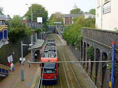
This station serves West Midlands Metro’s lines
Popular routes from Bilston Central, Bilston East
Light Rail station near Bilston Central
The CrescentTrain station near Bilston Central
CoseleyPopular public transport stations in Bilston East
Engine Lane,Solihull Gate,Pype Hayes Park,Norton Canes Business Park,New Cross Hospital (Stop N5),Milehouse Primary Care Centre,Old Hill,Blackwood Drive,Portway Rd,Longbridge,Ashmore Lake Way,Banbury,Top Barn Farm,D & G Bus Depot,Star City Terminus,Forknell Avenue,Old Birmingham Road,The Londonderry,Aldridge Road,Sandwell Council HouseGet around Bilston East by public transport!
Travelling around Bilston East has never been so easy. See step by step directions as you travel to any attraction, street or major public transport station. View bus and train timetables, arrival times, service alerts and detailed routes on a map, so you know exactly how to get to anywhere in Bilston East.
When travelling to any destination around Bilston East use Moovit's Live Directions with Get Off Notifications to know exactly where and how far to walk, how long to wait for your line , and how many stops are left. Moovit will alert you when it’s time to get off — no need to constantly re-check whether yours is the next stop.
Wondering how to use public transport in Bilston East or how to pay for public transport in Bilston East? Moovit public transport app can help you navigate your way with public transport easily, and at minimum cost. It includes public transport fees, ticket prices, and costs. Looking for a map of Bilston East public transport lines? Moovit public transport app shows all public transport maps in Bilston East with all bus, light rail or train routes and stops on an interactive map.
Bilston East has 3 transport type(s), including: bus, light rail or train, operated by several transport agencies, including National Express West Midlands, National Express Coventry, National Express, Diamond Bus, Arriva Midlands, Stagecoach Midlands, West Midlands Metro, Stagecoach West, Stagecoach South Wales, First Potteries, First Worcestershire, LandFlight, trentbarton, D & G Bus and Flexibus