See Bilston Central Metro Station, Bilston East, on the map
Directions to Bilston Central Metro Station (Bilston East) with public transport
The following transport lines have routes that pass near Bilston Central Metro Station
 Bus:
Bus: - Train:
- Light rail:
How to get to Bilston Central Metro Station by bus?
Click on the bus route to see step by step directions with maps, line arrival times and updated time schedules.
How to get to Bilston Central Metro Station by train?
Click on the train route to see step by step directions with maps, line arrival times and updated time schedules.
Bus stations near Bilston Central Metro Station in Bilston East
- Bilston,2 min walk,
- War Memorial (Stop Bb),5 min walk,
- Wellington Road,8 min walk,
Light Rail stations near Bilston Central Metro Station in Bilston East
- The Crescent,37 min walk,
Bus lines to Bilston Central Metro Station in Bilston East
- 23,Bilston North - Wednesbury South,
- 25,St. Peter's - Oxley,
- 34,Bilston East - St. Matthew's,
- 39,Bilston North - St. Matthew's,
- 43,Bilston East - West Bromwich Central,
- 53,Bilston East - St. Peter's,
- 57,Bilston East - St. Peter's,
- 80,Darlaston South - Bilston East,
- 82,St. Peter's - St. James's,
- 223,Bilston East - St. James's,
- 224,Sedgley - Bilston East,
- 229,Bilston East - St. James's,
- 303,Willenhall South - Bilston East,
- 303,Bilston East - Willenhall South,
- 326,Bilston East - Bloxwich East,
- 530,Bilston East - St. Peter's,
- 530,St. Peter's - Bilston East,
- 79,West Bromwich,
- 26A,Wolverhampton,
What are the nearest stations to Bilston Central Metro Station?
The nearest stations to Bilston Central Metro Station are:
- Bilston is 106 meters away, 2 min walk.
- War Memorial (Stop Bb) is 328 meters away, 5 min walk.
- Wellington Road is 557 meters away, 8 min walk.
- The Crescent is 2902 meters away, 37 min walk.
Which bus lines stop near Bilston Central Metro Station?
These bus lines stop near Bilston Central Metro Station: 229, 39, 43, 530, 82.
Which train line stops near Bilston Central Metro Station?
WEST MIDLANDS RAILWAY
Which light rail line stops near Bilston Central Metro Station?
METRO
What’s the nearest bus stop to Bilston Central Metro Station in Bilston East?
The nearest bus stop to Bilston Central Metro Station in Bilston East is Bilston. It’s a 2 min walk away.
What time is the first light rail to Bilston Central Metro Station in Bilston East?
The METRO is the first light rail that goes to Bilston Central Metro Station in Bilston East. It stops nearby at 04:56.
What time is the last light rail to Bilston Central Metro Station in Bilston East?
The METRO is the last light rail that goes to Bilston Central Metro Station in Bilston East. It stops nearby at 00:44.
What time is the first bus to Bilston Central Metro Station in Bilston East?
The 79 is the first bus that goes to Bilston Central Metro Station in Bilston East. It stops nearby at 04:24.
What time is the last bus to Bilston Central Metro Station in Bilston East?
The 79 is the last bus that goes to Bilston Central Metro Station in Bilston East. It stops nearby at 00:29.
See Bilston Central Metro Station, Bilston East, on the map
Public Transit to Bilston Central Metro Station in Bilston East
Wondering how to get to Bilston Central Metro Station in Bilston East, United Kingdom? Moovit helps you find the best way to get to Bilston Central Metro Station with step-by-step directions from the nearest public transit station.
Moovit provides free maps and live directions to help you navigate through your city. View schedules, routes, timetables, and find out how long does it take to get to Bilston Central Metro Station in real time.
Looking for the nearest stop or station to Bilston Central Metro Station? Check out this list of stops closest to your destination: Bilston; War Memorial (Stop Bb); Wellington Road; The Crescent.
Bus:Train:Light rail:
Want to see if there’s another route that gets you there at an earlier time? Moovit helps you find alternative routes or times. Get directions from and directions to Bilston Central Metro Station easily from the Moovit App or Website.
We make riding to Bilston Central Metro Station easy, which is why over 1.5 million users, including users in Bilston East, trust Moovit as the best app for public transit. You don’t need to download an individual bus app or train app, Moovit is your all-in-one transit app that helps you find the best bus time or train time available.
For information on prices of bus, light rail and train, costs and ride fares to Bilston Central Metro Station, please check the Moovit app.
Use the app to navigate to popular places including to the airport, hospital, stadium, grocery store, mall, coffee shop, school, college, and university.
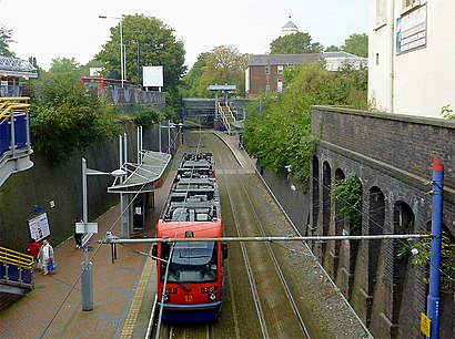
Bilston Central Metro Station Address: Hall Street street in Bilston East
Attractions near Bilston Central Metro Station
Bilston Angling Centre,Bilston Central tram stop,Original Flavour,Angelo Services,Chaplins,Good Shepherd,Ikonic,W&G Grocery,D&W Mini Supermarket,The Vegan Bistro,Thai Spa Centre,Simply Essential Massage Therapy,Simply Essential,Pizza Plus Cafe,Paypoint,Grewal & Daughters,The Wool Ladies,Bilston Bus Station,P Donnelly,Window To the Womb WolverhamptonHow to get to popular attractions in Bilston East with public transportation
Warwick Racecourse, Warwick Aylesford,Sandwell General Hospital, West Bromwich Central,Tyburn House, Pype Hayes,Nuneaton Bus Station, Abbey,Stourbridge, Wollaston And Stourbridge Town,Bewdley Bridge, Bewdley & Rock,Cannon Hill Park, Moseley,Woodbourne Priory Hospital, Harborne,Walsall, St. Matthew's,Cineworld, Wednesfield South,West Heath Hospital, King's Norton North,Joseph Chamberlain 6th Form College, Sparkbrook & Balsall Heath East,Bearwood, Abbey,Warley Woods, Abbey,Corpus Christi Catholic Primary School, Yardley West & Stechford,Hilton Birmingham Metropole, Bickenhill,RAC, Palfrey,Aylestone Hill, College,Tamworth Castle Grounds, Castle,Odeon Cinema, ArburyGet around Bilston East by public transport!
Travelling around Bilston East has never been so easy. See step by step directions as you travel to any attraction, street or major public transport station. View bus and train timetables, arrival times, service alerts and detailed routes on a map, so you know exactly how to get to anywhere in Bilston East.
When travelling to any destination around Bilston East use Moovit's Live Directions with Get Off Notifications to know exactly where and how far to walk, how long to wait for your line , and how many stops are left. Moovit will alert you when it’s time to get off — no need to constantly re-check whether yours is the next stop.
Wondering how to use public transport in Bilston East or how to pay for public transport in Bilston East? Moovit public transport app can help you navigate your way with public transport easily, and at minimum cost. It includes public transport fees, ticket prices, and costs. Looking for a map of Bilston East public transport lines? Moovit public transport app shows all public transport maps in Bilston East with all bus, light rail or train routes and stops on an interactive map.
Bilston East has 3 transport type(s), including: bus, light rail or train, operated by several transport agencies, including National Express West Midlands, National Express Coventry, National Express, Diamond Bus, Arriva Midlands, Stagecoach Midlands, West Midlands Metro, Stagecoach West, Stagecoach South Wales, First Potteries, First Worcestershire, LandFlight, trentbarton, D & G Bus and Flexibus