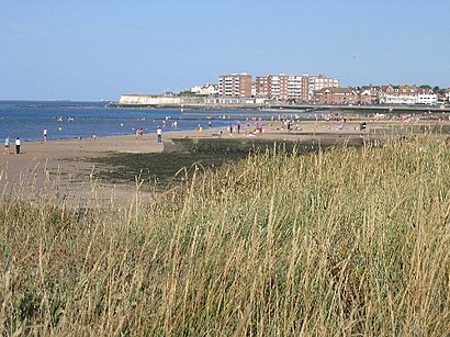
Directions to Birchington on Sea (Margate) with public transport
The following transport lines have routes that pass near Birchington on Sea
How to get to Birchington on Sea by bus?
Click on the bus route to see step by step directions with maps, line arrival times and updated time schedules.
How to get to Birchington on Sea by train?
Click on the train route to see step by step directions with maps, line arrival times and updated time schedules.
Bus stops near Birchington on Sea in Margate
- Primary School, Birchington-On-Sea, 6 min walk,
- Park Avenue, Birchington-On-Sea, 6 min walk,
- Railway Station, Birchington-On-Sea, 7 min walk,
- Birchington-On-Sea, 8 min walk,
- The Square, Birchington-On-Sea, 14 min walk,
Bus lines to Birchington on Sea in Margate
- 48, Birchington-On-Sea,
- 942, St Peters,
- 944, Manna Hutte,
- 8, Westwood Cross,
- 8A, Northdown Park,
- 8X, Birchington-On-Sea,
- 36, Westcliff,
- 32, Minnis Bay,
- 48A, Dane Court School - Birchington,
- 932, Minnis Bay - Dane Valley,
- SOUTHEASTERN, Ramsgate,
- SOUTHEASTERN, Bus Replacement: Margate,
- 022, Victoria,
What are the nearest stations to Birchington on Sea?
The nearest stations to Birchington on Sea are:
- Primary School, Birchington-On-Sea is 432 meters away, 6 min walk.
- Park Avenue, Birchington-On-Sea is 433 meters away, 6 min walk.
- Railway Station, Birchington-On-Sea is 521 meters away, 7 min walk.
- Birchington-On-Sea is 565 meters away, 8 min walk.
- The Square, Birchington-On-Sea is 1080 meters away, 14 min walk.
Which bus lines stop near Birchington on Sea?
These bus lines stop near Birchington on Sea: 8, 8X.
Which train line stops near Birchington on Sea?
SOUTHEASTERN
What’s the nearest bus stop to Birchington on Sea in Margate?
The nearest bus stops to Birchington on Sea in Margate are Primary School, Birchington-On-Sea and Park Avenue, Birchington-On-Sea. The closest one is a 6 min walk away.
What time is the first train to Birchington on Sea in Margate?
The SOUTHEASTERN is the first train that goes to Birchington on Sea in Margate. It stops nearby at 07:12.
What time is the last train to Birchington on Sea in Margate?
The SOUTHEASTERN is the last train that goes to Birchington on Sea in Margate. It stops nearby at 00:18.
What time is the first bus to Birchington on Sea in Margate?
The 022 is the first bus that goes to Birchington on Sea in Margate. It stops nearby at 06:32.
What time is the last bus to Birchington on Sea in Margate?
The 022 is the last bus that goes to Birchington on Sea in Margate. It stops nearby at 23:52.
See Birchington on Sea, Margate, on the map
Public Transit to Birchington on Sea in Margate
Wondering how to get to Birchington on Sea in Margate, United Kingdom? Moovit helps you find the best way to get to Birchington on Sea with step-by-step directions from the nearest public transit station.
Moovit provides free maps and live directions to help you navigate through your city. View schedules, routes, timetables, and find out how long does it take to get to Birchington on Sea in real time.
Looking for the nearest stop or station to Birchington on Sea? Check out this list of stops closest to your destination: Primary School; Park Avenue; Railway Station; Birchington-On-Sea; The Square.
Bus: 8, 8X, 8A, 36, 48, 942, 944, 32, 48A, 932, SOUTHEASTERN, SOUTHEASTERN, 022.Train: SOUTHEASTERN.
Want to see if there’s another route that gets you there at an earlier time? Moovit helps you find alternative routes or times. Get directions from and directions to Birchington on Sea easily from the Moovit App or Website.
We make riding to Birchington on Sea easy, which is why over 1.5 million users, including users in Margate, trust Moovit as the best app for public transit. You don’t need to download an individual bus app or train app, Moovit is your all-in-one transit app that helps you find the best bus time or train time available.
For information on prices of bus and train, costs and ride fares to Birchington on Sea, please check the Moovit app.
Use the app to navigate to popular places including to the airport, hospital, stadium, grocery store, mall, coffee shop, school, college, and university.
Location: Margate, London
Attractions near Birchington on Sea
Food of Love Thanet,Birchwood Kent,Home Counties Distribution Limited,Brown & Mason,Catherine Bew Tarot,Ryan Mitchell Double Glazing Repairs,Kamagra Online,Birchington,3 Brandon Way,Thanet Cattery,Clark Dawson Electrical,Quex Park and The Powell-Cotton Museum,Slimming World,Go Emu,Birchington on Sea Quex Park,MR I D Mather,Quex Barn Farm Shop And Restaurant,Ct7 9ub,Birchington Hand Car Wash & Valet Centre,Quex ParkHow to get to popular attractions in Margate with public transportation
Emirates Stadium, Highbury,Uxbridge College, Uxbridge,Trafalgar Square, Charing Cross,Lewisham Shopping Centre, Lewisham,Churchill Square Shopping Centre, Brighton And Hove,Cineworld, Chichester (Town),Berkhamsted Railway Station (BKM), Berkhamsted,Hammersmith Hospital, White City,Gatwick Airport, Crawley,Kingston Hospital, Norbiton,Middlesex University, Hendon,Ikea, Neasden,Waitrose, Surbiton,Hampstead, Hampstead,Harpenden, Harpenden,St Thomas' Hospital, Waterloo,Sainsbury's, Chiswick,Barking Station, Barking,Bluewater, Greenhithe,Southall, SouthallGet around London by public transport!
Travelling around London has never been so easy. See step by step directions as you travel to any attraction, street or major public transport station. View bus and train timetables, arrival times, service alerts and detailed routes on a map, so you know exactly how to get to anywhere in London.
When travelling to any destination around London use Moovit's Live Directions with Get Off Notifications to know exactly where and how far to walk, how long to wait for your line , and how many stops are left. Moovit will alert you when it’s time to get off — no need to constantly re-check whether yours is the next stop.
Wondering how to use public transport in London or how to pay for public transport in London? Moovit public transport app can help you navigate your way with public transport easily, and at minimum cost. It includes public transport fees, ticket prices, and costs. Looking for a map of London public transport lines? Moovit public transport app shows all public transport maps in London with all Bus, Train, Tube, Tramlink, River Bus and DLR routes and stops on an interactive map.
London has 6 transport type(s), including: Bus, Train, Tube, Tramlink, River Bus and DLR, operated by several transport agencies, including London Underground, London Buses, Transport for London, London Tramlink, National Rail, Bluestar, Berry's Coaches, Oxford Bus Company, Stagecoach West, Community First Wessex, Cresta Coaches, D & P Boat Hire, First Portsmouth, Fareham & Gosport, FYTbus, IFS Cloud Cable Car