Directions to Black Cart Water (Scotland) with public transport
The following transport lines have routes that pass near Black Cart Water
How to get to Black Cart Water by bus?
Click on the bus route to see step by step directions with maps, line arrival times and updated time schedules.
How to get to Black Cart Water by train?
Click on the train route to see step by step directions with maps, line arrival times and updated time schedules.
Bus stations near Black Cart Water in Scotland
- Sunart Avenue, Blythswood,10 min walk,
- Normandy Hotel, Blythswood,10 min walk,
- Inchinnan Bridge, Blythswood,17 min walk,
Bus lines to Black Cart Water in Scotland
- 23,Erskine - Glasgow via Govan,
- 23A,Erskine - Glasgow via Inchinnan Ind Est,
- X23,Erskine - Glasgow,
- 26,Paisley Nethercraigs - Glasgow,
- 23P,Paisley,
- 6,Paisley,
- 26A,Inchinnan,
What are the nearest stations to Black Cart Water?
The nearest stations to Black Cart Water are:
- Sunart Avenue, Blythswood is 707 meters away, 10 min walk.
- Normandy Hotel, Blythswood is 733 meters away, 10 min walk.
- Inchinnan Bridge, Blythswood is 1288 meters away, 17 min walk.
Which bus line stops near Black Cart Water?
23
Which train line stops near Black Cart Water?
SCOTRAIL
What’s the nearest bus stop to Black Cart Water in Scotland?
The nearest bus stops to Black Cart Water in Scotland are Sunart Avenue, Blythswood and Normandy Hotel, Blythswood. The closest one is a 10 min walk away.
See Black Cart Water, Scotland, on the map
Public Transit to Black Cart Water in Scotland
Wondering how to get to Black Cart Water in Scotland, United Kingdom? Moovit helps you find the best way to get to Black Cart Water with step-by-step directions from the nearest public transit station.
Moovit provides free maps and live directions to help you navigate through your city. View schedules, routes, timetables, and find out how long does it take to get to Black Cart Water in real time.
Looking for the nearest stop or station to Black Cart Water? Check out this list of stops closest to your destination: Sunart Avenue; Normandy Hotel; Inchinnan Bridge.
Bus:2323AX232623P626ATrain:SCOTRAIL
Want to see if there’s another route that gets you there at an earlier time? Moovit helps you find alternative routes or times. Get directions from and directions to Black Cart Water easily from the Moovit App or Website.
We make riding to Black Cart Water easy, which is why over 1.5 million users, including users in Scotland, trust Moovit as the best app for public transit. You don’t need to download an individual bus app or train app, Moovit is your all-in-one transit app that helps you find the best bus time or train time available.
For information on prices of bus, train and light rail, costs and ride fares to Black Cart Water, please check the Moovit app.
Use the app to navigate to popular places including to the airport, hospital, stadium, grocery store, mall, coffee shop, school, college, and university.
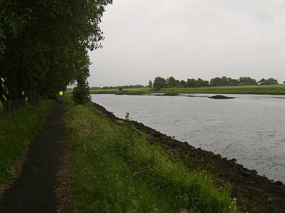
Black Cart Water Address: Renfrew street in Scotland
Attractions near Black Cart Water
St Michaels Golf Club,Normandy,Inchinnan Road,PA4 9EN,Matalan,Sunart Avenue, Blythswood,Normandy Hotel,Glitzi Bitzi Beauty,Normandy Hotel, Blythswood,Xercise4Less Renfrew,Blythswood Industrial Estate,Portnauld,Perfectly Pampered Hair,Greenock Road,Inchinnan Road,Blythswood Beacon,Leven Square,KTS Hiab Hire,Renfrew Football Club,Kirklandneuk RoadHow to get to popular attractions in Scotland with public transportation
The Crystal Palace (Wetherspoon), Glasgow,Cathcart Railway Station (CCT), Glasgow,Edinburgh Castle, Edinburgh,Woodside, Aberdeen,Aberdeen International Airport (ABZ), Dyce,Tynecastle Park, Edinburgh,Edinburgh Airport (EDI), Ratho Station,Drumgelloch Railway Station (DRU), Airdrie,Buchanan Street Bus Station, Glasgow,Nuffield Health Glasgow Central Fitness & Wellbeing Gym, Glasgow,Dunfermline Bus Station, Dunfermline,Scottish Event Campus (SEC), Glasgow,Ocean Terminal, Edinburgh,South Queensferry, Queensferry,IKEA, Loanhead,Annandale Water Motorway Services (RoadChef), Dumfries And Galloway,Asda, Glasgow,Buchanan Bus Station, Glasgow,Bellshill, Bellshill,St Andrews University Library, St AndrewsGet around Scotland by public transport!
Travelling around Scotland has never been so easy. See step by step directions as you travel to any attraction, street or major public transport station. View bus and train timetables, arrival times, service alerts and detailed routes on a map, so you know exactly how to get to anywhere in Scotland.
When travelling to any destination around Scotland use Moovit's Live Directions with Get Off Notifications to know exactly where and how far to walk, how long to wait for your line , and how many stops are left. Moovit will alert you when it’s time to get off — no need to constantly re-check whether yours is the next stop.
Wondering how to use public transport in Scotland or how to pay for public transport in Scotland? Moovit public transport app can help you navigate your way with public transport easily, and at minimum cost. It includes public transport fees, ticket prices, and costs. Looking for a map of Scotland public transport lines? Moovit public transport app shows all public transport maps in Scotland with all bus, train or light rail routes and stops on an interactive map.
Scotland has 3 transport type(s), including: bus, train or light rail, operated by several transport agencies, including First Greater Glasgow, First Aberdeen, Lothian Buses, McGill's Bus Service, Stagecoach East Scotland, Stagecoach Bluebird, Xplore Dundee, Community Transport Glasgow, Prentice Westwood, McCall's Coaches, J P Minibus, National Rail, R Robertson & Son, Burnbrae Garage and Ember