Blossom Street stop - Wednesday schedule
| Line | Direction | Time |
|---|---|---|
| 11 | Burnholme | 06:20 |
| Y12 | Monks Cross Asda | 06:31 |
| 5 | Strensall | 06:39 |
| 840 | Thornton-Le-Dale | 07:01 |
| 11 | Burnholme | 07:02 |
| 5 | Strensall | 07:09 |
| 5A | Strensall | 07:28 |
| 843 | Scarborough | 07:29 |
| Y12 | Monks Cross Asda | 07:31 |
| 13 | West Nooks | 07:42 |
| 13 | Haxby | 07:42 |
| 5 | Strensall | 07:46 |
| 11 | Burnholme | 07:50 |
| 840 | Whitby Bus Station | 07:58 |
| 5A | Strensall | 08:05 |
| 13 | West Nooks | 08:17 |
| 13 | Haxby | 08:17 |
| 843 | Scarborough | 08:23 |
| 5 | Strensall | 08:24 |
| Y12 | Monks Cross Asda | 08:36 |
| 11 | Burnholme | 08:38 |
| 843 | York Clifford St | 08:43 |
| 5A | Strensall | 08:44 |
| 24 | Fulford | 09:04 |
| 5 | Strensall | 09:04 |
Directions to Blossom Street stop (York) with public transport
The following transport lines have routes that pass near Blossom Street
How to get to Blossom Street stop by bus?
Click on the bus route to see step by step directions with maps, line arrival times and updated time schedules.
Bus stops near Blossom Street stop in York
- Blossom Street, 1 min walk,
- Queen Street, 4 min walk,
- Nunnery Lane Car Park, 4 min walk,
- The Mount, 4 min walk,
- Rail Station (Stop Rj), 7 min walk,
- Rail Station (Stop Ra), 7 min walk,
Train stations near Blossom Street station in York
- Poppleton, 42 min walk,
- York, 50 min walk,
Bus lines to Blossom Street stop in York
- 1, Chapelfields,
- 1A, Wigginton,
- 3, Askham Bar,
- 4, Acomb Tudor Rd,
- 10, Poppleton,
- 16, Acomb,
- 30, Raskelf,
- 30XS, Easingwold,
- 40, York Rail Station,
- 74, York Exhibition Sq,
- 82, Boroughbridge Market Place,
- 83, White Horse,
- 84, York Rail Station,
- 412, Wetherby,
- 412, Boot And Shoe Inn,
- Y12, Woodthorpe Shops,
- 13, Copmanthorpe,
- Y14, York Stonebow,
- 37, Tadcaster,
- 80, Askham Bryan College,
What are the nearest stations to Blossom Street?
The nearest stations to Blossom Street are:
- Blossom Street is 9 meters away, 1 min walk.
- Queen Street is 219 meters away, 4 min walk.
- Nunnery Lane Car Park is 235 meters away, 4 min walk.
- The Mount is 259 meters away, 4 min walk.
- Rail Station (Stop Rj) is 480 meters away, 7 min walk.
- Rail Station (Stop Ra) is 490 meters away, 7 min walk.
- Poppleton is 3285 meters away, 42 min walk.
- York is 3863 meters away, 50 min walk.
Which bus lines stop near Blossom Street?
These bus lines stop near Blossom Street: 10, 3, 4, 412, 7, 840, X46.
What’s the nearest bus stop to Blossom Street in York?
The nearest bus stop to Blossom Street in York is Blossom Street. It’s a 1 min walk away.
What time is the first train to Blossom Street in York?
The TRANSPENNINE EXPRESS is the first train that goes to Blossom Street in York. It stops nearby at 03:13.
What time is the last train to Blossom Street in York?
The TRANSPENNINE EXPRESS is the last train that goes to Blossom Street in York. It stops nearby at 04:58.
What time is the first bus to Blossom Street in York?
The 200 is the first bus that goes to Blossom Street in York. It stops nearby at 05:05.
What time is the last bus to Blossom Street in York?
The NORTHERN is the last bus that goes to Blossom Street in York. It stops nearby at 01:20.
See Blossom Street stop, York, on the map
Public transport to Blossom Street stop (ID: 32900151) in York
Looking for directions to Blossom Street in York, United Kingdom?
Download the Moovit App to find the current schedule and step-by-step directions for Bus routes that pass through Blossom Street.
Looking for the nearest stops closest to Blossom Street ? Check out this list of closest stops to your destination: Blossom Street; Queen Street; Nunnery Lane Car Park; The Mount; Rail Station (Stop Rj); Rail Station (Stop Ra); Poppleton; York.
Bus: 10, 3, 4, 412, 7, 840, X46, 1, 1A, Y12, 13, Y14, 37, 80, 5, 5A, 24, 36, X45, X47, 747.Train: NORTHERN, CROSSCOUNTRY, CROSSCOUNTRY, GRAND CENTRAL, LONDON NORTH EASTERN RAILWAY, LONDON NORTH EASTERN RAILWAY.
We make riding on public transit to Blossom Street easy, which is why over 1.5 million users, including users in York trust Moovit as the best app for public transit.
Use the app to navigate to popular places including to the airport, hospital, stadium, grocery store, mall, coffee shop, school, college, and university.
Blossom Street stop’s code is 32900151
The first line to this stop is 11, at 06:20, and the last line is 843 at 00:20.
The Crescent, York, England, United Kingdom
This stop serves Connexions Buses, First York, Coastliner, East Yorkshire and York Pullman’s lines
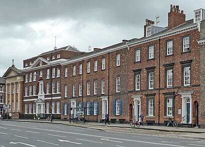
Blossom Street is a road in York, in England, immediately west of the city centre.Wiki
Popular routes from Blossom Street stop, York
Bus stops near Blossom Street stop
Popular public transport stations in York
Get around York by public transport!
Travelling around York has never been so easy. See step by step directions as you travel to any attraction, street or major public transport station. View bus and train timetables, arrival times, service alerts and detailed routes on a map, so you know exactly how to get to anywhere in York.
When travelling to any destination around York use Moovit's Live Directions with Get Off Notifications to know exactly where and how far to walk, how long to wait for your line , and how many stops are left. Moovit will alert you when it’s time to get off — no need to constantly re-check whether yours is the next stop.
Wondering how to use public transport in York or how to pay for public transport in York? Moovit public transport app can help you navigate your way with public transport easily, and at minimum cost. It includes public transport fees, ticket prices, and costs. Looking for a map of York public transport lines? Moovit public transport app shows all public transport maps in York with all Bus, Train and Light rail routes and stops on an interactive map.
Yorkshire has 3 transport type(s), including: Bus, Train and Light rail, operated by several transport agencies, including National Rail, South Yorkshire Future Tram, Stevenson's Travel, North Yorkshire County Council, Hulleys of Baslow, TLC Travel, R & S Watersons, The Keighley Bus Company, Stagecoach Yorkshire, Goole Go Far, Jacksons of Silsden Ltd, First Bradford, Hodgsons, Sheffield Community Transport and Station Coaches