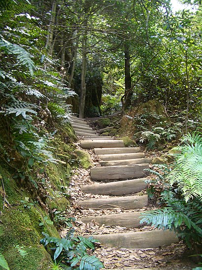
Directions to Blue Mountains Walking Tracks (Blackheath) with public transport
The following transport lines have routes that pass near Blue Mountains Walking Tracks
Directions to Blue Mountains Walking Tracks (Blackheath) with public transport
The following transport lines have routes that pass near Blue Mountains Walking Tracks
How to get to Blue Mountains Walking Tracks by bus?
Click on the bus route to see step by step directions with maps, line arrival times and updated time schedules.
How to get to Blue Mountains Walking Tracks by train?
Click on the train route to see step by step directions with maps, line arrival times and updated time schedules.
Bus lines to Blue Mountains Walking Tracks in Blackheath
- 698,Blue Mountains Grammar Sch, Matcham,
- 8710,Blackheath,
- 8717,Bmnp & Wildlife Ctr,
- 698V,Katoomba via Mt Victoria,
- 8331,Katoomba HS,
- 8321,Blackheath Station,
- 8737,Blackheath,
- S371,School Bus,
- S368,Rosella Bus - Wentworth Falls to Mount Victoria Public via Katoomba,
- S375,Swan Bus - Lithgow to Lithgow Schools via Mt Victoria & Blackheath,
- 8705,Bmnp & Wildlife Ctr,
What are the nearest stations to Blue Mountains Walking Tracks?
The nearest stations to Blue Mountains Walking Tracks are:
- St Aidan's Anglican Church, Hat Hill Rd is 76 meters away, 2 min walk.
- Great Western Hwy opp Blackheath Station is 153 meters away, 3 min walk.
- Blackheath Station, Great Western Hwy is 174 meters away, 3 min walk.
- Blackheath Public School, Wentworth St is 335 meters away, 5 min walk.
- Great Western Hwy at Govetts Leap Rd is 436 meters away, 6 min walk.
- Great Western Hwy before Bundarra St is 450 meters away, 7 min walk.
- Blackheath Station is 2809 meters away, 36 min walk.
Which bus line stops near Blue Mountains Walking Tracks?
698
Which train line stops near Blue Mountains Walking Tracks?
BMT
What’s the nearest bus stop to Blue Mountains Walking Tracks in Blackheath?
The nearest bus stop to Blue Mountains Walking Tracks in Blackheath is St Aidan's Anglican Church, Hat Hill Rd. It’s a 2 min walk away.
What time is the first train to Blue Mountains Walking Tracks in Blackheath?
The BMT is the first train that goes to Blue Mountains Walking Tracks in Blackheath. It stops nearby at 03:38.
What time is the last train to Blue Mountains Walking Tracks in Blackheath?
The BMT is the last train that goes to Blue Mountains Walking Tracks in Blackheath. It stops nearby at 02:56.
What time is the first bus to Blue Mountains Walking Tracks in Blackheath?
The 698 is the first bus that goes to Blue Mountains Walking Tracks in Blackheath. It stops nearby at 07:59.
What time is the last bus to Blue Mountains Walking Tracks in Blackheath?
The 698 is the last bus that goes to Blue Mountains Walking Tracks in Blackheath. It stops nearby at 18:20.
How much is the train fare to Blue Mountains Walking Tracks?
The train fare to Blue Mountains Walking Tracks costs about $2.80 - $9.84.
How much is the bus fare to Blue Mountains Walking Tracks?
The bus fare to Blue Mountains Walking Tracks costs about $2.24.
See Blue Mountains Walking Tracks, Blackheath, on the map
Public Transit to Blue Mountains Walking Tracks in Blackheath
Wondering how to get to Blue Mountains Walking Tracks in Blackheath, Australia? Moovit helps you find the best way to get to Blue Mountains Walking Tracks with step-by-step directions from the nearest public transit station.
Moovit provides free maps and live directions to help you navigate through your city. View schedules, routes, timetables, and find out how long does it take to get to Blue Mountains Walking Tracks in real time.
Looking for the nearest stop or station to Blue Mountains Walking Tracks? Check out this list of stops closest to your destination: St Aidan's Anglican Church; Great Western Hwy opp Blackheath Station; Blackheath Station; Blackheath Public School; Great Western Hwy at Govetts Leap Rd; Great Western Hwy before Bundarra St; Blackheath Station.
Bus: 698, 8710, 8717, 698V, 8331, 8321, 8737, S371, S368, S375.Train: BMT.
Want to see if there’s another route that gets you there at an earlier time? Moovit helps you find alternative routes or times. Get directions from and directions to Blue Mountains Walking Tracks easily from the Moovit App or Website.
We make riding to Blue Mountains Walking Tracks easy, which is why over 1.5 million users, including users in Blackheath, trust Moovit as the best app for public transit. You don’t need to download an individual bus app or train app, Moovit is your all-in-one transit app that helps you find the best bus time or train time available.
For information on prices of train and bus, costs and ride fares to Blue Mountains Walking Tracks, please check the Moovit app.
Use the app to navigate to popular places including to the airport, hospital, stadium, grocery store, mall, coffee shop, school, college, and university.
Blue Mountains Walking Tracks Address: Govetts Leap Rd Blackheath, 2785 Blackheath street in Blackheath
Attractions near Blue Mountains Walking Tracks
Blackheath Public School,Dawn Cady Alleviate Pain Clinic,Yanping Li,Chiropractic Health Quarters Blackheath,Michael Wooldridge Building,Oeh,Annette,Zeal Property Maintenance,Kristi's Video,Black Maple Lifestyl,Hala Francka Import Export,Loved It,Blackheath Boutique,Blackheath Holiday Cabins,atmx,Thai Silk,Bendigo Bank,Heath Cafe,Cashcard,Julia E GuestHow to get to popular attractions in Blackheath with public transportation
Manly Beach, Manly (NSW),Manly, Manly (NSW),Turramurra Station, Turramurra,Munich Brauhaus, The Rocks (Sydney - NSW),University of Wollongong, Keiraville,The Rose Hotel, Chippendale,Westfield Warringah Mall, Brookvale,West Ryde Station, West Ryde,Starbucks, Sydney,Kogarah Station, Kogarah,Mortdale Station, Mortdale,Westfield Tuggerah, Tuggerah,Manly Wharf Bar,Wynyard, Sydney,Blue Mountains National Park, Katoomba,Newtown, Newtown (NSW),4 Pines Brewpub, Manly (NSW),Single O, Surry Hills,Central, Haymarket,Chat Thai, HaymarketGet around Sydney by public transport!
Travelling around Sydney has never been so easy. See step by step directions as you travel to any attraction, street or major public transport station. View bus and train timetables, arrival times, service alerts and detailed routes on a map, so you know exactly how to get to anywhere in Sydney.
When travelling to any destination around Sydney use Moovit's Live Directions with Get Off Notifications to know exactly where and how far to walk, how long to wait for your line , and how many stops are left. Moovit will alert you when it’s time to get off — no need to constantly re-check whether yours is the next stop.
Wondering how to use public transport in Sydney or how to pay for public transport in Sydney? Moovit public transport app can help you navigate your way with public transport easily, and at minimum cost. It includes public transport fees, ticket prices, and costs. Looking for a map of Sydney public transport lines? Moovit public transport app shows all public transport maps in Sydney with all Bus, Train, Metro, Light rail and Ferry routes and stops on an interactive map.
Sydney has 5 transport type(s), including: Bus, Train, Metro, Light rail and Ferry, operated by several transport agencies, including Sydney Metro, Sydney Trains, Sydney Light Rail, Sydney Ferries, Intercity Trains, Intercity Train, NSW TrainLink, CDC NSW R14, U-Go Mobility, Keolis Downer Northern Beaches, Manly Fast Ferry, Transdev John Holland Buses, Busways, Busways North West, Dysons Buslines