See Bolsover Castle on the map
Directions to Bolsover Castle with public transportation
The following transport lines have routes that pass near Bolsover Castle
 Bus:
Bus:
How to get to Bolsover Castle by bus?
Click on the bus route to see step by step directions with maps, line arrival times and updated time schedules.
Bus stations near Bolsover Castle
- 4 High Street, Bolsover,5 min walk,
- Station Road Top, Bolsover,7 min walk,
- Market Place, Bolsover,8 min walk,
Bus routes to Bolsover Castle
- 1A,Newbold,
- 49,Clay Cross,
- 1,Hillstown,
- 53,Sheffield Centre,
- 53A,Halfway,
- 583,Long Duckmanton,
What are the nearest stations to Bolsover Castle?
The nearest stations to Bolsover Castle are:
- 4 High Street, Bolsover is 354 meters away, 5 min walk.
- Station Road Top, Bolsover is 478 meters away, 7 min walk.
- Market Place, Bolsover is 544 meters away, 8 min walk.
Which bus lines stop near Bolsover Castle?
These bus lines stop near Bolsover Castle: 1, 1A, 53.
What’s the nearest bus stop to Bolsover Castle?
The nearest bus stop to Bolsover Castle is 4 High Street, Bolsover. It’s a 5 min walk away.
What time is the first bus to Bolsover Castle?
The 1 is the first bus that goes to Bolsover Castle. It stops nearby at 05:00.
What time is the last bus to Bolsover Castle?
The 53A is the last bus that goes to Bolsover Castle. It stops nearby at 00:01.
See Bolsover Castle on the map
Public Transportation to Bolsover Castle
Wondering how to get to Bolsover Castle, United Kingdom? Moovit helps you find the best way to get to Bolsover Castle with step-by-step directions from the nearest public transit station.
Moovit provides free maps and live directions to help you navigate through your city. View schedules, routes, timetables, and find out how long does it take to get to Bolsover Castle in real time.
Looking for the nearest stop or station to Bolsover Castle? Check out this list of stops closest to your destination: 4 High Street; Station Road Top; Market Place.
Bus:
Want to see if there’s another route that gets you there at an earlier time? Moovit helps you find alternative routes or times. Get directions from and directions to Bolsover Castle easily from the Moovit App or Website.
We make riding to Bolsover Castle easy, which is why over 1.5 million users, including users in Bolsover, trust Moovit as the best app for public transit. You don’t need to download an individual bus app or train app, Moovit is your all-in-one transit app that helps you find the best bus time or train time available.
For information on prices of bus, costs and ride fares to Bolsover Castle, please check the Moovit app.
Use the app to navigate to popular places including to the airport, hospital, stadium, grocery store, mall, coffee shop, school, college, and university.
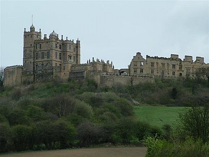
Bolsover Castle Address: 55 Station Road, Bolsover, Chesterfield, Derbyshire S44 6BE, UK street in Bolsover
Popular routes to Bolsover Castle
Attractions near Bolsover Castle
Old Hill & Station Road,Bolsover Castle,The Vale Care Home,Bolsover,Royal Mail,Elliott Meats,Market Place (Stop 1),Crozier Consulting Services,Ye Olde Curiosity Shop,Sykes Field Retail Park,Stubbins & Hope Funeral Directors,Premium 4 Training,Post Office,Sweet Zone,The Blue Bell At Bolsover,Econcept Retail,Les Harrison Business Solutions Limited,Snixnik,Bolsover Parish Church St Mary & St Laurence,Bainbridge HallHow to get to popular attractions in Bolsover with public transportation
Nuffield Health Nottingham Fitness & Wellbeing Gym, Gedling,Westwood Centre, Peterborough,Bradgate Park & Swithland Wood Country Park, Charnwood,Asda, Derby,Wyberton, Boston,Sir Robert Pattinson Academy, North Kesteven,British Gas Museum, Leicester,The Carlton Centre, Lincoln,Quorn & Woodhouse Railway Station (GC Railway), Charnwood,Sherwood, Nottingham,Tottle Bakery, Nottingham,RBS Kegworth Data Centre, North West Leicestershire,Currys PC World, Nottingham,Premier Inn Nottingham West, Broxtowe,University Of Derby, Derby,De Montfort University, Leicester,Gotham, Rushcliffe,Lakeside Arts Centre, Nottingham,YBS Group - Lynch Wood, Peterborough,The Samuel Hall (Wetherspoon), NottinghamGet around Bolsover by public transport!
Travelling around Bolsover has never been so easy. See step by step directions as you travel to any attraction, street or major public transport station. View bus and train timetables, arrival times, service alerts and detailed routes on a map, so you know exactly how to get to anywhere in Bolsover.
When travelling to any destination around Bolsover use Moovit's Live Directions with Get Off Notifications to know exactly where and how far to walk, how long to wait for your line , and how many stops are left. Moovit will alert you when it’s time to get off — no need to constantly re-check whether yours is the next stop.
Wondering how to use public transport in Bolsover or how to pay for public transport in Bolsover? Moovit public transport app can help you navigate your way with public transport easily, and at minimum cost. It includes public transport fees, ticket prices, and costs. Looking for a map of Bolsover public transport lines? Moovit public transport app shows all public transport maps in Bolsover with all bus routes and stops on an interactive map.
Bolsover has 1 transport type(s), including: bus, operated by several transport agencies, including National Rail, Ashbourne Community Transport, Delaine Buses, Arriva Midlands, Centrebus, Our Centre, Hulleys of Baslow, D & G Bus, Stagecoach East Midlands, North Lincolnshire Council, National Rail, Roberts Coaches, Hawkes Coaches, Lawson's of Corby and East Yorkshire