Directions to Boroondara City Council (Camberwell) with public transport
The following transport lines have routes that pass near Boroondara City Council
How to get to Boroondara City Council by bus?
Click on the bus route to see step by step directions with maps, line arrival times and updated time schedules.
How to get to Boroondara City Council by train?
Click on the train route to see step by step directions with maps, line arrival times and updated time schedules.
Bus stops near Boroondara City Council in Camberwell
- Camberwell Civic Centre/Opp 347 Camberwell Rd (Camberwell), 2 min walk,
- Opp 29 Fairholm Gr (Camberwell), 7 min walk,
Tram stations near Boroondara City Council in Camberwell
- 42-Camberwell Primary School/Camberwell Rd (Camberwell), 3 min walk,
- 59-Seymour Gr/Burke Rd (Camberwell), 5 min walk,
Bus lines to Boroondara City Council in Camberwell
- 612, Box Hill,
- 285, Camberwell Sc,
What are the nearest stations to Boroondara City Council?
The nearest stations to Boroondara City Council are:
- Camberwell Civic Centre/Opp 347 Camberwell Rd (Camberwell) is 104 meters away, 2 min walk.
- 42-Camberwell Primary School/Camberwell Rd (Camberwell) is 117 meters away, 3 min walk.
- 59-Seymour Gr/Burke Rd (Camberwell) is 311 meters away, 5 min walk.
- Opp 29 Fairholm Gr (Camberwell) is 505 meters away, 7 min walk.
Which bus lines stop near Boroondara City Council?
These bus lines stop near Boroondara City Council: 285, 612.
Which train line stops near Boroondara City Council?
LILYDALE (Lilydale Via City Loop)
Which tram line stops near Boroondara City Council?
75 (Vermont South)
What’s the nearest tram station to Boroondara City Council in Camberwell?
The nearest tram station to Boroondara City Council in Camberwell is 42-Camberwell Primary School/Camberwell Rd (Camberwell). It’s a 3 min walk away.
What’s the nearest bus station to Boroondara City Council in Camberwell?
The nearest bus station to Boroondara City Council in Camberwell is Camberwell Civic Centre/Opp 347 Camberwell Rd (Camberwell). It’s a 2 min walk away.
What time is the first tram to Boroondara City Council in Camberwell?
The 75 is the first tram that goes to Boroondara City Council in Camberwell. It stops nearby at 03:00.
What time is the last tram to Boroondara City Council in Camberwell?
The 75 is the last tram that goes to Boroondara City Council in Camberwell. It stops nearby at 01:15.
What time is the first bus to Boroondara City Council in Camberwell?
The 285 is the first bus that goes to Boroondara City Council in Camberwell. It stops nearby at 06:54.
What time is the last bus to Boroondara City Council in Camberwell?
The 285 is the last bus that goes to Boroondara City Council in Camberwell. It stops nearby at 18:44.
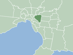
See Boroondara City Council, Camberwell, on the map
Public Transit to Boroondara City Council in Camberwell
Wondering how to get to Boroondara City Council in Camberwell, Australia? Moovit helps you find the best way to get to Boroondara City Council with step-by-step directions from the nearest public transit station.
Moovit provides free maps and live directions to help you navigate through your city. View schedules, routes, timetables, and find out how long does it take to get to Boroondara City Council in real time.
Looking for the nearest stop or station to Boroondara City Council? Check out this list of stops closest to your destination: Camberwell Civic Centre/Opp 347 Camberwell Rd (Camberwell); 42-Camberwell Primary School/Camberwell Rd (Camberwell); 59-Seymour Gr/Burke Rd (Camberwell); Opp 29 Fairholm Gr (Camberwell).
Bus: 285, 612.Train: LILYDALE.Tram: 75.
Want to see if there’s another route that gets you there at an earlier time? Moovit helps you find alternative routes or times. Get directions from and directions to Boroondara City Council easily from the Moovit App or Website.
We make riding to Boroondara City Council easy, which is why over 1.5 million users, including users in Camberwell, trust Moovit as the best app for public transit. You don’t need to download an individual bus app or train app, Moovit is your all-in-one transit app that helps you find the best bus time or train time available.
For information on prices of tram, bus and train, costs and ride fares to Boroondara City Council, please check the Moovit app.
Use the app to navigate to popular places including to the airport, hospital, stadium, grocery store, mall, coffee shop, school, college, and university.
Boroondara City Council Address: Inglesby Rd 8 Camberwell, 3124 Melbourne street in Camberwell
Places Near Boroondara City Council (Camberwell)
How to get to popular places in Melbourne with public transport
Get around Camberwell by public transport!
Travelling around Camberwell has never been so easy. See step by step directions as you travel to any attraction, street or major public transport station. View bus and train timetables, arrival times, service alerts and detailed routes on a map, so you know exactly how to get to anywhere in Camberwell.
When travelling to any destination around Camberwell use Moovit's Live Directions with Get Off Notifications to know exactly where and how far to walk, how long to wait for your line , and how many stops are left. Moovit will alert you when it’s time to get off — no need to constantly re-check whether yours is the next stop.
Wondering how to use public transport in Camberwell or how to pay for public transport in Camberwell? Moovit public transport app can help you navigate your way with public transport easily, and at minimum cost. It includes public transport fees, ticket prices, and costs. Looking for a map of Camberwell public transport lines? Moovit public transport app shows all public transport maps in Camberwell with all Bus, Train and Tram routes and stops on an interactive map.
Melbourne has 3 transport type(s), including: Bus, Train and Tram, operated by several transport agencies, including PTV Metropolitan Trains, PTV Metropolitan Bus, Yarra Trams, PTV Regional Bus, SkyBus, Interstate Services, V/Line and V/Line (Coach)