See Botanic Gardens, Cambridge on the map
Directions to Botanic Gardens, Cambridge with public transportation
The following transport lines have routes that pass near Botanic Gardens, Cambridge
 Bus:
Bus: - Train:
How to get to Botanic Gardens, Cambridge by bus?
Click on the bus route to see step by step directions with maps, line arrival times and updated time schedules.
How to get to Botanic Gardens, Cambridge by train?
Click on the train route to see step by step directions with maps, line arrival times and updated time schedules.
Bus stations near Botanic Gardens, Cambridge
- Botanic Gardens, Cambridge,2 min walk,
- Hills Road, Cambridge,4 min walk,
- Cambridge,6 min walk,
- Railway Station, Cambridge,7 min walk,
- The Busway Railway Station, Cambridge,7 min walk,
Bus routes to Botanic Gardens, Cambridge
- B,Hinchingbrooke Park,
- U1,Addenbrookes,
- U2,Girton,
- X3,Cambridge,
- 13,Little Wratting,
- 13A,Haverhill,
- X13,Kedington,
- 16A,Cambridge,
- 31,Barley,
- X75,Orwell,
- 132,Cambridge,
- 1,Arbury - Fulbourn,
- X2,Huntingdon - Cambridge,
- 3,Fison Road - Cherry Hinton,
- PR4,Cambridge City Centre - Babraham Road park&ride,
- 7,Saffron Walden - Cambridge,
- CROSSCOUNTRY,Cambridge,
- GREAT NORTHERN,Bus Replacement: Ely,
- GREAT NORTHERN,Cambridge,
- GREATER ANGLIA,Stansted Airport,
What are the nearest stations to Botanic Gardens, Cambridge?
The nearest stations to Botanic Gardens, Cambridge are:
- Botanic Gardens, Cambridge is 117 meters away, 2 min walk.
- Hills Road, Cambridge is 292 meters away, 4 min walk.
- Cambridge is 387 meters away, 6 min walk.
- Railway Station, Cambridge is 454 meters away, 7 min walk.
- The Busway Railway Station, Cambridge is 512 meters away, 7 min walk.
Which bus lines stop near Botanic Gardens, Cambridge?
These bus lines stop near Botanic Gardens, Cambridge: 13, 13A, 7, A, U1, X13.
Which train lines stop near Botanic Gardens, Cambridge?
These train lines stop near Botanic Gardens, Cambridge: GREAT NORTHERN, GREATER ANGLIA.
What’s the nearest bus stop to Botanic Gardens, Cambridge?
The nearest bus stop to Botanic Gardens, Cambridge is Botanic Gardens, Cambridge. It’s a 2 min walk away.
What time is the first train to Botanic Gardens, Cambridge?
The CROSSCOUNTRY is the first train that goes to Botanic Gardens, Cambridge. It stops nearby at 04:44.
What time is the last train to Botanic Gardens, Cambridge?
The GREAT NORTHERN is the last train that goes to Botanic Gardens, Cambridge. It stops nearby at 01:44.
What time is the first bus to Botanic Gardens, Cambridge?
The A is the first bus that goes to Botanic Gardens, Cambridge. It stops nearby at 05:25.
What time is the last bus to Botanic Gardens, Cambridge?
The 1 is the last bus that goes to Botanic Gardens, Cambridge. It stops nearby at 00:37.
See Botanic Gardens, Cambridge on the map
Public Transportation to Botanic Gardens, Cambridge
Wondering how to get to Botanic Gardens, Cambridge, United Kingdom? Moovit helps you find the best way to get to Botanic Gardens, Cambridge with step-by-step directions from the nearest public transit station.
Moovit provides free maps and live directions to help you navigate through your city. View schedules, routes, timetables, and find out how long does it take to get to Botanic Gardens, Cambridge in real time.
Looking for the nearest stop or station to Botanic Gardens, Cambridge? Check out this list of stops closest to your destination: Botanic Gardens; Hills Road; Cambridge; Railway Station; The Busway Railway Station.
Bus:Train:
Want to see if there’s another route that gets you there at an earlier time? Moovit helps you find alternative routes or times. Get directions from and directions to Botanic Gardens, Cambridge easily from the Moovit App or Website.
We make riding to Botanic Gardens, Cambridge easy, which is why over 1.5 million users, including users in Cambridge, trust Moovit as the best app for public transit. You don’t need to download an individual bus app or train app, Moovit is your all-in-one transit app that helps you find the best bus time or train time available.
For information on prices of bus and train, costs and ride fares to Botanic Gardens, Cambridge, please check the Moovit app.
Use the app to navigate to popular places including to the airport, hospital, stadium, grocery store, mall, coffee shop, school, college, and university.
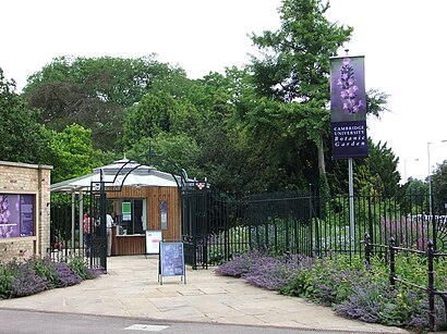
Botanic Gardens, Cambridge Address: 108 Hills Road Cambridge Cambridge CB2 1 street in Cambridge
Attractions near Botanic Gardens, Cambridge
Dante,Siemens Industry Software,Trinity College Cambridge Properties,Cambridge Holiday S,Wallace Estates Limited,Aston House,Coast Fish & Chip Restaurant,Ling Ling's Steam Kitchen,Breeze Taxis,A1307,B B C Radio Cambridgeshire,Short Term Lets Cambridge,Gao Fei Consulting,Rustat Property Co,Cecil Lodge Property Management,Cherry Close Freehold Limited,Firexx Limited,Sewells Holdings Limited,Newnham College,7 Brooklands AvenueHow to get to popular attractions in Cambridge with public transportation
Holiday Inn Norwich - North, Norwich,Wickham Market, Suffolk Coastal,Breydon Waters Holiday Park, Great Yarmouth,The Punter, Cambridge,Burwash Manor, South Cambridgeshire,Shrine of Our Lady of Walsingham, North Norfolk,Gislingham, Mid Suffolk,Ransome's Europark, Ipswich,Hunstanton Beach, King'S Lynn And West Norfolk,Chemistry and Pharmacy Building UEA, Norwich,Seckford Hall, Suffolk Coastal,Robert Kett Junior School, South Norfolk,Lucy Cavendish College, Cambridge,Hinchingbrooke Country Park, Huntingdonshire,GO Outdoors, Norwich,Cambridge School of Visual & Performing Arts, Cambridge,John Lewis at Home, Ipswich,Notcutts Garden Centre, Norwich,Downham Market, King'S Lynn And West Norfolk,Milsoms, Kesgrave Hall, Suffolk CoastalGet around Cambridge by public transport!
Travelling around Cambridge has never been so easy. See step by step directions as you travel to any attraction, street or major public transport station. View bus and train timetables, arrival times, service alerts and detailed routes on a map, so you know exactly how to get to anywhere in Cambridge.
When travelling to any destination around Cambridge use Moovit's Live Directions with Get Off Notifications to know exactly where and how far to walk, how long to wait for your line , and how many stops are left. Moovit will alert you when it’s time to get off — no need to constantly re-check whether yours is the next stop.
Wondering how to use public transport in Cambridge or how to pay for public transport in Cambridge? Moovit public transport app can help you navigate your way with public transport easily, and at minimum cost. It includes public transport fees, ticket prices, and costs. Looking for a map of Cambridge public transport lines? Moovit public transport app shows all public transport maps in Cambridge with all bus or train routes and stops on an interactive map.
Cambridge has 2 transport type(s), including: bus or train, operated by several transport agencies, including National Rail, Ambassador Travel, Harwich Harbour Ferry, Stephensons of Essex, Villager Minibus Sharnbrook, The Voluntary Network, Dews Coaches, Lord's Travel, Felixstowe Ferry Boat Yard, Hadleigh Community Transport, Beestons, Fenland Association for Community Transport, First Norfolk & Suffolk, National Rail and Mulleys Motorways