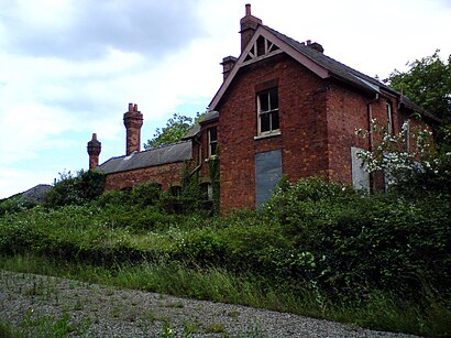
Directions to Bottisham Lode Station (East Cambridgeshire) with public transport
The following transport lines have routes that pass near Bottisham Lode Station
Directions to Bottisham Lode Station (East Cambridgeshire) with public transport
The following transport lines have routes that pass near Bottisham Lode Station
How to get to Bottisham Lode Station by bus?
Click on the bus route to see step by step directions with maps, line arrival times and updated time schedules.
Bus lines to Bottisham Lode Station in East Cambridgeshire
- 11,Newmarket,
What are the nearest stations to Bottisham Lode Station?
The nearest stations to Bottisham Lode Station are:
- Fassage Close, Lode is 507 meters away, 7 min walk.
Which bus line stops near Bottisham Lode Station?
11
What’s the nearest bus stop to Bottisham Lode Station in East Cambridgeshire?
The nearest bus stop to Bottisham Lode Station in East Cambridgeshire is Fassage Close, Lode. It’s a 7 min walk away.
See Bottisham Lode Station, East Cambridgeshire, on the map
Public Transit to Bottisham Lode Station in East Cambridgeshire
Wondering how to get to Bottisham Lode Station in East Cambridgeshire, United Kingdom? Moovit helps you find the best way to get to Bottisham Lode Station with step-by-step directions from the nearest public transit station.
Moovit provides free maps and live directions to help you navigate through your city. View schedules, routes, timetables, and find out how long does it take to get to Bottisham Lode Station in real time.
Looking for the nearest stop or station to Bottisham Lode Station? Check out this list of stops closest to your destination: Fassage Close.
Bus: 11.
Want to see if there’s another route that gets you there at an earlier time? Moovit helps you find alternative routes or times. Get directions from and directions to Bottisham Lode Station easily from the Moovit App or Website.
We make riding to Bottisham Lode Station easy, which is why over 1.5 million users, including users in East Cambridgeshire, trust Moovit as the best app for public transit. You don’t need to download an individual bus app or train app, Moovit is your all-in-one transit app that helps you find the best bus time or train time available.
For information on prices of bus, costs and ride fares to Bottisham Lode Station, please check the Moovit app.
Use the app to navigate to popular places including to the airport, hospital, stadium, grocery store, mall, coffee shop, school, college, and university.
Location: East Cambridgeshire, East Anglia
Attractions near Bottisham Lode Station
Lloyds Gardens,Greek Property for Sale,Little Legs of Lode Montessori Inspired Nursery,Fen Edge Services Limited,Little Legs Montessori,Management Services To Hotels Limited,Dickinson Gallop,Ian Kirton and,LKC Global Integrated Technology Services,Alan Lamb Associates,Red2green,J I Marsh & Son,Lode Post Office and Shop,Royal Mail,Kariannes Secret,Mannvit Uk,Cambridge Yoga & Fitness,Usas Consulting,Complete Unity Yoga,LWR CHow to get to popular attractions in East Cambridgeshire with public transportation
Chemistry and Pharmacy Building UEA, Norwich,Hunstanton Beach, King'S Lynn And West Norfolk,Littleport, East Cambridgeshire,Pembroke College, Cambridge,Needham Lake, Mid Suffolk,The Buttermarket, Ipswich,Halesworth, Waveney,Hinchingbrooke Country Park, Huntingdonshire,Attleborough Railway Station (ATL), Breckland,The Range, South Norfolk,Mathematical Bridge, Cambridge,Milton Country Park, South Cambridgeshire,Market Gates Shopping Centre, Great Yarmouth,David Lloyd, Ipswich,Felixstowe Sea Front, Suffolk Coastal,The Glass House (Wetherspoon), Norwich,Cambridge University Sports Centre, Cambridge,Cambridge University Press, Cambridge,The Sea Front, Great Yarmouth,John Lewis, NorwichGet around East Anglia by public transport!
Travelling around East Anglia has never been so easy. See step by step directions as you travel to any attraction, street or major public transport station. View bus and train timetables, arrival times, service alerts and detailed routes on a map, so you know exactly how to get to anywhere in East Anglia.
When travelling to any destination around East Anglia use Moovit's Live Directions with Get Off Notifications to know exactly where and how far to walk, how long to wait for your line , and how many stops are left. Moovit will alert you when it’s time to get off — no need to constantly re-check whether yours is the next stop.
Wondering how to use public transport in East Anglia or how to pay for public transport in East Anglia? Moovit public transport app can help you navigate your way with public transport easily, and at minimum cost. It includes public transport fees, ticket prices, and costs. Looking for a map of East Anglia public transport lines? Moovit public transport app shows all public transport maps in East Anglia with all Bus, Train and Ferry routes and stops on an interactive map.
East Anglia has 3 transport type(s), including: Bus, Train and Ferry, operated by several transport agencies, including National Rail, Ambassador Travel, Harwich Harbour Ferry, Stephensons of Essex, Villager Minibus Sharnbrook, The Voluntary Network, Dews Coaches, Lord's Travel, Felixstowe Ferry Boat Yard, Hadleigh Community Transport, Beestons, Fenland Association for Community Transport, First Norfolk & Suffolk, Mulleys Motorways, Halesworth Area Community Transport